Russian Shahed drone tracked over Odesa city; series of incursions across southern Ukraine
What happened
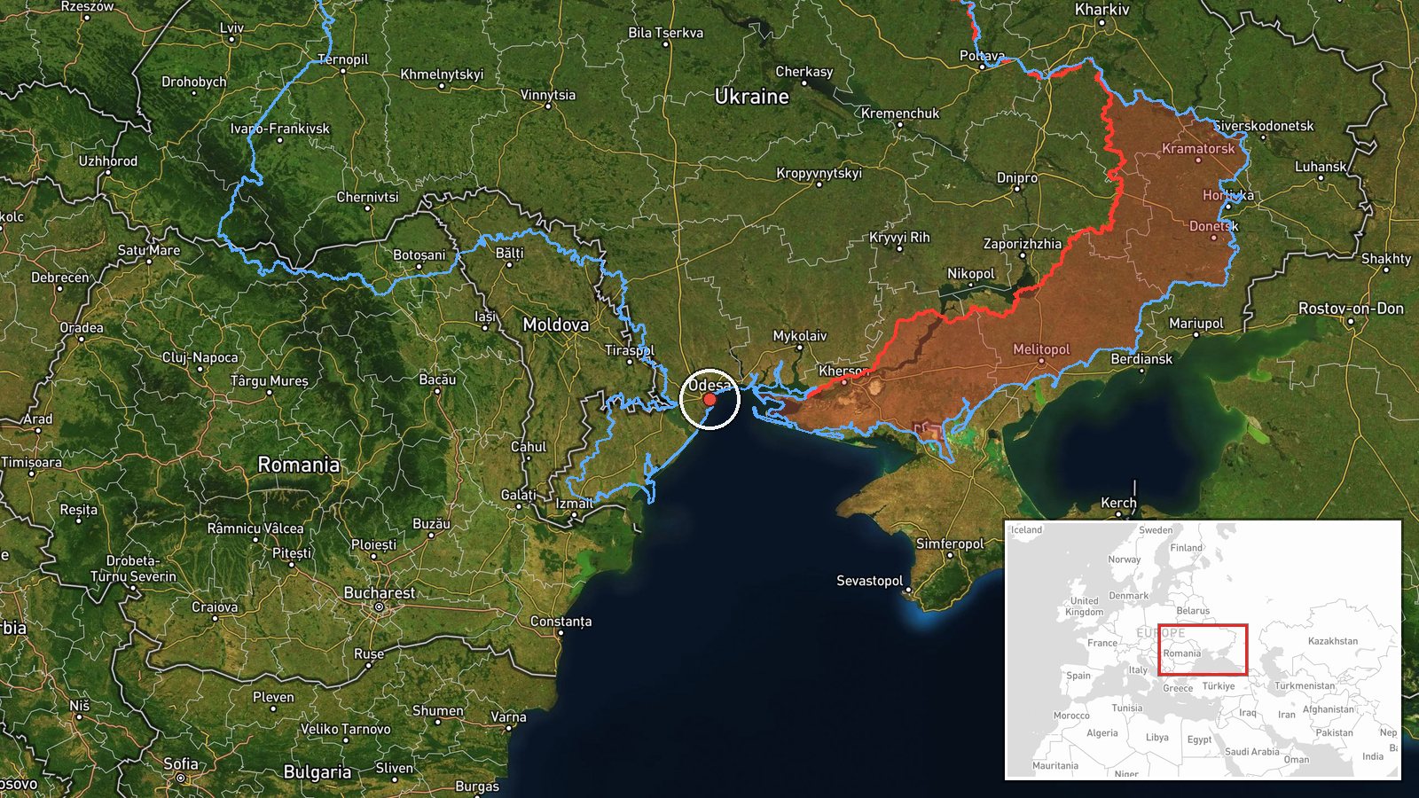
Ukrainian air monitoring reported one Russian jet-powered Shahed (Geran-3) drone over Odesa city at approximately 15:27 UTC on 13 October 2026. The Kyiv Post Special Operations Command (@kpszsu) issued a civil alert instructing residents to seek shelter. This sighting followed at least three earlier drone transits across Odesa Oblast, the Odesa–Mykolaiv border region, and Mykolaiv Oblast during the same day, suggesting a coordinated wave of incursions from the Black Sea.
Context and assessment
Odesa, Ukraine's primary maritime hub and a Black Sea logistics chokepoint, remains a persistent target for Russian long-range strikes. Shahed drones, which carry modest warheads but offer Russia a low-cost attrition tool, have become a routine feature of operations against southern Ukrainian cities. The pattern of multiple transits across Odesa and Mykolaiv oblasts on 13 October aligns with recurring Russian tactics of saturation drone attacks designed to overwhelm air defences and inflict cumulative damage. This wave occurred on the same day Ukrainian forces reportedly disrupted a Russian river crossing attempt in Kherson, suggesting possible Russian retaliation or sustained pressure across the southern front. The trajectory and timing indicate continued Russian attempts to contest airspace and strike civilian and military infrastructure in Ukraine's south.
Sources and confidence
Reported solely by Telegram channel @kpszsu (Kyiv Post Special Operations Command). No secondary confirmation from other monitoring services is documented in available data. Confidence scored at 8.0 due to single-source reporting and low geographic precision, though @kpszsu is an established Ukrainian official channel. Confirmation by independent air-defence tracking or imagery would raise confidence; absence of follow-up reports or intercept claims would lower it.
Location
Odesa city, located at 46.48°N, 30.73°E on Ukraine's southwestern Black Sea coast. Precision rated as regional due to reliance on air-monitoring alerts rather than direct impact confirmation. Odesa lies approximately 470 km southwest of Kyiv and serves as Ukraine's primary naval and commercial port. The drone's northbound trajectory from maritime approaches is consistent with previous Shahed ingress routes from the Black Sea.
Related events nearby
- Ukrainian air monitoring: 1 Russian jet-powered Shahed (Geran-3) drone over Odesa Oblast.2026-10-13 13:28 UTC · Drone Transit · Odesa Oblast, Ukraine
- Ukrainian air monitoring reports 1 Russian jet-powered Shahed (Geran-3) drone on northbound trajectory at the 2026-10-13 14:33 UTC · Drone Transit · Odesa Oblast and Mykolaiv Oblast border, Ukraine
- Ukrainian air monitoring: 2+ Russian jet-powered Shahed (Geran-3) drones from Black Sea toward Mykolaiv Oblast2026-10-13 14:28 UTC · Drone Transit · Mykolaiv Oblast, Ukraine
- Ukrainian air monitoring: 1 Russian jet-powered Shahed (Geran-3) drone heading toward Mykolaiv.2026-10-13 13:28 UTC · Drone Transit · Mykolaiv, Ukraine
- Ukrainian drone forces destroyed a large group of Russian Spetsnaz special forces attempting to cross the Dnip2026-10-13 09:15 UTC · UAS Strike · Kherson, Kherson Oblast, Ukraine
▶ View this event on the live map

Intel Mapper aggregates open-source reports from monitored Telegram and X channels, geolocates them, cross-checks duplicates across sources and assigns a confidence score. Entries are updated as new confirmations arrive. Read how we verify events.