Russian Shahed drone tracked toward Sarny in Rivne Oblast
What happened
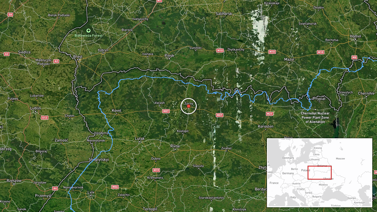
Ukrainian air monitoring reported a single Russian jet-powered Shahed (Geran-3) drone heading toward Sarny in Rivne Oblast on October 13 at 19:52 UTC. The report was issued by the Kyiv Post Special Communications Service via Telegram. The drone represents one of several Shahed aircraft detected transiting northwestern Ukraine during the same operational period, though this particular track indicates the final confirmed position as the drone approached the city.
Context and assessment
Sarny is a city of approximately 21,000 residents in western Rivne Oblast, roughly 280 kilometers northwest of Kyiv. The detection follows a pattern of multiple Shahed incursions across the region during October 13, with related tracking data showing drones moving through Zhytomyr, Khmelnytskyi, and Rivne Oblasts with apparent targeting focus on Rivne Oblast and nearby population centers including Kostopil and Lutsk. Such dispersed drone operations typically indicate either strikes on distributed infrastructure, testing of air defenses, or simultaneous pressure on multiple objectives across the northwestern approach.
Sources and confidence
Single source: Kyiv Post Special Communications Service Telegram channel (@kpszsu), which monitors Ukrainian air defense networks. No cross-confirmation from independent sources or other monitoring channels documented. Confidence score of 8.0 reflects reliable institutional source but absence of secondary verification. Corroboration from air defense engagement reports or damage assessments would raise confidence; retraction or contradicting reports would lower it.
Location
Sarny, a city in Rivne Oblast located at approximately 51.34°N, 26.61°E. Situated in northwestern Ukraine roughly 180 kilometers from the Belarusian border and 80 kilometers southwest of Lutsk. The settlement is positioned in flat terrain characteristic of the region, serving as an administrative center for the surrounding district.
Related events nearby
- Ukrainian air monitoring reports 1 Russian jet-powered Shahed (Geran-3) drone transiting northern Zhytomyr Obl2026-10-13 17:14 UTC · Drone Transit · Rivne Oblast, Ukraine
- Ukrainian air monitoring: 1 Russian jet-powered Shahed (Geran-3) drone from Rivne Oblast toward Kostopil.2026-10-13 17:25 UTC · Drone Transit · Kostopil, Ukraine
- Ukrainian air monitoring: 1 Russian jet-powered Shahed (Geran-3) drone from Khmelnytskyi Oblast toward Rivne O2026-10-13 18:45 UTC · Drone Transit · Rivne Oblast, Ukraine
- Ukrainian air monitoring: 2+ Russian jet-powered Shahed (Geran-3) drones heading toward Rivne Oblast.2026-10-13 18:03 UTC · Drone Transit · Rivne Oblast, Ukraine
- Ukrainian air monitoring: 1 Russian jet-powered Shahed (Geran-3) drone heading toward Lutsk.2026-10-13 18:52 UTC · Drone Transit · Lutsk, Ukraine
▶ View this event on the live map

Intel Mapper aggregates open-source reports from monitored Telegram and X channels, geolocates them, cross-checks duplicates across sources and assigns a confidence score. Entries are updated as new confirmations arrive. Read how we verify events.