Russian Geran-3 drone tracked toward Krasyliv in western Ukraine
What happened
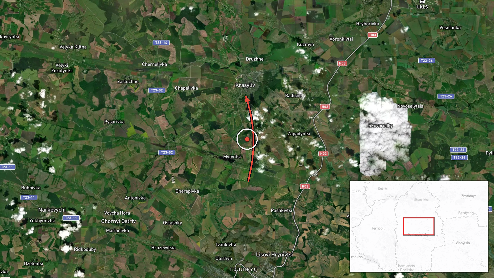
Ukrainian air monitoring reported a single Russian jet-powered Shahed (Geran-3) drone transiting toward Krasyliv, a town in Khmelnytskyi Oblast in western Ukraine, on the evening of 13 October 2026. The drone was detected approaching from the southeast. The report was logged by the Ukrainian air command's public monitoring channel at 23:41 UTC. No impact or air defense engagement was mentioned in the alert.
Context and assessment
Krasyliv lies in Khmelnytskyi Oblast, a western Ukrainian region bordering Poland and Moldova, far from active ground combat but within drone strike range of Russian launch sites. Related monitoring data from earlier the same day shows a sustained pattern of Geran-3 operations, with multiple detections of the same or similar drones over Khmelnytskyi city and oblast between 15:41 and 20:30 UTC. The Geran-3 is a long-range, jet-powered loitering munition capable of precision strikes. Repeated activity in this sector may suggest either a coordinated multi-drone campaign, reconnaissance of air defense positions, or persistent pressure against infrastructure in western Ukraine.
Sources and confidence
Single source: Ukrainian Armed Forces Main Directorate of Intelligence public Telegram channel (@kpszsu). Confidence score of 8.0 reflects reliance on a single official Ukrainian monitoring feed with high institutional credibility, though no independent cross-confirmation is noted. Confidence would rise with corroborating reports from other Ukrainian agencies or international monitors; it would lower if follow-up reports contradict the track or timing.
Location
Krasyliv is a town in northwestern Khmelnytskyi Oblast, western Ukraine, located approximately 49.65°N, 26.97°E. The settlement sits in an agricultural and lightly industrialized region, roughly 300 km west-northwest of Kyiv and near the Polish border. Geographic precision is assessed as high, pinpointing the settlement itself rather than a wider area.
Related events nearby
- Ukrainian air monitoring: 1 Russian jet-powered Shahed (Geran-3) drone over Khmelnytskyi.2026-10-13 20:30 UTC · Drone Transit · Khmelnytskyi, Ukraine
- Ukrainian air monitoring: 1 Russian jet-powered Shahed (Geran-3) drone over Khmelnytskyi.2026-10-13 18:59 UTC · Drone Transit · Khmelnytskyi, Ukraine
- Ukrainian air monitoring: 1 Russian jet-powered Shahed (Geran-3) drone heading toward Khmelnytskyi.2026-10-13 17:27 UTC · Drone Transit · Khmelnytskyi, Ukraine
- Ukrainian air monitoring: 1 Russian jet-powered Shahed (Geran-3) drone heading toward Khmelnytskyi Oblast.2026-10-13 17:18 UTC · Drone Transit · Khmelnytskyi Oblast, Ukraine
- Ukrainian air monitoring: 1 Russian jet-powered Shahed (Geran-3) drone heading toward Khmelnytskyi; 1 Russian 2026-10-13 15:41 UTC · Drone Transit · Khmelnytskyi, Ukraine
▶ View this event on the live map

Intel Mapper aggregates open-source reports from monitored Telegram and X channels, geolocates them, cross-checks duplicates across sources and assigns a confidence score. Entries are updated as new confirmations arrive. Read how we verify events.