Russian Shahed drone tracked toward Ichnia in Chernihiv Oblast
What happened
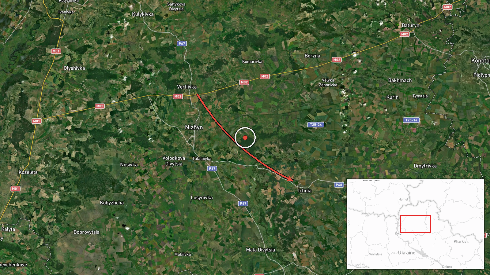
Ukrainian air monitoring reported one Russian Shahed-type unmanned aerial vehicle transiting from the northeast toward Ichnia, a settlement in northern Chernihiv Oblast, on the morning of 15 October at 05:18 UTC. The report originated from the Telegram channel of the Ukrainian Main Directorate of Intelligence (kpszsu). No strike assessment or interception result was provided in the available monitoring data.
Context and assessment
Ichnia lies in northern Chernihiv Oblast near the border with Russia and Belarus, an area that has seen repeated drone transits throughout the conflict. This sighting occurred as part of a broader coordinated wave of Shahed-type drone activity across northeastern Ukraine during the early morning hours of 15 October, with simultaneous reports of transits near Buryn, Hadyach, Kalynivka, and northern Kyiv Oblast. Ukrainian air defenses were reportedly active across the region, with multiple siren warnings issued. Such repeated drone operations in this corridor suggest ongoing Russian efforts to target civilian or military infrastructure in rear areas of northeastern Ukraine.
Sources and confidence
Single source: Telegram channel @kpszsu (Ukrainian Main Directorate of Intelligence). No cross-confirmation from independent monitoring networks or Ukrainian military official statements in provided data. Confidence score of 8.0 reflects official Ukrainian government reporting but absence of corroborating sources. Higher confidence would require reporting from additional air monitoring channels or official air force statements.
Location
Ichnia is a settlement in Chernihiv Oblast, northern Ukraine (50.86°N, 32.39°E). Located approximately 130 km north-northeast of Kyiv and roughly 30 km south of the Russian border, it sits in relatively flat terrain typical of northern Ukrainian countryside. The settlement was specified as the destination in monitoring reports.
Related events nearby
- Ukrainian air monitoring: Multiple Russian jet-powered Shahed (Geran-3) kamikaze drones tracked transiting fro2026-10-15 04:42 UTC · Drone Transit · Northern Kyiv Oblast, Ukraine
- Ukrainian air monitoring: 1 Russian jet-powered Shahed (Geran-3) drone passing Zakhod, heading toward Chernihi2026-10-15 05:30 UTC · Drone Transit · Chernihiv, Ukraine
- Ukrainian air monitoring warns of Russian tactical aircraft and aviation strike weapon activity across northea2026-10-15 04:59 UTC · Siren · Northern and Eastern Ukraine
- Ukrainian air monitoring: 1 Russian Shahed-type drone from Sumy Oblast toward Buryn.2026-10-15 03:10 UTC · Drone Transit · Buryn, Ukraine
- Ukrainian air monitoring: 1 Russian Shahed-type drone over Kalynivka.2026-10-14 08:54 UTC · Drone Transit · Kalynivka, Ukraine
▶ View this event on the live map

Intel Mapper aggregates open-source reports from monitored Telegram and X channels, geolocates them, cross-checks duplicates across sources and assigns a confidence score. Entries are updated as new confirmations arrive. Read how we verify events.