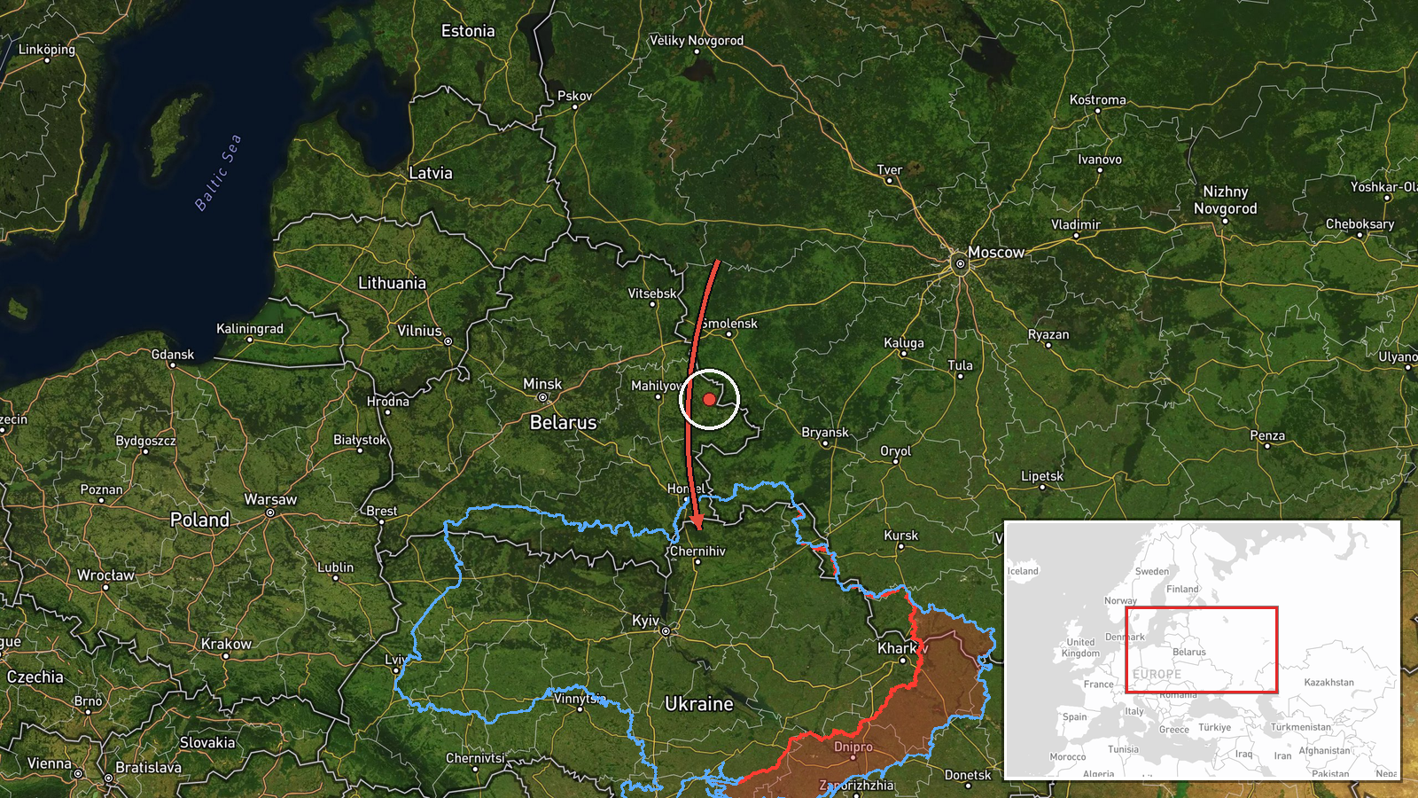
Russian Geran-3 drone tracked approaching Chernihiv from the west
What happened
Ukrainian air monitoring reported one Russian jet-powered Shahed (Geran-3) kamikaze drone passing west of Chernihiv and heading toward the city on the morning of October 15. The detection came at 05:30 UTC. The Geran-3, an Iranian-origin loitering munition, was tracked in transit rather than confirmed striking a target. The report was posted by the Kyiv Post Space & Air Defense Service (@kpszsu) on Telegram, Ukraine's primary air alert channel.
Context and assessment
Chernihiv Oblast, located in northern Ukraine near the Russian border, has been a recurring target for Russian drone operations throughout the conflict. The October 15 sighting occurred amid a broader wave of Shahed attacks that morning, with multiple Geran-3 drones simultaneously tracked moving through the region toward Slavutych, Ripky, Ichnia, and northern Kyiv Oblast. This pattern suggests a coordinated, multi-target drone strike designed to overwhelm Ukrainian air defenses across a wide area. Chernihiv city itself houses critical infrastructure and administrative facilities, making it a strategically significant target for Russian strikes.
Sources and confidence
The report originates solely from @kpszsu, the official Kyiv Post Space & Air Defense Service Telegram channel, which aggregates real-time Ukrainian air monitoring data. No corroborating reports from other sources are included. Confidence remains at 8.0 due to the single source; @kpszsu is generally reliable but reports transit rather than confirmed impact. Confirmation would strengthen confidence; lack of follow-up attack reports would lower it.
Location
Chernihiv city (51.49°N, 31.29°E) lies in northern Ukraine, approximately 150 kilometers north-northeast of Kyiv. The city straddles the Desna River and serves as the regional administrative center. Its location near the Russian border and proximity to critical infrastructure make it tactically significant; the drone was approaching from the west, consistent with transit patterns from Russian-held or staging areas.
Related events nearby
- Ukrainian air monitoring: 1 Russian jet-powered Shahed (Geran-3) drone from Chernihiv Oblast toward Ripky.2026-10-15 02:21 UTC · Drone Transit · Ripky, Ukraine
- Ukrainian air monitoring: 2+ Russian jet-powered Shahed (Geran-3) drones heading toward Slavutych.2026-10-15 05:14 UTC · Drone Transit · Slavutych, Ukraine
- Ukrainian air monitoring: 2+ Russian jet-powered Shahed (Geran-3) drones heading toward Slavutych.2026-10-15 01:52 UTC · Drone Transit · Slavutych, Ukraine
- Ukrainian air monitoring: Multiple Russian jet-powered Shahed (Geran-3) kamikaze drones tracked transiting fro2026-10-15 04:42 UTC · Drone Transit · Northern Kyiv Oblast, Ukraine
- Ukrainian air monitoring: 1 Russian Shahed-type drone from Chernihiv Oblast toward Ichnia.2026-10-15 05:18 UTC · Drone Transit · Ichnia, Ukraine
▶ View this event on the live map

Intel Mapper aggregates open-source reports from monitored Telegram and X channels, geolocates them, cross-checks duplicates across sources and assigns a confidence score. Entries are updated as new confirmations arrive. Read how we verify events.