Russian jet-powered drones tracked toward Mykolaiv Oblast from Black Sea
What happened
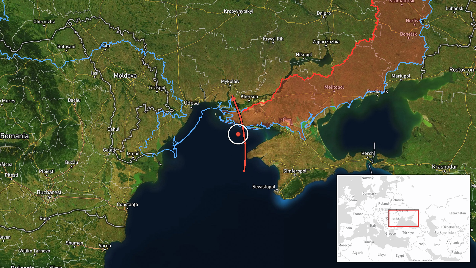
Ukraine's air monitoring service reported at least two Russian jet-powered Shahed (Geran-3) drones transiting from the Black Sea toward Mykolaiv Oblast on the morning of 15 October at 06:52 UTC. The report, issued via the official Telegram channel of Ukraine's air force command (@kpszsu), indicated the drones were traveling inland in a northwesterly direction after crossing the Black Sea.
Context and assessment
Mykolaiv Oblast, located in southern Ukraine along the Black Sea coast, has been a recurring target of Russian drone operations throughout the conflict. The Geran-3 is a jet-powered variant of the Shahed design, capable of longer range and higher speeds than its turboprop predecessors, making it suitable for strikes against rear-area infrastructure. This transit follows a series of reported Shahed movements over the preceding hours, including similar drones crossing the Black Sea earlier on 15 October and passing through Beryslav district to the east on 15 October. The pattern suggests a sustained campaign of drone strikes targeting southern Ukrainian territory, with Mykolaiv Oblast's industrial and logistical infrastructure as probable objectives.
Sources and confidence
Report originated from @kpszsu, the official Telegram channel of Ukraine's air force command. Single-source reporting limits confidence; no independent cross-confirmation is provided. Confidence of 8.0 reflects the authoritative Ukrainian source but regional-level geographic precision and lack of secondary corroboration. Confirmation of impact, interception status, or damage would materially raise confidence.
Location
Mykolaiv Oblast, southern Ukraine, bounded by the Black Sea to the south. The report provides regional rather than specific-target precision. The latitude and longitude (46.97, 32.0) indicate the oblast's central area. Nearby notable features include Mykolaiv city (regional administrative center) and the Pivdennoukrainsk nuclear power station complex to the east.
Related events nearby
- Ukrainian air monitoring: 2+ Russian jet-powered Shahed (Geran-3) drones over Black Sea.2026-10-15 05:26 UTC · Drone Transit · Black Sea, Ukraine
- Ukrainian air monitoring: 2+ Russian jet-powered Shahed (Geran-3) drones passing Beryslav district, heading no2026-10-15 01:54 UTC · Drone Transit · Beryslav district, Ukraine
- Ukrainian air monitoring: 30 Russian Shahed-type drones heading toward Pivdennoukrainsk.2026-10-14 19:50 UTC · Drone Transit · Pivdennoukrainsk, Ukraine
▶ View this event on the live map

Intel Mapper aggregates open-source reports from monitored Telegram and X channels, geolocates them, cross-checks duplicates across sources and assigns a confidence score. Entries are updated as new confirmations arrive. Read how we verify events.