Russian Geran-3 drone tracked toward Lymanka in Odesa Oblast
What happened
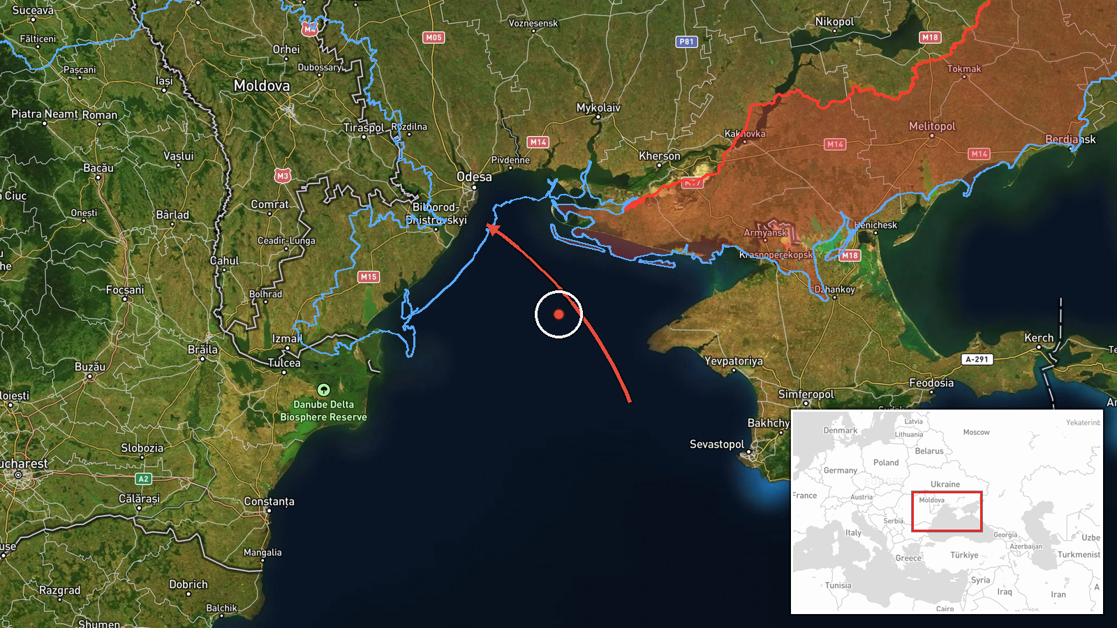
Ukrainian air monitoring reported a single Russian jet-powered Shahed (Geran-3) unmanned aerial vehicle transiting from the Black Sea toward Lymanka in Odesa Oblast on 15 October at 09:09 UTC. The drone was detected and tracked by air defense observation systems. The report comes from the Ukrainian Air Force command's official Telegram channel, which monitors and publishes drone transit alerts across Ukrainian airspace.
Context and assessment
Lymanka lies in southern Odesa Oblast, approximately 40 kilometers inland from the Black Sea coast. The report is one of at least five Geran-3 drone sightings reported by Ukrainian monitors within a 90-minute window on 15 October, spanning from Karolino-Buhaz in the west to Artsyz to the northeast, suggesting a coordinated Russian drone operation across the Odesa-Mykolaiv region. Geran-3 drones, reported to have jet propulsion and extended range, are typically employed in strikes against civilian and military infrastructure. The concentration of transit alerts in this timeframe indicates either a multi-pronged attack attempt or Russian reconnaissance activity across southern Ukrainian territory.
Sources and confidence
Single source report from @kpszsu (Ukrainian Air Force command Telegram channel), a primary official source for air defense monitoring. No cross-confirmation from independent channels is noted in available data. Confidence score of 8.0 reflects the official source credibility but moderate coverage breadth; confirmation by multiple independent monitors or defense statements would strengthen confidence.
Location
Lymanka is a settlement in Odesa Oblast, southern Ukraine, approximately 40 km inland from the Black Sea coast and near the Odesa-Mykolaiv Oblast border region. Coordinates determined from settlement location (46.386°N, 30.677°E). The area is part of the active drone transit corridor observed throughout 15 October.
Related events nearby
- Ukrainian air monitoring: 2+ Russian jet-powered Shahed (Geran-3) drones from Odesa Oblast toward Karolino-Buh2026-10-15 08:03 UTC · Drone Transit · Karolino-Buhaz, Ukraine
- Ukrainian air monitoring: 1 Russian jet-powered Shahed (Geran-3) drone heading toward Mayaky.2026-10-15 08:20 UTC · Drone Transit · Mayaky, Ukraine
- Ukrainian air monitoring reports Russian jet-powered Shahed (Geran-3) drone(s) in transit at the Odesa-Mykolai2026-10-15 08:46 UTC · Drone Transit · Odesa-Mykolaiv Oblast Border, Ukraine
- Ukrainian air monitoring: 1 Russian jet-powered Shahed (Geran-3) drone from Odesa Oblast toward Tatarbunary.2026-10-15 08:15 UTC · Drone Transit · Tatarbunary, Ukraine
- Ukrainian air monitoring: 1 Russian jet-powered Shahed (Geran-3) drone from Odesa Oblast toward Artsyz.2026-10-15 09:19 UTC · Drone Transit · Artsyz, Ukraine
▶ View this event on the live map

Intel Mapper aggregates open-source reports from monitored Telegram and X channels, geolocates them, cross-checks duplicates across sources and assigns a confidence score. Entries are updated as new confirmations arrive. Read how we verify events.