Russian Geran-3 drone tracked toward Mayaky in Odesa Oblast
What happened
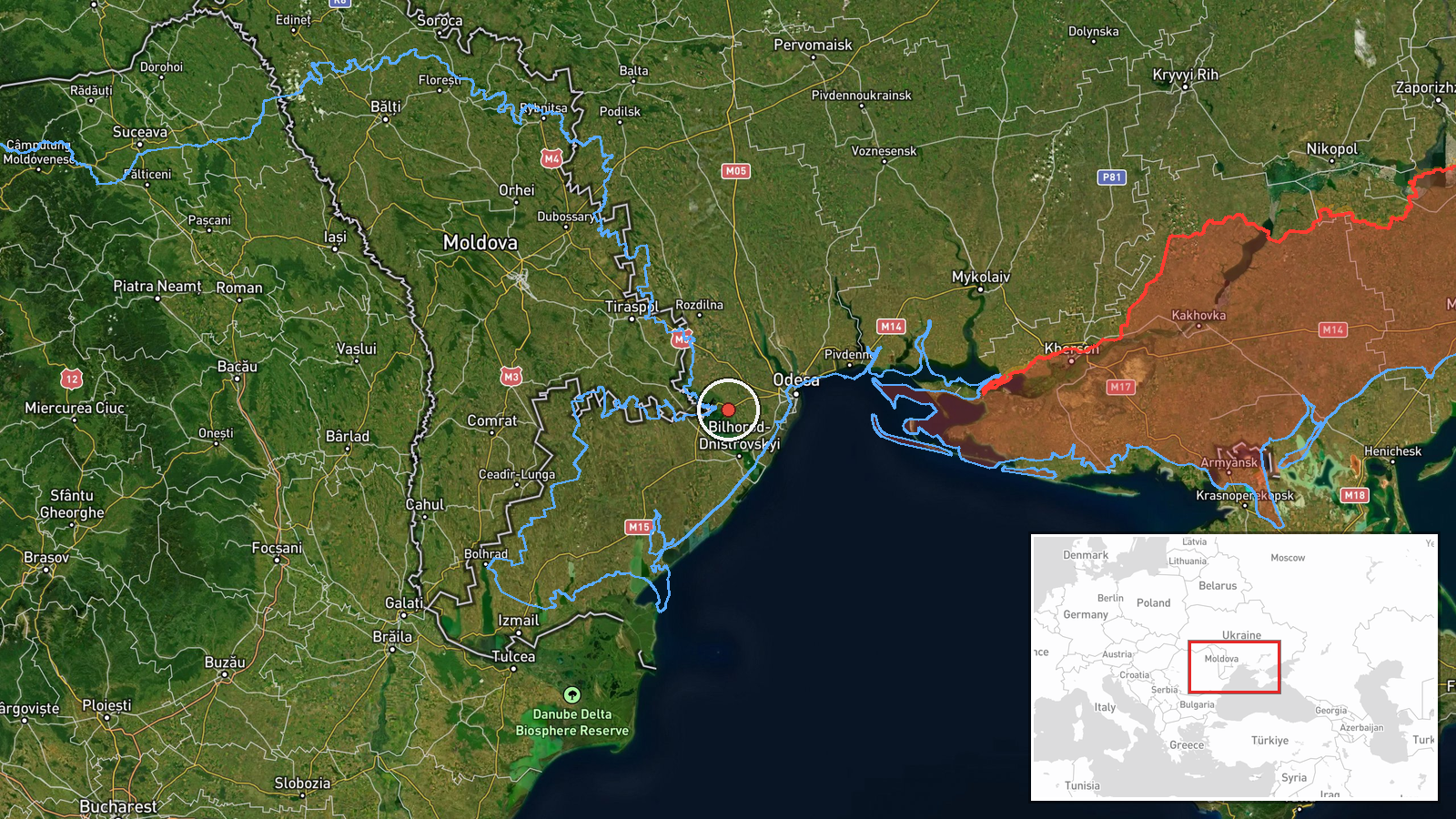
Ukrainian air monitoring detected one Russian jet-powered Shahed (Geran-3) unmanned aerial vehicle heading toward Mayaky, a settlement in Odesa Oblast, on the morning of 15 October at 08:20 UTC. The report was posted by the Command of Air Forces of the Armed Forces of Ukraine (@kpszsu) via Telegram. The drone's intended target or impact is not specified in the available report.
Context and assessment
Mayaky lies in southwestern Odesa Oblast near the Black Sea coast, an area that has seen sustained Russian drone operations throughout October. The detection is part of a broader wave of Geran-3 attacks on the region: Ukrainian air monitoring recorded at least four separate drone transits within a 90-minute window on 15 October, affecting settlements and areas across Odesa and Mykolaiv oblasts. Geran-3 drones are Russian cruise missiles with extended range and jet propulsion, typically used to strike infrastructure targets. The repeated targeting pattern suggests Russia may be maintaining pressure on southern Ukrainian logistics, energy, or military facilities in the region.
Sources and confidence
Report sourced from the Command of Air Forces of the Armed Forces of Ukraine (@kpszsu) via Telegram. Confidence is moderate (8.0/10) as only one primary channel has reported this specific drone transit; however, the report is part of a corroborating sequence of drone detections in the same region within minutes. Cross-confirmation of impact would raise confidence; clarification of the drone's origin and intended target would strengthen assessment.
Location
Mayaky is a settlement in Odesa Oblast, southwestern Ukraine, located at approximately 46.41°N, 30.27°E, roughly 15 km northeast of the Danube delta and near the Kiliya branch of the Danube River. The settlement sits in a low-lying, coastal agrarian zone vulnerable to airstrikes on regional infrastructure.
Related events nearby
- Ukrainian air monitoring: 2+ Russian jet-powered Shahed (Geran-3) drones from Odesa Oblast toward Karolino-Buh2026-10-15 08:03 UTC · Drone Transit · Karolino-Buhaz, Ukraine
- Ukrainian air monitoring reports Russian jet-powered Shahed (Geran-3) drone(s) in transit at the Odesa-Mykolai2026-10-15 08:46 UTC · Drone Transit · Odesa-Mykolaiv Oblast Border, Ukraine
- Ukrainian air monitoring: 1 Russian jet-powered Shahed (Geran-3) drone from Odesa Oblast toward Tatarbunary.2026-10-15 08:15 UTC · Drone Transit · Tatarbunary, Ukraine
- Ukrainian air monitoring: 2+ Russian jet-powered Shahed (Geran-3) drones from Black Sea toward Mykolaiv Oblast2026-10-15 06:52 UTC · Drone Transit · Mykolaiv Oblast, Ukraine
- Ukrainian air monitoring: 2+ Russian jet-powered Shahed (Geran-3) drones over Black Sea.2026-10-15 05:26 UTC · Drone Transit · Black Sea, Ukraine
▶ View this event on the live map

Intel Mapper aggregates open-source reports from monitored Telegram and X channels, geolocates them, cross-checks duplicates across sources and assigns a confidence score. Entries are updated as new confirmations arrive. Read how we verify events.