Russian Shahed drones tracked toward Odesa region in coordinated transit
What happened
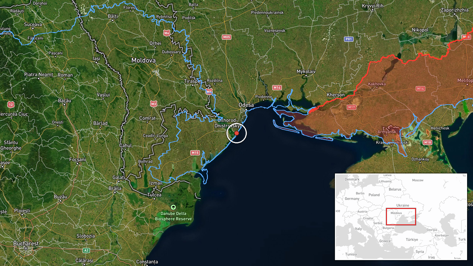
Ukrainian air monitoring reported at least two Russian jet-powered Shahed (Geran-3) drones transiting from the Black Sea toward Karolino-Buhaz in Odesa Oblast on the morning of October 15. The report was issued by Ukraine's air defense command (@kpszsu) at 08:03 UTC. Shahed drones are loitering munitions typically used for strikes on infrastructure and populated areas across Ukraine.
Context and assessment
Karolino-Buhaz sits in southwestern Odesa Oblast near the Danube Delta and Romanian border, an area that has faced recurring Russian drone operations throughout the conflict. The October 15 tracking represents part of a broader multi-vector drone transit pattern that morning: concurrent reports identified similar Shahed movements toward Mayaky, Tatarbunary, and Mykolaiv Oblast between 05:26 and 08:20 UTC. This coordinated timing and dispersed targeting pattern suggests a planned multi-target strike or harassment operation. Odesa and its surroundings remain strategically significant due to their proximity to grain export routes and military infrastructure.
Sources and confidence
Single source: Ukrainian air command Telegram channel (@kpszsu). Corroboration exists through related drone transit events reported simultaneously in the same region and timeframe by the same monitoring network, raising confidence in the overall pattern. Confidence score of 8.0 reflects Ukrainian military source authority but limited independent third-party confirmation of this specific track. Higher confidence would require reporting from additional independent monitors or post-strike assessment.
Location
Karolino-Buhaz is a settlement in southwestern Odesa Oblast, approximately 100 km southwest of Odesa city and near the Danube estuary and Romanian border. The Black Sea coastal region and delta marshlands characterize the area's geography. Precision rated as settlement-level based on Ukrainian air monitoring coordinates (46.14°N, 30.53°E).
Related events nearby
- Ukrainian air monitoring: 1 Russian jet-powered Shahed (Geran-3) drone heading toward Mayaky.2026-10-15 08:20 UTC · Drone Transit · Mayaky, Ukraine
- Ukrainian air monitoring reports Russian jet-powered Shahed (Geran-3) drone(s) in transit at the Odesa-Mykolai2026-10-15 08:46 UTC · Drone Transit · Odesa-Mykolaiv Oblast Border, Ukraine
- Ukrainian air monitoring: 1 Russian jet-powered Shahed (Geran-3) drone from Odesa Oblast toward Tatarbunary.2026-10-15 08:15 UTC · Drone Transit · Tatarbunary, Ukraine
- Ukrainian air monitoring: 2+ Russian jet-powered Shahed (Geran-3) drones over Black Sea.2026-10-15 05:26 UTC · Drone Transit · Black Sea, Ukraine
- Ukrainian air monitoring: 2+ Russian jet-powered Shahed (Geran-3) drones from Black Sea toward Mykolaiv Oblast2026-10-15 06:52 UTC · Drone Transit · Mykolaiv Oblast, Ukraine
▶ View this event on the live map

Intel Mapper aggregates open-source reports from monitored Telegram and X channels, geolocates them, cross-checks duplicates across sources and assigns a confidence score. Entries are updated as new confirmations arrive. Read how we verify events.