Russian Shahed drones tracked crossing Odesa-Mykolaiv border heading north
What happened
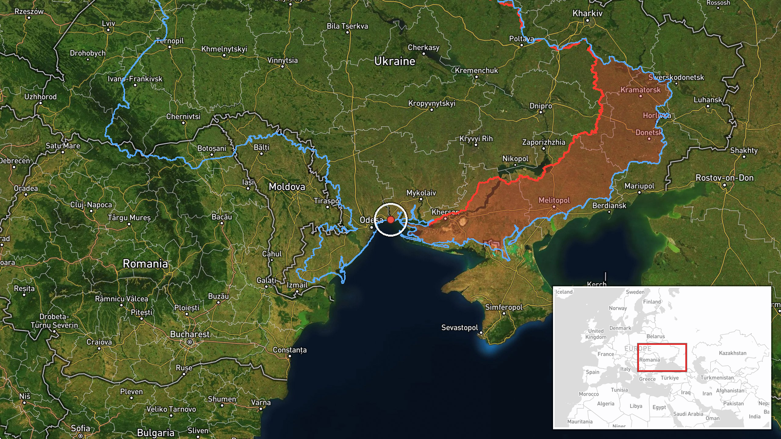
Ukrainian air monitoring detected jet-powered Shahed (Geran-3) drone(s) in transit at the border between Odesa and Mykolaiv Oblasts on the morning of 15 October, flying northward. The report was issued by the Ukrainian Command of Air Force (@kpszsu) on Telegram at 08:46 UTC. The observation fits a broader pattern of Russian drone activity across the southern and central Ukrainian regions that morning, with multiple similar transits reported across a two-hour window.
Context and assessment
The Odesa-Mykolaiv border region sits in southern Ukraine between the Black Sea and inland population centers. Shahed drones, particularly the jet-powered Geran-3 variant, are commonly used by Russia for strikes on infrastructure and military targets across Ukraine. The detection of northbound drones at this juncture follows earlier reports the same morning of similar craft crossing from the Black Sea toward Mykolaiv Oblast and transiting through nearby Odesa Oblast settlements. This sequence suggests a coordinated wave of strikes or reconnaissance missions aimed at targets in central or northern Ukraine, consistent with recent Russian drone campaign patterns that often involve multiple simultaneous or sequential ingress routes to complicate air defense responses.
Sources and confidence
Single source: Ukrainian Air Force Command via Telegram (@kpszsu), which routinely reports real-time air monitoring detections. No cross-confirmation from other channels noted. Confidence score of 8.0 reflects the source's established credibility in air threat reporting, though the lack of secondary confirmation and the region-level geographic precision (rather than pinpoint location) introduce moderate uncertainty about exact transit corridor and drone count.
Location
The reported position lies at the administrative boundary between Odesa and Mykolaiv Oblasts in southern Ukraine, approximately 46.6°N, 31.2°E. Precision is regional rather than site-specific. The area encompasses flat southern steppe terrain with scattered settlements, situated inland from the Black Sea coast where many Russian drone sorties originate.
Related events nearby
- Ukrainian air monitoring: 1 Russian jet-powered Shahed (Geran-3) drone from Black Sea toward Lymanka.2026-10-15 09:09 UTC · Drone Transit · Lymanka, Ukraine
- Ukrainian air monitoring: 2+ Russian jet-powered Shahed (Geran-3) drones from Black Sea toward Mykolaiv Oblast2026-10-15 06:52 UTC · Drone Transit · Mykolaiv Oblast, Ukraine
- Ukrainian air monitoring: 2+ Russian jet-powered Shahed (Geran-3) drones from Odesa Oblast toward Karolino-Buh2026-10-15 08:03 UTC · Drone Transit · Karolino-Buhaz, Ukraine
- Ukrainian air monitoring: 1 Russian jet-powered Shahed (Geran-3) drone heading toward Mayaky.2026-10-15 08:20 UTC · Drone Transit · Mayaky, Ukraine
- Ukrainian air monitoring: 2+ Russian jet-powered Shahed (Geran-3) drones over Black Sea.2026-10-15 05:26 UTC · Drone Transit · Black Sea, Ukraine
▶ View this event on the live map

Intel Mapper aggregates open-source reports from monitored Telegram and X channels, geolocates them, cross-checks duplicates across sources and assigns a confidence score. Entries are updated as new confirmations arrive. Read how we verify events.