Russian jet-powered Shahed drones tracked over northern Chernihiv Oblast
What happened
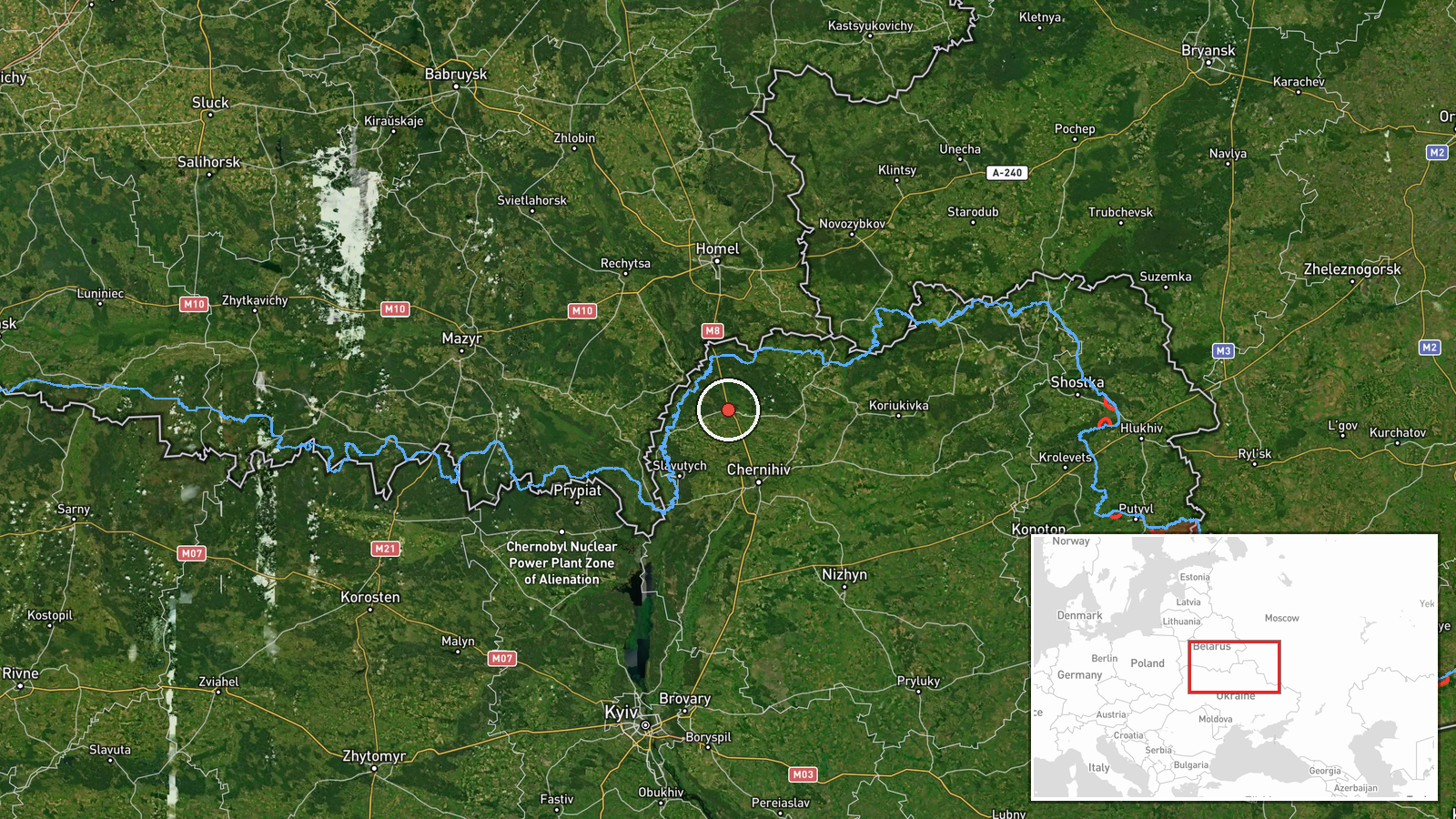
Ukrainian air monitoring reported two or more Russian jet-powered Shahed (Geran-3) drones passing through Ripky in northern Chernihiv Oblast on 15 October at 10:39 UTC, traveling in a southwestern direction. The report was posted by the Chornobyl Nuclear Power Station Monitoring Service (@kpszsu) via Telegram. Ripky is a settlement in the Chernihiv region near the Belarus border.
Context and assessment
Ripky lies on a common transit corridor for Russian drone operations heading toward central Ukraine from Belarusian airspace. Multiple Shahed transits were tracked across northern Ukraine on 15 October, including earlier passages near Ripky, Chernihiv city, Slavutych, and over Belarus itself. The jet-powered Geran-3 variant represents Russia's long-range loitering munition capability. The concentration of reported sightings along this northern axis suggests either a coordinated strike package or multiple separate operations targeting locations in central or southern Ukraine. Such transits typically precede attacks on critical infrastructure or military positions hours after detection.
Sources and confidence
Report sourced from Telegram channel @kpszsu (Chornobyl Nuclear Power Station Monitoring Service), a Ukrainian air defense monitoring account. Single-source reporting lowers confidence; however, the account maintains a track record of accuracy in drone transit alerts. Confidence score of 8.0 reflects consistent reporting from an official Ukrainian source but lack of independent cross-confirmation. Higher confidence would require corroboration from additional air monitoring channels; lower confidence would result from contradictory reports or source retraction.
Location
Ripky is a settlement in northern Chernihiv Oblast, approximately 160 kilometers north-northwest of Kyiv, situated near the Ukraine-Belarus border at approximately 51.80°N, 31.09°E. The settlement lies in a region traversed by multiple drone corridors flowing from Belarusian staging areas southwestward into central Ukraine. Nearby features include the Desna River valley and relatively open terrain facilitating drone transit at low altitude.
Related events nearby
- Ukrainian air monitoring: 1 Russian jet-powered Shahed (Geran-3) drone from Chernihiv Oblast toward Ripky.2026-10-15 02:21 UTC · Drone Transit · Ripky, Ukraine
- Ukrainian air monitoring: 1 Russian jet-powered Shahed (Geran-3) drone passing Zakhod, heading toward Chernihi2026-10-15 05:30 UTC · Drone Transit · Chernihiv, Ukraine
- Ukrainian air monitoring: 2+ Russian jet-powered Shahed (Geran-3) drones heading toward Slavutych.2026-10-15 05:14 UTC · Drone Transit · Slavutych, Ukraine
- Ukrainian air monitoring: 2+ Russian jet-powered Shahed (Geran-3) drones heading toward Slavutych.2026-10-15 01:52 UTC · Drone Transit · Slavutych, Ukraine
- Ukrainian air monitoring: 2+ Russian jet-powered Shahed (Geran-3) drones over Belarus.2026-10-15 07:07 UTC · Drone Transit · Belarus
▶ View this event on the live map

Intel Mapper aggregates open-source reports from monitored Telegram and X channels, geolocates them, cross-checks duplicates across sources and assigns a confidence score. Entries are updated as new confirmations arrive. Read how we verify events.