Russian Shahed drone tracked toward Dunayivtsi in western Ukraine
What happened
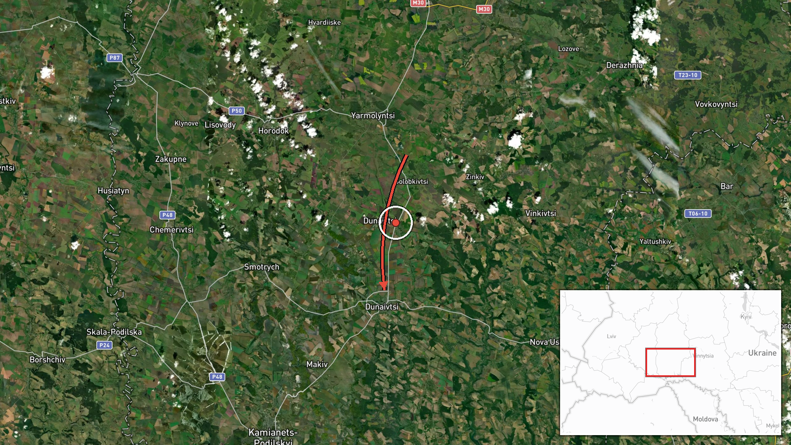
Ukrainian air monitoring reported detecting one Russian jet-powered Shahed (Geran-3) drone transiting through Khmelnytskyi Oblast with a course toward Dunayivtsi on 15 October at 16:37 UTC. The drone was tracked by Khmelnytskyi Civil Protection and Self-Defence (KPSZSU) via their Telegram channel. Dunayivtsi is a town in Khmelnytskyi Oblast approximately 100 km west of the regional capital.
Context and assessment
Khmelnytskyi Oblast in western Ukraine has faced repeated Russian drone strikes throughout 2026, with particular intensity on 15 October when at least five Shahed transits were detected in the region within a seven-hour window. The Geran-3 variant, a jet-powered derivative of the Iranian Shahed-136, represents the loitering munition component of Russia's sustained campaign against Ukrainian infrastructure and settlements. The concentration of sightings in this sector suggests either a coordinated multi-drone operation or sustained harassment targeting. Dunayivtsi, while smaller than oblast administrative centres, hosts civilian and potentially strategic infrastructure. This transit pattern is consistent with Russia's autumn 2026 air campaign rhythm.
Sources and confidence
Reported solely by Khmelnytskyi Civil Protection and Self-Defence (@kpszsu) on Telegram. No cross-confirmation from other channels visible in dataset. Confidence score of 8.0 reflects reliance on a single Ukrainian official source with established monitoring credibility, but absence of independent verification. Score would rise with reports from additional channels; would lower if subsequent events contradicted the track.
Location
Dunayivtsi, a settlement in Khmelnytskyi Oblast, western Ukraine, coordinates 48.887°N, 26.848°E. Located approximately 100 km northwest of Khmelnytskyi city, the town lies in the Dniester river valley region near the Moldovan border, an area historically important for Soviet-era infrastructure. Precision determined at settlement level from Ukrainian monitoring.
Related events nearby
- Ukrainian air monitoring: 1 Russian jet-powered Shahed (Geran-3) drone heading toward Khmelnytskyi Oblast.2026-10-15 17:30 UTC · Drone Transit · Khmelnytskyi Oblast, Ukraine
- Ukrainian air monitoring: 1 Russian Shahed-type drone passing Pivdennyi, heading toward Khmelnytskyi Oblast.2026-10-15 16:59 UTC · Drone Transit · Khmelnytskyi Oblast, Ukraine
- Ukrainian air monitoring: 1 Russian jet-powered Shahed (Geran-3) drone heading toward Khmelnytskyi.2026-10-15 16:04 UTC · Drone Transit · Khmelnytskyi, Ukraine
- Ukrainian air monitoring: 1 Russian jet-powered Shahed (Geran-3) drone heading toward Khmelnytskyi Oblast.2026-10-15 12:27 UTC · Drone Transit · Khmelnytskyi Oblast, Ukraine
- Ukrainian air monitoring: 1 Russian jet-powered Shahed (Geran-3) drone heading toward Khmelnytskyi Oblast.2026-10-15 12:10 UTC · Drone Transit · Khmelnytskyi Oblast, Ukraine
▶ View this event on the live map

Intel Mapper aggregates open-source reports from monitored Telegram and X channels, geolocates them, cross-checks duplicates across sources and assigns a confidence score. Entries are updated as new confirmations arrive. Read how we verify events.