Russian jet-powered Shahed drones transit toward Krasyliv in western Ukraine
What happened
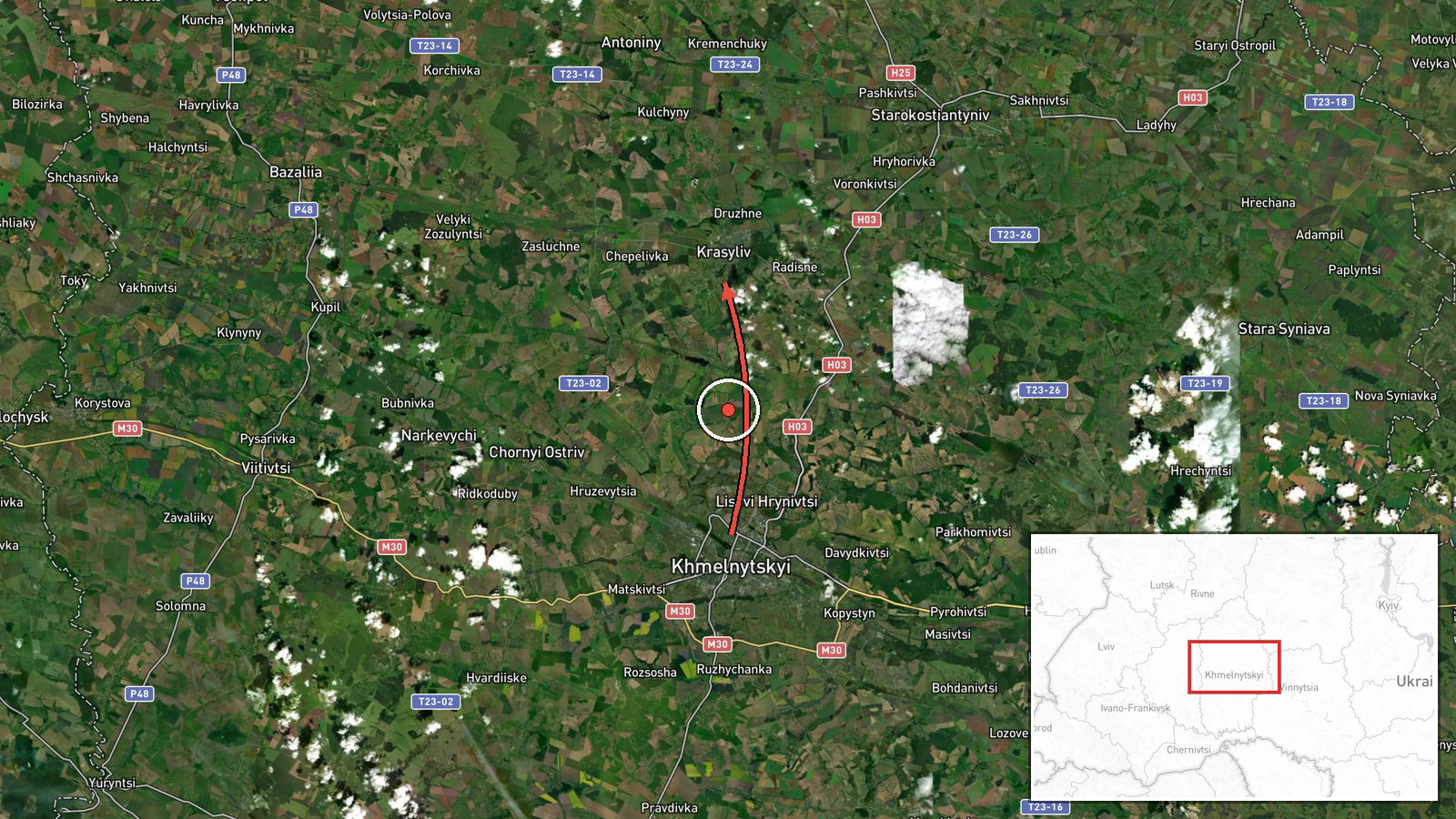
Ukrainian air monitoring reported at least two Russian jet-powered Shahed (Geran-3) drones passing over Khmelnytskyi on October 15 at 17:35 UTC, heading toward Krasyliv. The sighting was documented by the Kyiv Post air alert service via Telegram. Krasyliv lies in Khmelnytskyi Oblast in western Ukraine, approximately 50 kilometers south of the oblast capital. The report does not specify whether the drones struck targets or were intercepted.
Context and assessment
The transit marks part of an intensive Russian drone campaign against Khmelnytskyi Oblast on October 15, with at least five separate Shahed detections tracked between 12:10 and 17:35 UTC, suggesting a coordinated multi-wave operation. Krasyliv, a town of roughly 8,000 people, has no major military industrial presence but sits within range of Russian long-range strike assets operating from Belarusian airspace. The repeated targeting or transit over the oblast indicates sustained Russian efforts to strain Ukrainian air defenses and possibly strike logistics nodes or civilian infrastructure. Western Ukraine remains a secondary but persistent target in Russian drone operations.
Sources and confidence
The report originates from Kyiv Post air alert service (@kpszsu), a widely-monitored open-source air defense channel. Single-source reporting lowers confidence to 8.0. Cross-confirmation from other Ukrainian channels or official statements would strengthen assessment. No Western or independent verification is available. Confidence would rise with corroboration from additional monitoring services or Ukrainian military statements.
Location
Krasyliv settlement in Khmelnytskyi Oblast, western Ukraine (49.65°N, 26.97°E). The town lies approximately 50 kilometers south of Khmelnytskyi city in a rural agricultural region. Nearby Khmelnytskyi Airport lies to the north. Precision rated as high based on settlement-level identification; the exact point of impact or final drone position remains unconfirmed.
Related events nearby
- Ukrainian air monitoring detected 1+ Russian jet-powered Shahed (Geran-3) drone(s) transiting northern Vinnyts2026-10-15 18:02 UTC · Drone Transit · Starokostiantyniv, Ukraine
- Ukrainian air monitoring: 1 Russian jet-powered Shahed (Geran-3) drone heading toward Khmelnytskyi Oblast.2026-10-15 17:30 UTC · Drone Transit · Khmelnytskyi Oblast, Ukraine
- Ukrainian air monitoring: 1 Russian Shahed-type drone passing Pivdennyi, heading toward Khmelnytskyi Oblast.2026-10-15 16:59 UTC · Drone Transit · Khmelnytskyi Oblast, Ukraine
- Ukrainian air monitoring: 1 Russian jet-powered Shahed (Geran-3) drone heading toward Khmelnytskyi.2026-10-15 16:04 UTC · Drone Transit · Khmelnytskyi, Ukraine
- Ukrainian air monitoring: 1 Russian jet-powered Shahed (Geran-3) drone heading toward Khmelnytskyi Oblast.2026-10-15 12:27 UTC · Drone Transit · Khmelnytskyi Oblast, Ukraine
▶ View this event on the live map

Intel Mapper aggregates open-source reports from monitored Telegram and X channels, geolocates them, cross-checks duplicates across sources and assigns a confidence score. Entries are updated as new confirmations arrive. Read how we verify events.