Jet-powered Shahed drone reported moving west over southern Cherkasy and eastern Kyiv Oblast
What happened
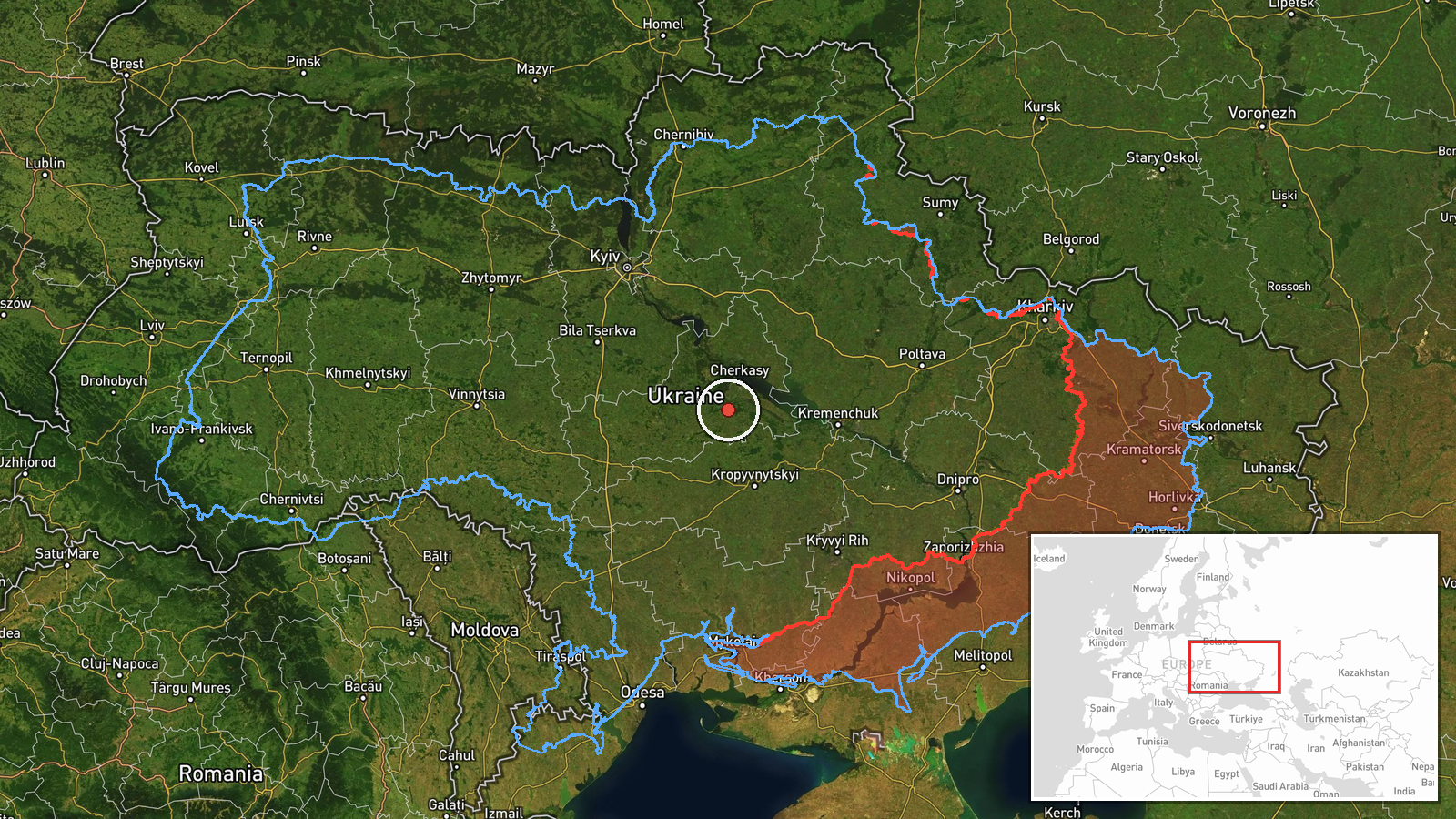
Ukrainian air monitoring reported on Telegram that a single jet-powered Shahed-type drone, described in the channel's wording as a Geran-3, was tracked over southern Cherkasy Oblast and eastern Kyiv Oblast, heading west. The post was published at 03:48 UTC on 16 October 2026 and uses the brief, shorthand style typical of regional air-alert updates. The original Ukrainian text refers to jet-powered drones on the southern Cherkasy and eastern Kyiv border area with a westward course. It gives no altitude, speed, or impact details. No strike, casualty, or damage is mentioned, and the report does not say whether the drone was intercepted. Russia is named as the launching side, which reflects the channel's framing rather than an independent identification of origin.
Context and assessment
Cherkasy and neighboring oblasts have appeared repeatedly in the same day's air-monitoring feed. Earlier reports from 15 October describe single Geran-3 drones passing Cherkasy Oblast at 07:29 UTC heading northwest, one over Kirovohrad Oblast at 10:56, and another heading toward Cherkasy Oblast at 17:50. A report of a drone heading toward Cherkasy at 01:49 on 16 October followed. This sequence points to individual jet-powered airframes moving through central Ukraine along several routes, rather than a single mass raid. The wider backdrop is a large overnight attack on 14 to 15 October, when Ukrainian air defenses reportedly downed or suppressed 536 Shahed-type, Geran, and decoy drones, and the same report notes additional missile types, though the text is cut off. Operationally, lone jet drones crossing central regions may be used to probe air defense coverage, to draw interceptor fire, or to reach targets further west, but the data does not establish intent. Monitoring posts of this kind also track drones that never strike, so a transit report alone does not identify a target.
Sources and confidence
The report comes from one Telegram channel, @kpszsu, which is widely identified as the Ukrainian Air Force's official channel. The source count is one, and the dataset contains no independent cross-confirmation from local officials, media, or wire services. The confidence score of 8.0 reflects this single-channel origin, the routine nature of the post, and its consistency with related same-day reports. The score would rise if regional administrations or other outlets independently reported the same track, or if wreckage or impact were confirmed. It would fall if later updates contradicted the course, the drone type, or the timing.
Location
The location is recorded at regional precision rather than at a named settlement or facility. The coordinates, 49.2 N and 31.9 E, mark an approximate central point in southern Cherkasy Oblast, and location confidence is rated low because the track spans more than one oblast and no specific place was named. The terrain is mainly open agricultural land on the right bank of the Dnipro, which runs through the wider region and is the most prominent geographic feature nearby.
Related events nearby
- Ukrainian air defenses downed/suppressed 536 Russian Shahed-type drones, Geran drones, and decoy drones from n2026-10-15 05:03 UTC · Air Defense · Ukraine
- Ukrainian air monitoring: 1 Russian jet-powered Shahed (Geran-3) drone heading toward Cherkasy.2026-10-16 01:49 UTC · Drone Transit · Cherkasy, Ukraine
- Ukrainian air monitoring: 1 Russian jet-powered Shahed (Geran-3) drone heading toward Cherkasy Oblast.2026-10-15 17:50 UTC · Drone Transit · Cherkasy Oblast, Ukraine
- Ukrainian air monitoring: 1 Russian jet-powered Shahed (Geran-3) drone passing Cherkasy Oblast, heading northw2026-10-15 07:29 UTC · Drone Transit · Cherkasy Oblast, Ukraine
- Ukrainian air monitoring: 1 Russian jet-powered Shahed (Geran-3) drone over Kirovohrad Oblast.2026-10-15 10:56 UTC · Drone Transit · Kirovohrad Oblast, Ukraine
▶ View this event on the live map

Intel Mapper aggregates open-source reports from monitored Telegram and X channels, geolocates them, cross-checks duplicates across sources and assigns a confidence score. Entries are updated as new confirmations arrive. Read how we verify events.