Single jet-powered Geran-3 drone reported over southern Ternopil Oblast, heading west
What happened
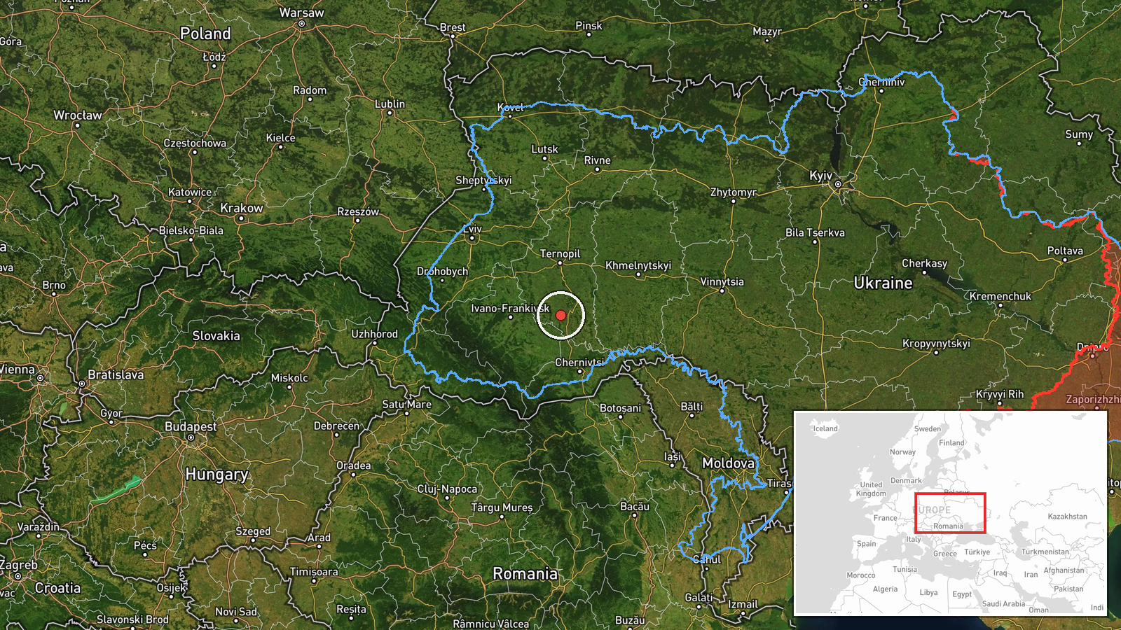
Ukrainian air monitoring reported a single Russian jet-powered Shahed, identified in the report as a Geran-3, over southern Ternopil Oblast at about 04:34 UTC on 16 October 2026, moving west. The original Ukrainian-language post describes a jet-powered drone (Реактивний БпЛА) on the south of Ternopil region heading west. It names no settlement, impact site, or casualties. The item is a transit notice rather than a strike report, recording a drone's track through the airspace and not a detonation. Attribution to Russia rests on the sourcing's description of the drone type, which matches the Geran-3 variant of the Shahed family. The report comes from a single Telegram channel, and the record lists no separate official statement or independent confirmation.
Context and assessment
Southern Ternopil sits on a corridor that Shahed-type drones have used repeatedly as they move from the south and east toward western Ukraine, so a transit report here fits a broader pattern rather than an isolated sighting. The related entries for the same early-morning window show a dense sequence: a drone from Khmelnytskyi Oblast toward Dunayivtsi at about 01:05, a drone toward Chortkiv at about 01:08, two drones toward Ivano-Frankivsk logged at 01:04 and 04:42, and a group of two or more drones heading toward Ternopil Oblast at about 02:18. Taken together, these entries suggest that several drones were tracked crossing the region in sequence over several hours, with the 04:34 report being one point on a longer track. Because the reports are timed and worded as heading toward different towns, the pattern may indicate routing toward multiple targets or a single group dispersing. Operationally, transit tracks of this kind are typically used to pressure air defence coverage and alert networks across a wide area, but the data alone cannot show whether these drones were directed at a specific installation, were diverted, or fell short of their intended targets.
Sources and confidence
The event rests on one Telegram channel, Telegram (@kpszsu), which carried the Ukrainian-language notice and is listed as the sole source with a source count of one. No second outlet or official confirmation appears in the record, and the origin field is empty, so the trajectory and launch point are unverified. The confidence score of 8.0 reflects that the report comes from an established air monitoring feed with a clear, specific description of the drone type, but it stays below higher values because it lacks independent cross-confirmation. Confidence would rise with a matching report from a second monitoring source, a regional military administration statement, or corroborating reports of the same track from neighbouring oblasts. It would fall if the drone's identification were revised or if the track proved to be a misreading of an adjacent contact.
Location
The location is recorded at region level for southern Ternopil Oblast, with the coordinates 48.95 N, 25.6 E, and location confidence rated low. The point is an approximate centroid rather than a settlement or facility, since the source gives no place name for the drone's position. Southern Ternopil is a hilly to upland area of western Ukraine near the borders with Khmelnytskyi, Chernivtsi, and Ivano-Frankivsk oblasts, and the sighting's stated westward heading places the track in that general direction.
Related events nearby
- Ukrainian air monitoring: 1 Russian jet-powered Shahed (Geran-3) drone heading toward Chortkiv.2026-10-16 01:08 UTC · Drone Transit · Chortkiv, Ukraine
- Ukrainian air monitoring: 1 Russian jet-powered Shahed (Geran-3) drone heading toward Ivano-Frankivsk.2026-10-16 04:42 UTC · Drone Transit · Ivano-Frankivsk, Ukraine
- Ukrainian air monitoring: 1 Russian jet-powered Shahed (Geran-3) drone heading toward Ivano-Frankivsk.2026-10-16 01:04 UTC · Drone Transit · Ivano-Frankivsk, Ukraine
- Ukrainian air monitoring: 2+ Russian jet-powered Shahed (Geran-3) drones heading toward Ternopil Oblast.2026-10-16 02:18 UTC · Drone Transit · Ternopil Oblast, Ukraine
- Ukrainian air monitoring: 1 Russian jet-powered Shahed (Geran-3) drone from Khmelnytskyi Oblast toward Dunayiv2026-10-16 01:05 UTC · Drone Transit · Dunayivtsi, Ukraine
▶ View this event on the live map

Intel Mapper aggregates open-source reports from monitored Telegram and X channels, geolocates them, cross-checks duplicates across sources and assigns a confidence score. Entries are updated as new confirmations arrive. Read how we verify events.