Jet-powered Shahed-type drone reported heading toward Dunayivtsi, Khmelnytskyi Oblast
What happened
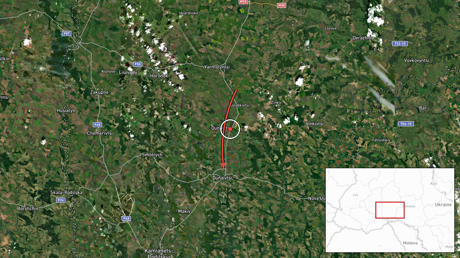
Ukraine's air monitoring reports, relayed through a single Telegram channel listed as @kpszsu, that one Russian jet-powered Shahed-type drone, identified as a Geran-3, was moving toward Dunayivtsi from the east within Khmelnytskyi Oblast. The original post, written in Ukrainian, describes a jet-powered unmanned aerial vehicle approaching Dunayivtsi from the east in the Khmelnytskyi region. The record is timestamped 16 October 2026 at 01:05 UTC and is categorized as drone transit rather than a confirmed strike. No impact, damage, or casualties are described, and the report does not state whether the drone reached the settlement or was later tracked elsewhere.
Context and assessment
Dunayivtsi matters in this record mainly as a point on a route rather than as a confirmed target. The related events show a sequence on 15 October: a jet-powered Geran-3 reported heading toward Khmelnytskyi at 16:04 UTC, a Shahed-type drone passing Pivdennyi at 16:59, drones heading toward Khmelnytskyi Oblast at 17:30, and an earlier transit at 16:37 that placed a drone over Dunayivtsi. The pattern continued after midnight, with a drone reported over the oblast at 01:07 on 16 October and another heading toward a place whose name is truncated in the record. Several drones crossing one oblast within hours, with reports naming the same few localities, is consistent with long-range one-way attack drones moving toward targets further along their track. The data does not confirm destinations or intent, and air-monitoring messages often reflect tracking updates rather than planned strikes. The repeated naming of jet-powered variants may suggest that the movements were followed closely as they changed direction. For readers, the sensible reading is that these are observed flight paths over western Ukraine, not evidence of any specific impact.
Sources and confidence
The event rests on one reporting channel, the Telegram account listed as @kpszsu, with no independent cross-confirmation in the data. The score of 8.0 is high for a single source because the feed is an air monitoring channel, the location is settlement-level with high confidence, and the related timestamps are internally consistent. It is not higher because no second outlet, radar record, or follow-up report corroborates the track or its endpoint. Confidence would rise with a second official source or a later update naming the drone's destination, and would fall if the track were corrected or the location revised.
Location
Coordinates mark Dunayivtsi, a settlement in Khmelnytskyi Oblast, at settlement precision with high location confidence. The point reflects the place name in the report rather than a specific site, so it marks the settlement rather than any facility. The area lies in the Podillia region of western-central Ukraine, characterized by rolling terrain, river valleys, and farmland. The phrase 'from the east' indicates the approach side, not a precise bearing.
Related events nearby
- Ukrainian air monitoring: 1 Russian jet-powered Shahed (Geran-3) drone from Khmelnytskyi Oblast toward Dunayiv2026-10-15 16:37 UTC · Drone Transit · Dunayivtsi, Ukraine
- Ukrainian air monitoring: 1 Russian jet-powered Shahed (Geran-3) drone over Khmelnytskyi.2026-10-16 01:35 UTC · Drone Transit · Khmelnytskyi, Ukraine
- Ukrainian air monitoring: 1 Russian jet-powered Shahed (Geran-3) drone over Khmelnytskyi Oblast; 1 Russian jet2026-10-16 01:07 UTC · Drone Transit · Khmelnytskyi Oblast, Ukraine
- Ukrainian air monitoring: 1 Russian jet-powered Shahed (Geran-3) drone heading toward Khmelnytskyi Oblast.2026-10-15 17:30 UTC · Drone Transit · Khmelnytskyi Oblast, Ukraine
- Ukrainian air monitoring: 1 Russian Shahed-type drone passing Pivdennyi, heading toward Khmelnytskyi Oblast.2026-10-15 16:59 UTC · Drone Transit · Khmelnytskyi Oblast, Ukraine
▶ View this event on the live map

Intel Mapper aggregates open-source reports from monitored Telegram and X channels, geolocates them, cross-checks duplicates across sources and assigns a confidence score. Entries are updated as new confirmations arrive. Read how we verify events.