Single jet-powered Shahed (Geran-3) drone reported moving north of Khmelnytskyi, Ukraine
What happened
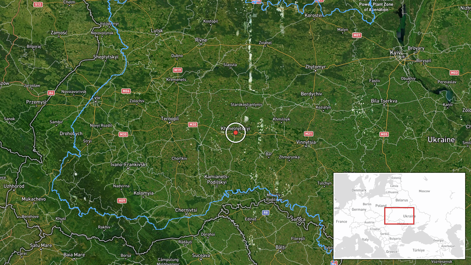
Ukrainian air monitoring reported on Telegram that one Russian jet-powered Shahed, identified as a Geran-3, was spotted north of Khmelnytskyi, flying on a northerly course. The report was posted at 01:35 UTC on 16 October 2026 by the Telegram channel @kpszsu, which is the account used for Ukrainian air force-related alerts. The post uses terse wording, describing a jet-powered drone ("Реактивний БпЛА") heading north from a point north of the city. The report does not mention impacts, casualties, interceptions or damage, and it does not state where the drone was ultimately headed. The event is recorded as a drone transit, meaning it is logged for the movement itself rather than a confirmed strike.
Context and assessment
Khmelnytskyi sits in western-central Ukraine, a region that has repeatedly appeared in Russian long-range drone routes toward western and northwestern targets. This event is one of five Drone Transit entries logged for Khmelnytskyi and its surrounding oblast between 12:27 and 01:35 UTC over roughly thirteen hours, with the sequence showing a steady stream of single drones moving through the area. Earlier reports in the series describe drones heading toward the oblast, then passing near Pivdennyi, and one report that mentions a drone heading toward Kor, which suggests the flights were not confined to a single target. The repeated appearance of the Geran-3 variant, which uses a jet engine and is faster than the piston-engine Shahed design, may indicate a deliberate effort to probe air defense coverage or to keep pressure on air-defense units across the region. Because each report concerns a single airframe, the pattern more likely reflects sustained transit traffic than one coordinated mass raid. Operationally, the evidence points to route monitoring rather than a confirmed target assignment.
Sources and confidence
The event rests on a single Telegram channel, @kpszsu, with no independent cross-confirmation in the dataset. The confidence score of 8.0 reflects that the source is an official-style Ukrainian air monitoring account with a consistent record across the related reports, but it is not reduced further because the report is brief and specific about the drone type and direction. The score would rise if regional military administrations, the Ukrainian Air Force, or independent flight-tracking observers confirmed the track. It would fall if later reporting contradicted the drone type, the timing, or the location, or if the track proved to be a different airframe.
Location
The location is recorded at settlement precision for Khmelnytskyi, with a high location confidence rating. The report places the drone north of the city, so the coordinates reflect the city center rather than the exact track. Khmelnytskyi is a regional capital on the Southern Bug River in western-central Ukraine, and the surrounding terrain is largely agricultural plain with scattered forest belts. The city is a regional hub with an airfield, so drones transiting the area may pass near infrastructure that is relevant to air defense planning.
Related events nearby
- Ukrainian air monitoring: 1 Russian jet-powered Shahed (Geran-3) drone over Khmelnytskyi Oblast; 1 Russian jet2026-10-16 01:07 UTC · Drone Transit · Khmelnytskyi Oblast, Ukraine
- Ukrainian air monitoring: 1 Russian jet-powered Shahed (Geran-3) drone heading toward Khmelnytskyi Oblast.2026-10-15 17:30 UTC · Drone Transit · Khmelnytskyi Oblast, Ukraine
- Ukrainian air monitoring: 1 Russian Shahed-type drone passing Pivdennyi, heading toward Khmelnytskyi Oblast.2026-10-15 16:59 UTC · Drone Transit · Khmelnytskyi Oblast, Ukraine
- Ukrainian air monitoring: 1 Russian jet-powered Shahed (Geran-3) drone heading toward Khmelnytskyi.2026-10-15 16:04 UTC · Drone Transit · Khmelnytskyi, Ukraine
- Ukrainian air monitoring: 1 Russian jet-powered Shahed (Geran-3) drone heading toward Khmelnytskyi Oblast.2026-10-15 12:27 UTC · Drone Transit · Khmelnytskyi Oblast, Ukraine
▶ View this event on the live map

Intel Mapper aggregates open-source reports from monitored Telegram and X channels, geolocates them, cross-checks duplicates across sources and assigns a confidence score. Entries are updated as new confirmations arrive. Read how we verify events.