Geran-3 jet drone reported crossing Khmelnytskyi Oblast toward Ternopil and Moldova border
What happened
A Ukrainian air monitoring post on the Telegram channel @kpszsu reported at about 01:07 UTC on 16 October 2026 that a single Russian jet-powered Shahed-type drone, described in the English summary as a Geran-3, was moving south toward the Ternopil region from Khmelnytskyi Oblast. A second track in the same report was described as a jet-powered drone moving from the south of Vinnytsia Oblast toward the border with the Republic of Moldova, and the English summary renders that route as heading toward Kordon. The original Ukrainian wording uses the term reaktyvnyi BpLA, meaning jet-powered unmanned aerial vehicle. The post gives no precise coordinates, altitude, or target. The report does not describe any impact, damage, or casualties, so it should be read as a movement notice rather than a confirmed strike.
Context and assessment
Khmelnytskyi Oblast sits on the main western approach into Ukraine, and it hosts military airfield infrastructure as well as rail and road links toward the Polish and Moldovan frontiers. Drones moving through the oblast are therefore significant for air defence planning even when no strike is reported. The event is part of a clear recent pattern. Five earlier notices on 15 October 2026, logged between 12:10 and 17:30 local reporting time, describe similar single jet-powered Shahed-type drones heading toward Khmelnytskyi or Khmelnytskyi Oblast, one of them passing near Pivdennyi. The repetition of short-interval tracks across one oblast suggests either several separate launches using a similar corridor or a sustained effort to probe or saturate the western air picture. Operationally, such routing may serve reconnaissance, may be intended to draw air defence assets westward, or may reflect drones being guided around defended areas toward the Moldovan border. These readings are inferences from the timing and geography of the notices and are not confirmed by the reports themselves.
Sources and confidence
All information comes from one Telegram post, attributed to a channel widely associated with the Ukrainian Air Force. The source is official and has generally been a reliable early indicator of drone movements, but this event has no independent cross-confirmation from another outlet, regional administration, or neighbouring state's airspace monitoring. The confidence score of 8.0 reflects the channel's institutional standing and the consistency of the surrounding series, while being held back by the single-source basis, the terse wording, and the absence of coordinates. Confidence would rise with corroboration from regional military administrations, Moldovan or Romanian airspace notices, or follow-up reporting on impacts. It would fall if later updates revised the track, reclassified the drone type, or indicated the alert was superseded.
Location
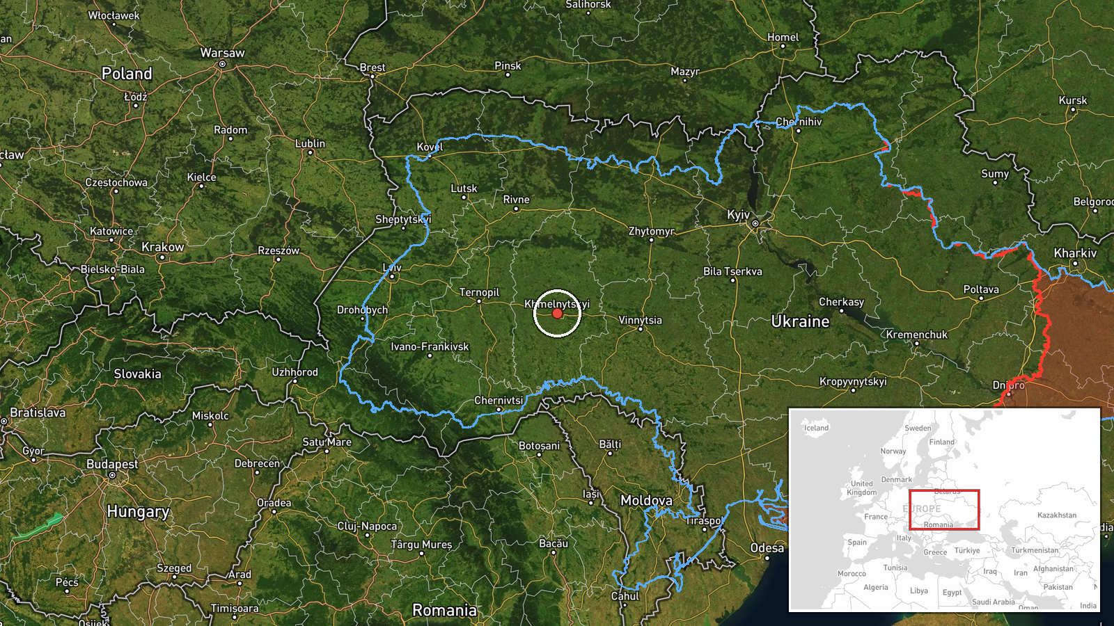
The location is recorded at region level for Khmelnytskyi Oblast, with approximate coordinates near 49.42 N, 26.98 E. This is a central-western point within the oblast rather than a specific settlement, facility, or route segment, so the location confidence is rated low. The area lies on the Podillia upland, a rolling plateau of farmland, forest patches, and river valleys draining toward the Southern Bug and Dniester systems. The Ternopil frontier lies to the west and south, and the Moldovan border lies further southwest.
Related events nearby
- Ukrainian air monitoring: 1 Russian jet-powered Shahed (Geran-3) drone over Khmelnytskyi.2026-10-16 01:35 UTC · Drone Transit · Khmelnytskyi, Ukraine
- Ukrainian air monitoring: 1 Russian jet-powered Shahed (Geran-3) drone heading toward Khmelnytskyi Oblast.2026-10-15 17:30 UTC · Drone Transit · Khmelnytskyi Oblast, Ukraine
- Ukrainian air monitoring: 1 Russian Shahed-type drone passing Pivdennyi, heading toward Khmelnytskyi Oblast.2026-10-15 16:59 UTC · Drone Transit · Khmelnytskyi Oblast, Ukraine
- Ukrainian air monitoring: 1 Russian jet-powered Shahed (Geran-3) drone heading toward Khmelnytskyi.2026-10-15 16:04 UTC · Drone Transit · Khmelnytskyi, Ukraine
- Ukrainian air monitoring: 1 Russian jet-powered Shahed (Geran-3) drone heading toward Khmelnytskyi Oblast.2026-10-15 12:27 UTC · Drone Transit · Khmelnytskyi Oblast, Ukraine
▶ View this event on the live map

Intel Mapper aggregates open-source reports from monitored Telegram and X channels, geolocates them, cross-checks duplicates across sources and assigns a confidence score. Entries are updated as new confirmations arrive. Read how we verify events.