Single jet-powered Geran-3 drone reported passing Slavutych toward Kyiv Oblast
What happened
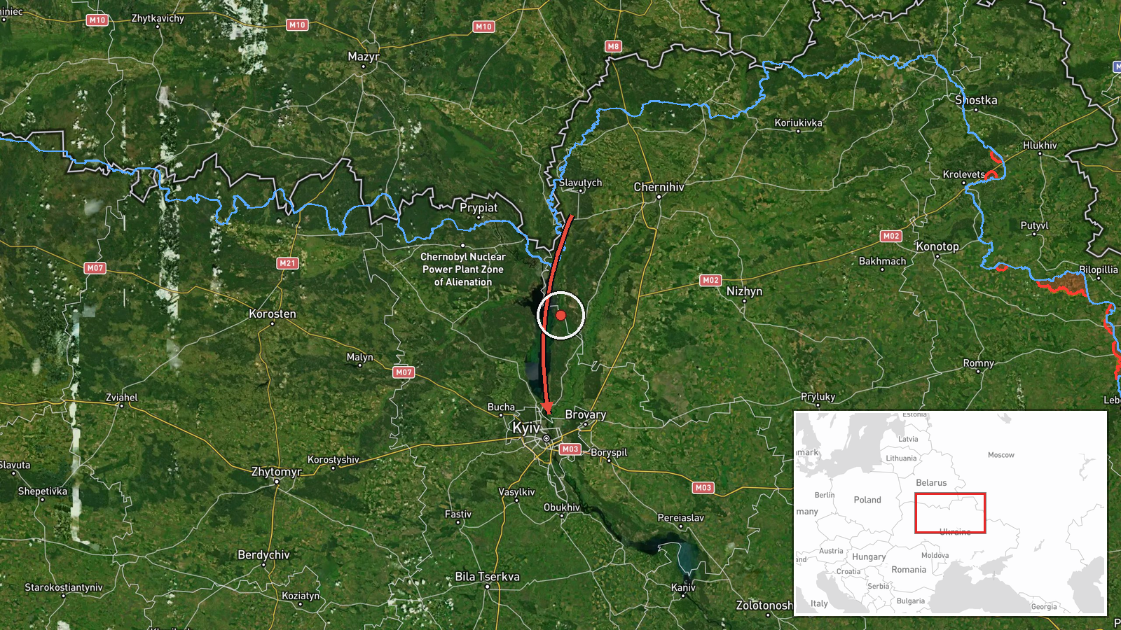
Ukrainian air monitoring reports on the Telegram channel @kpszsu described one Russian jet-powered Shahed, designated Geran-3, passing Slavutych and heading toward Kyiv Oblast. The original Ukrainian-language post, timed 16 October 2026 at 07:51 UTC, carries a header naming Chernihiv region (Чернігівщина), while the platform summary places the track in Kyiv Oblast. The report does not describe impact, damage, casualties, or interception. It is a single transit notice, so the event is recorded as a drone transit rather than a strike. Altitude, speed, and the exact route are not stated in the post.
Context and assessment
Slavutych sits in northeastern Kyiv Oblast near the Chernihiv border and the Chernobyl exclusion zone, along the approaches that Russian drones have used to reach the capital from the north. The related events show a sustained sequence on the same date. Between 01:08 and 06:54 UTC, separate Geran-3 transits were logged from western Chernihiv and western Cherkasy oblasts, then over Kyiv Oblast, past Boryspil and Boyarka, and toward Kyiv itself. The tracks rotate around the capital's periphery rather than converging on one visible point, which suggests a multi-axis overnight and morning pattern rather than a single aimpoint. Operationally, transit notices of this kind are generally used to warn air defence units and the public. A drone passing a city's edge may be heading for Kyiv, for another target, or may be a decoy or a rerouted track. Jet-powered variants are faster and harder to intercept than older piston-engine Shaheds, which helps explain why monitoring networks follow them closely. The pattern is consistent with a continuing raid, but these reports alone do not establish intent or the intended target.
Sources and confidence
The event rests on a single Telegram channel, @kpszsu, which is widely understood to be associated with the Ukrainian Air Force. No independent outlet or second channel in the data confirms this specific track. The related events come from the same monitoring type and corroborate the overall timing and direction of the drone traffic, but not this particular transit. The confidence score of 8.0 reflects an official-origin source with a clear, specific report. It is reduced by the absence of independent confirmation, the mismatch between the Chernihiv header and the Kyiv Oblast tag, and the region-level geocoding. Confidence would rise with a second channel, wire confirmation, or an official situational update naming this track. It would fall if the report were corrected or withdrawn.
Location
The coordinates (50.45, 30.52) fall in central Kyiv, not Slavutych, so the marker reflects regional geocoding rather than the reported point of passage. Slavutych lies to the northeast in Kyiv Oblast on the Desna River, near the Chernihiv border. The location is approximate and carries low confidence. The marker should not be read as a precise position or track point.
Related events nearby
- Ukrainian air monitoring: 1 Russian jet-powered Shahed (Geran-3) drone passing Slavutych, heading toward Kyiv 2026-10-16 08:16 UTC · Drone Transit · Kyiv Oblast, Ukraine
- Ukrainian air monitoring: 1 Russian jet-powered Shahed (Geran-3) drone passing Boyarka, heading toward Kyiv.2026-10-16 06:54 UTC · Drone Transit · Kyiv, Ukraine
- Ukrainian air monitoring: 1 Russian jet-powered Shahed (Geran-3) drone over Kyiv Oblast.2026-10-16 03:43 UTC · Drone Transit · Kyiv Oblast, Ukraine
- Ukrainian air monitoring: 1 Russian jet-powered Shahed (Geran-3) drone from western Cherkasy Oblast toward Kyi2026-10-16 03:27 UTC · Drone Transit · Kyiv Oblast, Ukraine
- Ukrainian air monitoring: 1 Russian jet-powered Shahed (Geran-3) drone passing Boryspil, heading toward Kyiv.2026-10-16 01:58 UTC · Drone Transit · Kyiv, Ukraine
▶ View this event on the live map

Intel Mapper aggregates open-source reports from monitored Telegram and X channels, geolocates them, cross-checks duplicates across sources and assigns a confidence score. Entries are updated as new confirmations arrive. Read how we verify events.