Ukrainian air monitoring reports a Geran-3 jet drone passing Slavutych toward Kyiv Oblast
What happened
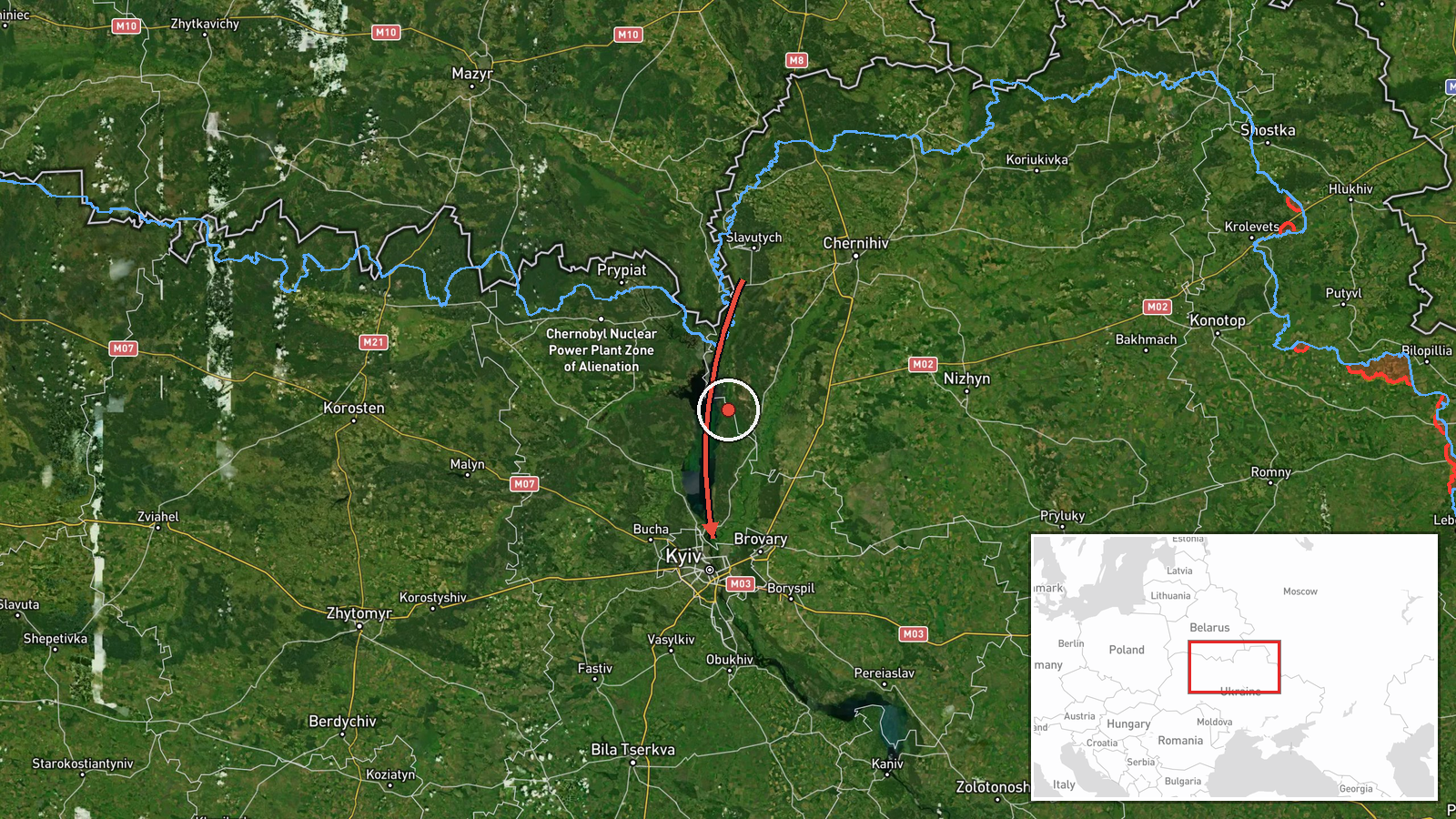
Ukraine's air monitoring channel on Telegram, @kpszsu, reported at 08:16 UTC on 16 October 2026 that one Russian jet-powered Shahed, identified in the report as a Geran-3, was passing Slavutych on a course toward Kyiv Oblast. The original Ukrainian post, which reads roughly as 'Chernihiv region: jet-powered UAV passing Slavutych on course toward Kyiv region,' places the sighting under Chernihiv region, while the event record assigns it to Kyiv Oblast. Slavutych sits close to the Chernihiv border, so the two labels may reflect how the drone's track was framed rather than a conflict in the sighting itself. The report describes no impact, casualties, or damage. It is a single-source transit notice and is not marked as corrected.
Context and assessment
Slavutych is a planned city northeast of Kyiv, close to the Chernihiv border, so a drone reported there is on a path toward the capital rather than an isolated sighting. The related events show a longer sequence on the same day. Between 01:58 and 07:51 UTC, monitors logged Geran-3 drones passing Boryspil and Boyarka, moving over Kyiv Oblast, and entering from western Cherkasy Oblast, each described as heading toward Kyiv or Kyiv Oblast. Taken together, these reports suggest a sustained approach to the capital area over several hours, with drones appearing along more than one axis. Jet-powered Geran-3 variants are generally faster and harder to intercept than older piston-engine Geran models, which is one reason monitoring reports now track them individually. Kyiv hosts government, energy, and transport infrastructure, so repeated transit reports near the city are often read as preparation for a wider salvo, though a transit notice alone does not establish a target. The pattern may indicate a multi-axis raid or drones that are being followed by monitors rather than all aimed at the same point.
Sources and confidence
The event rests on one Telegram channel, @kpszsu, which appears to be the Ukrainian Air Force's official account. The record shows no independent cross-confirmation from other outlets or monitoring accounts. The channel's routine reporting supports a fairly high score of 8.0, but a single-source transit notice with no impact data and a regional labeling discrepancy keeps full verification out of reach. Corroboration from other monitoring channels, official statements from Kyiv Oblast or Chernihiv authorities, or flight-track data would raise confidence. A confirmed misidentification of the location or the drone type would lower it.
Location
The coordinates, 50.45 N and 30.52 E, fall near central Kyiv and appear to be a regional placeholder rather than a fix on the drone or on Slavutych. Location confidence is low and precision is recorded only at region level. Slavutych lies in the north-east of the region near the Desna basin and the Chernihiv border, roughly northeast of the capital and close to the Chernobyl exclusion zone. Readers should treat the map marker as indicating the broader Kyiv area, not the exact track.
Related events nearby
- Ukrainian air monitoring: 1 Russian jet-powered Shahed (Geran-3) drone passing Slavutych, heading toward Kyiv 2026-10-16 07:51 UTC · Drone Transit · Kyiv Oblast, Ukraine
- Ukrainian air monitoring: 1 Russian jet-powered Shahed (Geran-3) drone passing Boyarka, heading toward Kyiv.2026-10-16 06:54 UTC · Drone Transit · Kyiv, Ukraine
- Ukrainian air monitoring: 1 Russian jet-powered Shahed (Geran-3) drone over Kyiv Oblast.2026-10-16 03:43 UTC · Drone Transit · Kyiv Oblast, Ukraine
- Ukrainian air monitoring: 1 Russian jet-powered Shahed (Geran-3) drone from western Cherkasy Oblast toward Kyi2026-10-16 03:27 UTC · Drone Transit · Kyiv Oblast, Ukraine
- Ukrainian air monitoring: 1 Russian jet-powered Shahed (Geran-3) drone passing Boryspil, heading toward Kyiv.2026-10-16 01:58 UTC · Drone Transit · Kyiv, Ukraine
▶ View this event on the live map

Intel Mapper aggregates open-source reports from monitored Telegram and X channels, geolocates them, cross-checks duplicates across sources and assigns a confidence score. Entries are updated as new confirmations arrive. Read how we verify events.