Russian Geran-3 jet drone reported heading toward Shepetivka in Khmelnytskyi Oblast
What happened
Ukrainian air monitoring reported one Russian jet-powered Shahed, identified as a Geran-3, on a course toward Shepetivka in Khmelnytskyi Oblast at about 10:01 UTC on 16 October 2026. The report was posted on the Telegram channel @kpszsu. Its original Ukrainian wording describes a jet-type unmanned aerial vehicle moving along a heading toward the city, and the post is brief. It does not describe any impact, debris, or detonation. The record is classified as a drone transit rather than a strike, so it concerns the aircraft's movement, not a confirmed hit. Only this one channel is attached to the record at present.
Context and assessment
Shepetivka is a rail and road junction in western Ukraine, and the recent record places it inside a sustained pattern of drone activity across Khmelnytskyi and neighbouring oblasts. Late on 15 October, a Russian UAV strike was reported against oil depots in the city, with large fires described, although impact beyond the fires remains unconfirmed. Earlier that day, a single Geran-3 was tracked from Khmelnytskyi Oblast toward Iziaslav, and on the morning of 16 October another was reported heading toward Starokostyantyniv, a town to the southeast that had also been on a Geran-3 path the previous evening. Separate monitoring in the early hours of 16 October described two or more jet-powered drones passing western Zhytomyr Oblast heading south. Taken together, these reports suggest a route of repeated transits through the region over roughly a day. Operationally, a sequence like this may indicate a campaign against fuel and logistics nodes, or it may reflect routine routing of long-range drones past several targets. The current report alone cannot distinguish between these readings.
Sources and confidence
The assessment rests on one Telegram channel, @kpszsu, with no independent confirmation in the record. The channel is a Ukrainian military-linked air monitoring feed and is generally used for early warning, which supports the basic reporting, but a single-source post cannot be checked against a second account of the same flight. The confidence score of 8.0 reflects a credible channel, a specific aircraft type, and a precise time, offset by the absence of cross-confirmation and the lack of any follow-up. Confidence would rise with corroboration from another monitoring source, a local official statement, or a later report of an interception or impact. It would fall if the track were revised, withdrawn, or matched to a different aircraft.
Location
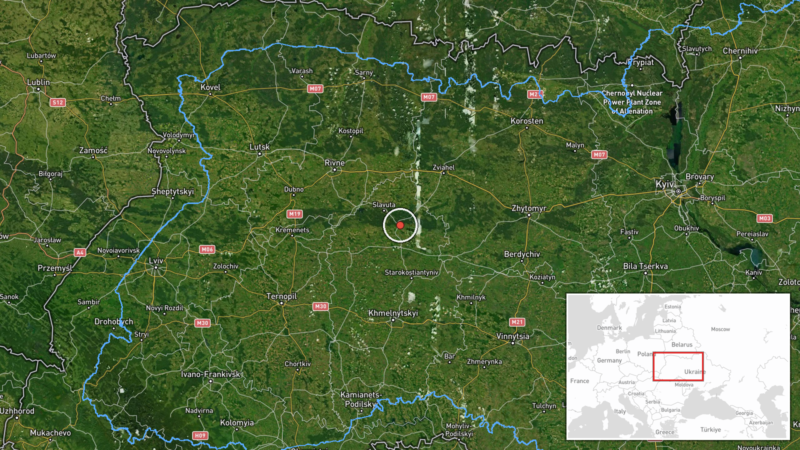
The location is placed at the settlement level, at the centre of Shepetivka, because the source names the city as the drone's heading and gives no more specific point. Location confidence is recorded as high because the settlement name is explicit and the coordinates match the municipal area. Shepetivka sits in the Khmelnytskyi region of west-central Ukraine, on relatively flat terrain near the Polish border. Nearby features include regional rail lines and roads that connect the city with Starokostyantyniv and Lviv-bound corridors.
Related events nearby
- Russian UAV strikes hit oil depots in Shepetivka, Khmelnytskyi region, causing large fires. Impact details bey2026-10-15 23:14 UTC · UAS Strike · Shepetivka, Khmelnytskyi Oblast, Ukraine
- Ukrainian air monitoring: 1 Russian jet-powered Shahed (Geran-3) drone from Khmelnytskyi Oblast toward Iziasla2026-10-15 18:11 UTC · Drone Transit · Iziaslav, Ukraine
- Ukrainian air monitoring: 1 Russian jet-powered Shahed (Geran-3) drone heading toward Starokostyantyniv.2026-10-16 09:33 UTC · Drone Transit · Starokostyantyniv, Ukraine
- Ukrainian air monitoring: 1 Russian jet-powered Shahed (Geran-3) drone from northern Vinnytsia Oblast toward S2026-10-15 18:02 UTC · Drone Transit · Starokostyantyniv, Ukraine
- Ukrainian air monitoring: jet-powered Shahed-type (Geran-3) drones tracked in Khmelnytskyi Oblast west of Star2026-10-16 11:01 UTC · Drone Transit · Starokostiantyniv, Khmelnytskyi Oblast, Ukraine
▶ View this event on the live map

Intel Mapper aggregates open-source reports from monitored Telegram and X channels, geolocates them, cross-checks duplicates across sources and assigns a confidence score. Entries are updated as new confirmations arrive. Read how we verify events.