Single jet-powered Shahed-type drone reported heading toward Starokostiantyniv
What happened
Ukraine's air monitoring channel, listed in the data as Telegram @kpszsu, reported on 16 October 2026 at 09:33 UTC that one jet-powered Shahed-type drone, identified as the Geran-3, was heading toward Starokostiantyniv in Khmelnytskyi Oblast. The original Ukrainian wording is brief: a jet-powered unmanned aerial vehicle on course for Starokostiantyniv, posted under the regional heading Khmelnytskyi. The report does not describe an impact, detonation, or casualties, and it does not say whether the drone was intercepted. The event is classified as a drone transit, meaning the object was tracked in flight rather than confirmed to have struck anything. Attribution to Russia rests on the type designation in the alert, since the Geran series is the Russian-associated Shahed family. The record is uncorrected and carries a single source.
Context and assessment
This alert belongs to a sequence of tracks logged over roughly sixteen hours on 15 and 16 October. Earlier that afternoon, a single Shahed-type drone was reported heading toward Krasyliv, followed by a group of two or more Geran-3 drones passing Khmelnytskyi on a similar course. At 18:02 on 15 October, another Geran-3 was reported moving toward Starokostiantyniv from northern Vinnytsia Oblast, and in the early hours of 16 October one was logged passing north of Khmelnytskyi heading north. A later alert placed two or more Geran-3 drones heading toward Khmelnytskyi itself. Taken together, the reports show repeated tracks across Khmelnytskyi and neighboring Vinnytsia Oblast, with Starokostiantyniv named more than once. Such a pattern may indicate drones routed through western-central Ukraine toward targets farther afield, or groups probing air defense coverage in the region. The data does not name the intended targets, and changes in heading and grouping are common in tracking of this kind, so the alerts should be read as movement indicators rather than confirmed strike plans. The jet-powered variant is generally faster than the older piston-engine models, which can shorten warning time for ground defenses.
Sources and confidence
All information comes from a single Telegram channel, @kpszsu, with no independent cross-confirmation recorded in the dataset. The confidence score of 8.0 reflects the channel's official-type origin, the regular pattern of track reporting, and the specific type designation, but it is not corroborated by a second outlet or by regional authorities. Confidence would rise with confirmation from regional military administrations, independent flight-tracking data, or reports of intercepts or impacts. It would fall if the track were revised, the heading corrected, or the object identified as a different type. The record is currently uncorrected.
Location
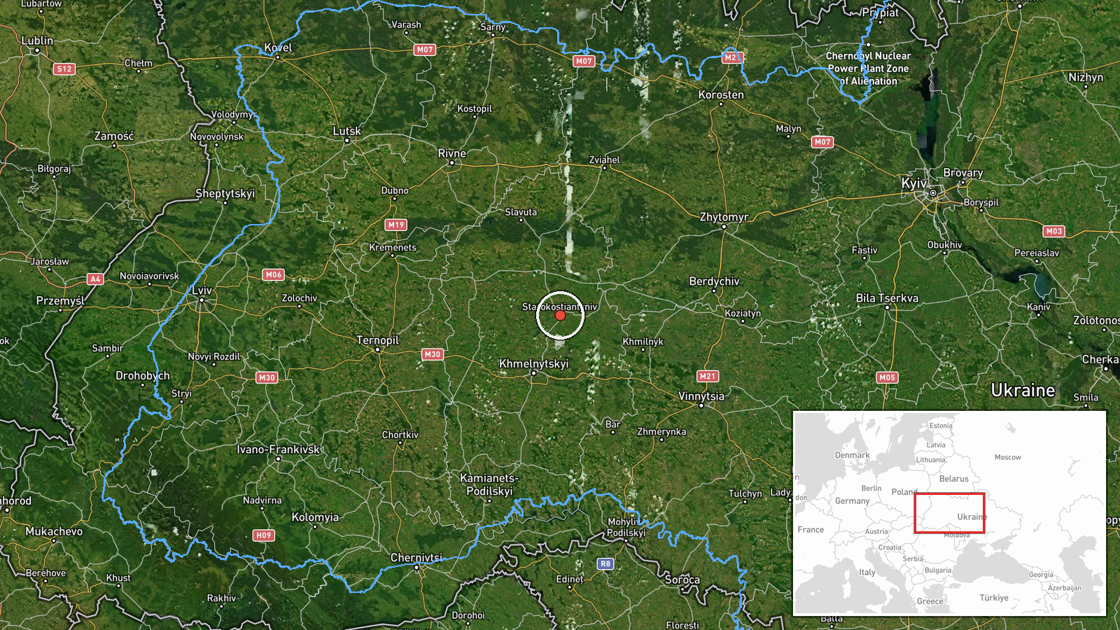
The coordinates are settlement-level, placing the marker at the centre of Starokostiantyniv rather than at any specific site, and the location confidence is rated high. Starokostiantyniv lies in Khmelnytskyi Oblast in west-central Ukraine, within the Podolia region. The terrain is mainly rolling farmland and river valleys, with Vinnytsia Oblast to the south. Khmelnytskyi, the regional capital, serves as the nearest major reference point, and several other alerts in this sequence were logged in its vicinity.
Related events nearby
- Ukrainian air monitoring: 1 Russian jet-powered Shahed (Geran-3) drone from northern Vinnytsia Oblast toward S2026-10-15 18:02 UTC · Drone Transit · Starokostyantyniv, Ukraine
- Ukrainian air monitoring: jet-powered Shahed-type (Geran-3) drones tracked in Khmelnytskyi Oblast west of Star2026-10-16 11:01 UTC · Drone Transit · Starokostiantyniv, Khmelnytskyi Oblast, Ukraine
- Ukrainian air monitoring: 1 Russian jet-powered Shahed (Geran-3) drone passing north of Khmelnytskyi, heading 2026-10-16 01:35 UTC · Drone Transit · north of Khmelnytskyi, Ukraine
- Ukrainian air monitoring: 2+ Russian jet-powered Shahed (Geran-3) drones passing Khmelnytskyi, heading toward 2026-10-15 17:35 UTC · Drone Transit · Krasyliv, Ukraine
- Ukrainian air monitoring: 1 Russian Shahed-type drone heading toward Krasyliv.2026-10-15 16:59 UTC · Drone Transit · Krasyliv, Ukraine
▶ View this event on the live map

Intel Mapper aggregates open-source reports from monitored Telegram and X channels, geolocates them, cross-checks duplicates across sources and assigns a confidence score. Entries are updated as new confirmations arrive. Read how we verify events.