Jet-powered Shahed-type drones tracked heading northwest across Khmelnytskyi Oblast
What happened
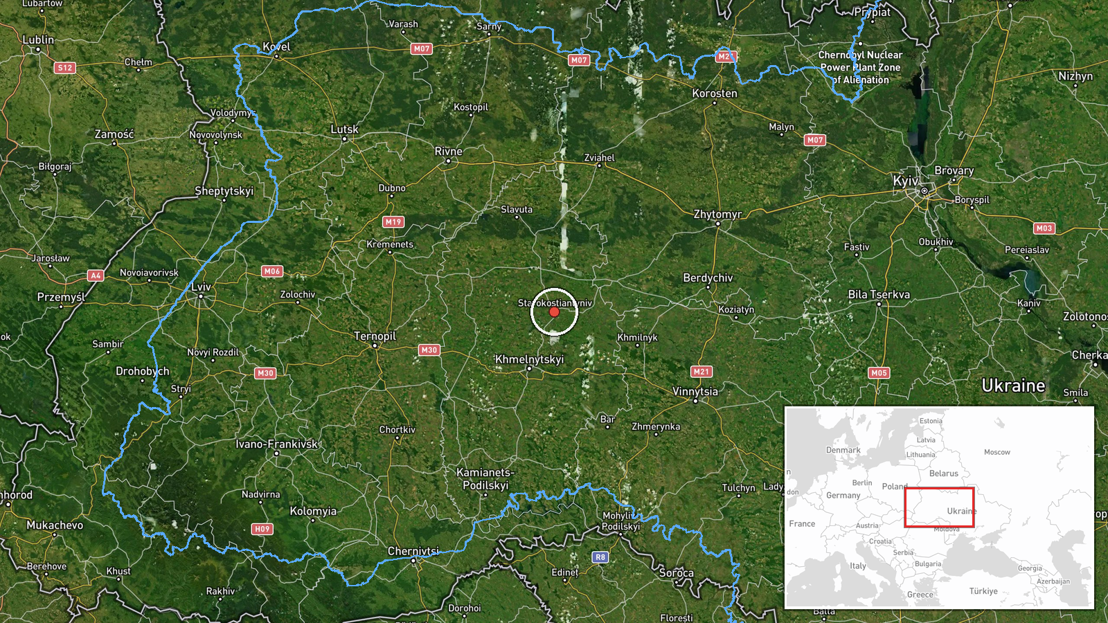
Ukrainian air monitoring reported on Telegram that jet-powered Shahed-type drones, described in the summary as Geran-3 models, were tracked in Khmelnytskyi Oblast in western Ukraine. The post placed them west of Starokostiantyniv and east of Khmelnytskyi city, on a course toward the northwest. The timestamp is 16 October 2026 at 11:01 UTC. The original Ukrainian wording refers to reactive unmanned aerial vehicles in Khmelnytskyi without giving a count, altitude, or speed. The Telegram channel is the only source attached to this event, and the report does not say whether any drone struck a target or was intercepted. As a transit notice, the event records movement along a path rather than an impact.
Context and assessment
This report belongs to a run of drone transit notices that began the previous afternoon. Between 16:59 and 18:02 UTC on 15 October, monitoring posts logged single drones and small groups moving toward Krasyliv and Starokostiantyniv, with one originating in northern Vinnytsia Oblast. Early on 16 October, another jet-powered drone was reported passing north of Khmelnytskyi and heading north, and a morning notice placed one more on a course toward Starokostiantyniv. Taken together, the sequence shows the same corridor being used repeatedly, with Starokostiantyniv appearing as a recurring heading. Starokostiantyniv hosts Ukrainian military aviation infrastructure, so repeated approaches to the area could reflect either a deliberate target set or air defense units tracking aircraft and drones to a point of interest. Operationally, individual transits of this kind are often consistent with reconnaissance, route testing, or attempts to stretch radar coverage across western oblasts, though the reports alone cannot confirm which purpose applies. The consistent use of the Geran-3 label across the sequence suggests a common platform rather than mixed threats, but this is inferred from wording, not verified by wreckage or official assessment.
Sources and confidence
The event rests on a single Telegram channel, @kpszsu, which is attached to Ukrainian air monitoring posts. The related events in this sequence use similar wording and come from the same type of monitoring feed, which supports consistency but not independent confirmation. No second outlet, official statement, or physical evidence is linked to this specific notice. The confidence score of 8.0 reflects a credible monitoring source with a clear timestamp and direction, offset by the lack of cross-confirmation and the absence of any reported outcome. Confidence would rise with independent reporting, a regional military administration statement, or debris recovery. It would fall if later posts revised the track or if the drone's destination proved to be elsewhere.
Location
The location is recorded at settlement precision, centered on Starokostiantyniv, a city in eastern Khmelnytskyi Oblast. The report describes the drone's position as west of that city, so the coordinates mark the reference settlement rather than the exact track point. The city lies roughly 40 km north-northeast of Khmelnytskyi city. The surrounding landscape is the Podillia upland region, which is mostly farmland, with patches of forest and river valleys. The terrain is open enough for long-range tracking from air defense radars in the region.
Related events nearby
- Ukrainian air monitoring: 1 Russian jet-powered Shahed (Geran-3) drone heading toward Starokostyantyniv.2026-10-16 09:33 UTC · Drone Transit · Starokostyantyniv, Ukraine
- Ukrainian air monitoring: 1 Russian jet-powered Shahed (Geran-3) drone from northern Vinnytsia Oblast toward S2026-10-15 18:02 UTC · Drone Transit · Starokostyantyniv, Ukraine
- Ukrainian air monitoring: 1 Russian jet-powered Shahed (Geran-3) drone passing north of Khmelnytskyi, heading 2026-10-16 01:35 UTC · Drone Transit · north of Khmelnytskyi, Ukraine
- Ukrainian air monitoring: 2+ Russian jet-powered Shahed (Geran-3) drones passing Khmelnytskyi, heading toward 2026-10-15 17:35 UTC · Drone Transit · Krasyliv, Ukraine
- Ukrainian air monitoring: 1 Russian Shahed-type drone heading toward Krasyliv.2026-10-15 16:59 UTC · Drone Transit · Krasyliv, Ukraine
▶ View this event on the live map

Intel Mapper aggregates open-source reports from monitored Telegram and X channels, geolocates them, cross-checks duplicates across sources and assigns a confidence score. Entries are updated as new confirmations arrive. Read how we verify events.