Single Shahed-type drone reported moving from Chernihiv Oblast toward Kyiv Oblast
What happened
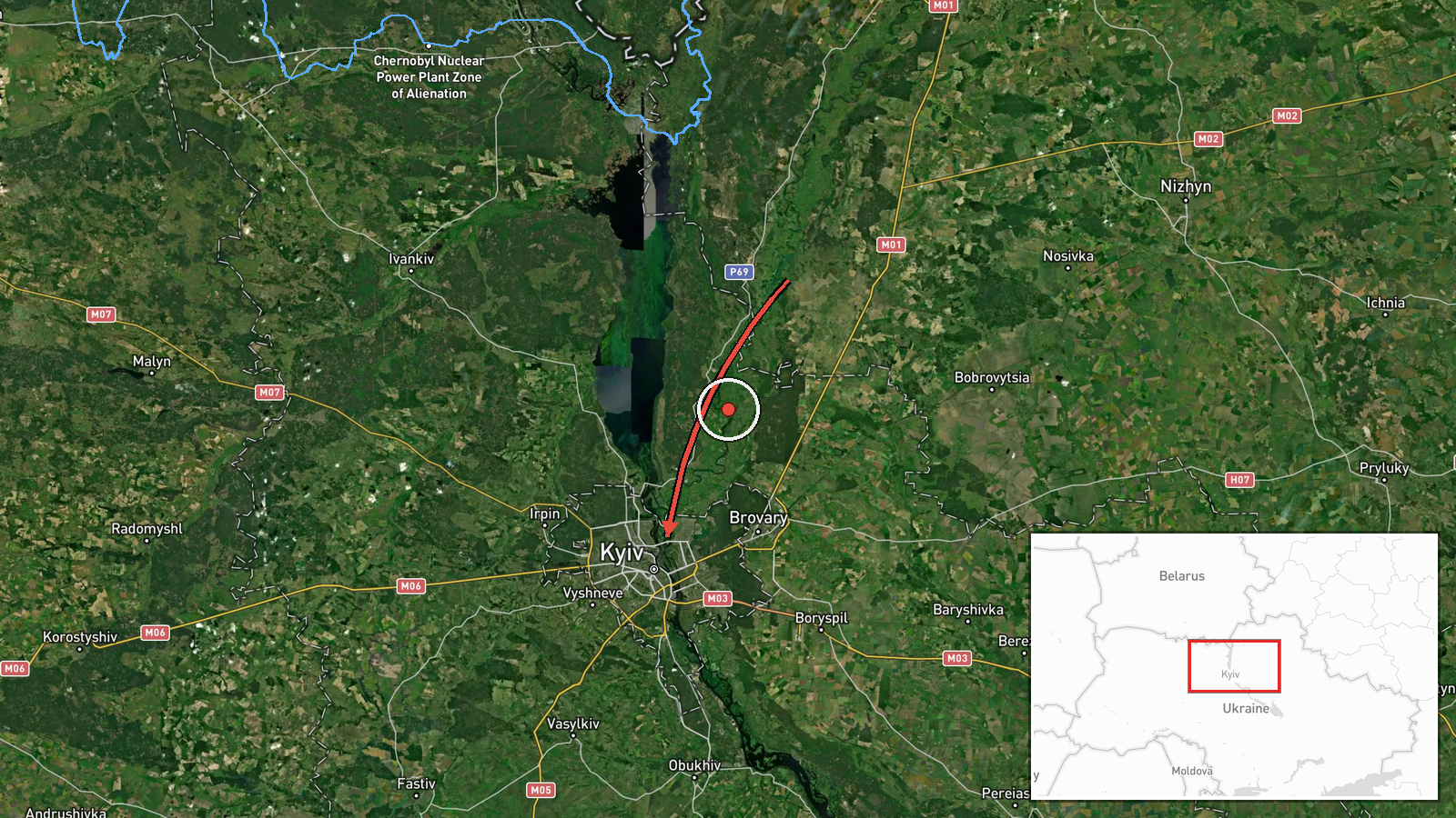
Ukrainian air monitoring channel Telegram @kpszsu reported at 14:33 UTC on 16 October 2026 that one Russian Shahed-type drone was moving from Chernihiv Oblast toward Kyiv Oblast. The original Ukrainian-language post refers to strike drones in Chernihiv region moving mostly on a western course toward Kyiv region, so the single-drone count in the summary is an interpretation of that wording rather than a quoted figure. The entry is recorded at region level only, with no settlement or specific flight point named. No impact, casualties, or damage are reported in the data. Attribution to Russia rests on the channel's description of the drone type and the wider pattern of Shahed-type use in the conflict.
Context and assessment
Kyiv has been a recurring focus of long-range drone activity since 2022. The capital and its surrounding oblast sit on the main approach from the north and west, so transit reports there are routine rather than unusual. The related entries from the same day show a dense sequence: a drone passing Boyarka at 06:54 UTC, Slavutych at 07:51 and again at 08:16, a Shahed-type drone from Cherkasy Oblast at 14:40, and a jet-powered Geran-3 passing Vyshhorod at 14:41 on its way toward Kyiv. Together these suggest several aircraft moving through the northern and central corridor over most of the day, with tracks converging on the capital. Jet-powered variants are generally described as faster and harder to intercept than piston-engine Shaheds, which may explain the close tracking. Transit reports of this kind can indicate reconnaissance, a feint to draw air defenses, or a staged approach ahead of a larger salvo, but a single post cannot distinguish between these. The pattern is best read as an approach being monitored in near real time, not as evidence of a specific target or outcome.
Sources and confidence
All of this rests on one Telegram channel, @kpszsu, the only source listed. Its post is a live air-monitoring alert rather than a confirmed incident report, and its wording describes drones moving mostly west, so the single-drone count is a reading of that post. Same-day related entries show consistent reporting, but that is not independent verification. The score of 8.0 reflects a source with a steady alert record, held back by single-source status and a region-level location. Confidence would rise with a second monitoring body, official regional statements, or matching sightings. It would fall if the count were corrected or if the flight path failed to reach Kyiv Oblast.
Location
Coordinates are region-level and placed within Kyiv Oblast rather than at a named settlement or flight point, so they mark an area, not a position. The point lies close to Kyiv city, which sits at the center of the oblast, so it may overstate precision for a drone in transit. Kyiv Oblast surrounds the capital and borders Chernihiv Oblast to the north, the route the report describes. The Dnipro River and Kyiv reservoir lie to the east and northeast of the city, with flat, wooded terrain typical of northern Ukraine.
Related events nearby
- Ukrainian air monitoring: 1 Russian jet-powered Shahed (Geran-3) drone passing Vyshhorod, heading toward Kyiv.2026-10-16 14:41 UTC · Drone Transit · Kyiv, Ukraine
- Ukrainian air monitoring: 1 Russian Shahed-type drone from Cherkasy Oblast toward Kyiv Oblast.2026-10-16 14:40 UTC · Drone Transit · Kyiv Oblast, Ukraine
- Ukrainian air monitoring: 1 Russian jet-powered Shahed (Geran-3) drone passing Slavutych, heading toward Kyiv 2026-10-16 08:16 UTC · Drone Transit · Kyiv Oblast, Ukraine
- Ukrainian air monitoring: 1 Russian jet-powered Shahed (Geran-3) drone passing Slavutych, heading toward Kyiv 2026-10-16 07:51 UTC · Drone Transit · Kyiv Oblast, Ukraine
- Ukrainian air monitoring: 1 Russian jet-powered Shahed (Geran-3) drone passing Boyarka, heading toward Kyiv.2026-10-16 06:54 UTC · Drone Transit · Kyiv, Ukraine
▶ View this event on the live map

Intel Mapper aggregates open-source reports from monitored Telegram and X channels, geolocates them, cross-checks duplicates across sources and assigns a confidence score. Entries are updated as new confirmations arrive. Read how we verify events.