Single Shahed-type drone reported moving north from Cherkasy toward Kyiv Oblast
What happened
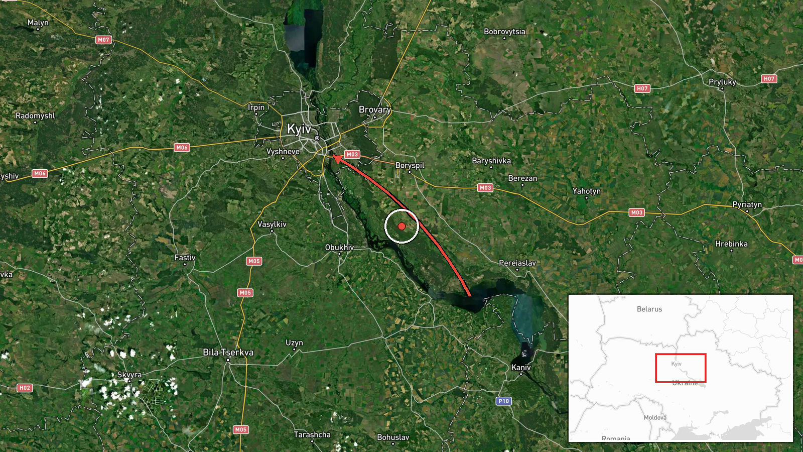
Ukrainian air monitoring, as relayed by the Telegram channel @kpszsu, reported at 14:40 UTC on 16 October 2026 one strike-type UAV, described as a Russian Shahed-type drone, flying on a northern course from Cherkasy Oblast toward Kyiv Oblast. The original Ukrainian-language post refers to a 'strike UAV' (ударний БпЛА) in the Cherkasy region heading north toward the Kyiv region. It does not name a specific settlement, a point of impact, or any damage. The report is a single-channel transit notice rather than a confirmed strike. It sits within a cluster of drone-transit notices logged the same day, several of which describe jet-powered Geran-3 variants passing near Kyiv-area towns. The source material does not say whether this drone reached a target or was intercepted, and no casualties or damage are attributed to it.
Context and assessment
Kyiv is both the national capital and a persistent focus of long-range drone and missile campaigns, so even a single drone reported on a track toward the city draws close attention. The same day's record shows a dense sequence of transit notices. Between 06:54 and 14:41 UTC, related entries describe Geran-3 drones passing Boyarka, Slavutych (twice), and Vyshhorod on approaches toward Kyiv or Kyiv Oblast, and a separate Shahed-type drone entering Kyiv Oblast from Chernihiv Oblast at 14:33. Taken together, the pattern suggests repeated waves or individual drones using northern corridors, with Kyiv as the consistent endpoint. The Cherkasy report stands out because Cherkasy lies to the southeast of Kyiv Oblast, so a northward heading from there is less direct than the northern approaches seen in the other entries. That may reflect routing around air defense, a launch or transit path through the area, or simply an imprecise initial report. Operationally, such transit notices are typically used by air defense and civil authorities to track threats and issue alerts rather than to establish impact. Without a confirmed origin or endpoint, the most cautious reading is that this drone was one element of a broader, sustained effort against the Kyiv area on that day.
Sources and confidence
The report comes from a single Telegram channel, @kpszsu, and the record lists one source. Related entries in the data follow the same transit-notice format, but the material provided does not show independent outlets confirming this specific track, so cross-confirmation is absent. The confidence score of 8.0 reflects the channel's established role in relaying Ukrainian air monitoring and the clarity of the post. It is not an independent verification of the track. Confidence would rise with corroboration from official Air Force reporting, additional monitoring channels, or confirmed impact or interception reports. It would fall if later updates contradicted the heading, or if the drone was identified as a different type or source.
Location
Location precision is region-level and the location confidence is low. The coordinates, 50.45 north and 30.52 east, are an approximate pin inside Kyiv Oblast near the capital and do not mark a verified point along the track. Kyiv Oblast surrounds the city and is largely flat terrain drained by the Dnipro and its tributaries. Cherkasy Oblast lies across the Dnipro to the southeast, which is the origin named in the report. No specific settlement or facility is identified in the source.
Related events nearby
- Ukrainian air monitoring: 1 Russian jet-powered Shahed (Geran-3) drone passing Vyshhorod, heading toward Kyiv.2026-10-16 14:41 UTC · Drone Transit · Kyiv, Ukraine
- Ukrainian air monitoring: 1 Russian Shahed-type drone from Chernihiv Oblast toward Kyiv Oblast.2026-10-16 14:33 UTC · Drone Transit · Kyiv Oblast, Ukraine
- Ukrainian air monitoring: 1 Russian jet-powered Shahed (Geran-3) drone passing Slavutych, heading toward Kyiv 2026-10-16 08:16 UTC · Drone Transit · Kyiv Oblast, Ukraine
- Ukrainian air monitoring: 1 Russian jet-powered Shahed (Geran-3) drone passing Slavutych, heading toward Kyiv 2026-10-16 07:51 UTC · Drone Transit · Kyiv Oblast, Ukraine
- Ukrainian air monitoring: 1 Russian jet-powered Shahed (Geran-3) drone passing Boyarka, heading toward Kyiv.2026-10-16 06:54 UTC · Drone Transit · Kyiv, Ukraine
▶ View this event on the live map

Intel Mapper aggregates open-source reports from monitored Telegram and X channels, geolocates them, cross-checks duplicates across sources and assigns a confidence score. Entries are updated as new confirmations arrive. Read how we verify events.