Ukrainian air monitors report 3+ Shahed-type drones moving west across southern Kharkiv Oblast
What happened
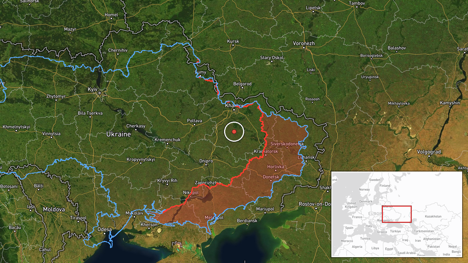
Ukrainian air monitoring reported on Telegram that three or more Russian Shahed-type drones were passing through southern Kharkiv Oblast on a westward heading. The report, posted by the channel @kpszsu on 16 October 2026 at 14:33 UTC, describes the drones as strike UAV groups moving on a western course. The post does not name a settlement the drones were aimed at, and it does not describe any impact, casualties, or damage. The summary's '3+' wording signals an approximate count that may have changed as monitoring continued. The event is classed as a drone transit rather than a confirmed strike, and it is mapped at regional rather than settlement precision.
Context and assessment
Kharkiv Oblast has been a recurring focus of Shahed-type activity since 2022, and the Kharkiv city area in particular is a frequent destination for these drones. The related reports from 15 and 16 October show a dense sequence. A single drone was reported heading toward Kharkiv on 15 October at 16:17 UTC. On 16 October, single drones were logged toward Kharkiv at 06:24 and again at 08:50, the latter described as a jet-powered Geran-3 variant. A single drone was then reported toward Lozova at 08:55, and a group of three or more toward Zlatopil at 10:15. This pattern of repeated small groups entering the same area over a short period may indicate sustained probing or a series of separate launch waves. The westward heading of the current group could mean it is routed toward targets further west, or that it is being tracked as part of a longer flight path. Transit reports of this kind are not in themselves evidence of a strike, and the available data does not show where the drones ended up.
Sources and confidence
The event rests on one Telegram channel, @kpszsu, which is the only source listed. Intel Mapper's source count is 1, and the confidence score of 8.0 reflects a credible monitoring post with a clear original wording, yet it is still uncorroborated by a second independent outlet. Confidence would rise if other monitoring channels, regional military administration statements, or flight-tracking data confirmed the group's count and westward heading. It would fall if later reporting contradicted the direction of travel, the number of drones, or the timing.
Location
The location is an approximate regional point near 49.395 N, 36.230 E, placed at region precision because the source names only southern Kharkiv Oblast, so location confidence is low. The point should be read as the general area of the reported transit, not a site of activity. The surrounding terrain is largely flat agricultural land, with river valleys of the Donets and Vorskla systems crossing the wider oblast. Kharkiv city lies to the north of this area, and Lozova and Zlatopil appear in related reports from the same day.
Related events nearby
- Ukrainian air monitoring: 1 Russian Shahed-type drone passing southern Kharkiv Oblast, heading west; 1 Russian2026-10-16 15:34 UTC · Drone Transit · southern Kharkiv Oblast, Ukraine
- Ukrainian air monitoring: 3+ Russian Shahed-type drones heading toward Zlatopil.2026-10-16 10:15 UTC · Drone Transit · Zlatopil, Ukraine
- Ukrainian air monitoring: 1 Russian Shahed-type drone heading toward Lozova.2026-10-16 08:55 UTC · Drone Transit · Lozova, Ukraine
- Ukrainian air monitoring: 1 Russian jet-powered Shahed (Geran-3) drone heading toward Kharkiv.2026-10-16 08:50 UTC · Drone Transit · Kharkiv, Ukraine
- Ukrainian air monitoring: 1 Russian Shahed-type drone heading toward Kharkiv.2026-10-16 06:24 UTC · Drone Transit · Kharkiv, Ukraine
▶ View this event on the live map

Intel Mapper aggregates open-source reports from monitored Telegram and X channels, geolocates them, cross-checks duplicates across sources and assigns a confidence score. Entries are updated as new confirmations arrive. Read how we verify events.