Ukrainian air monitoring reports one Russian Shahed-type drone heading toward Kremenchuk from the east
What happened
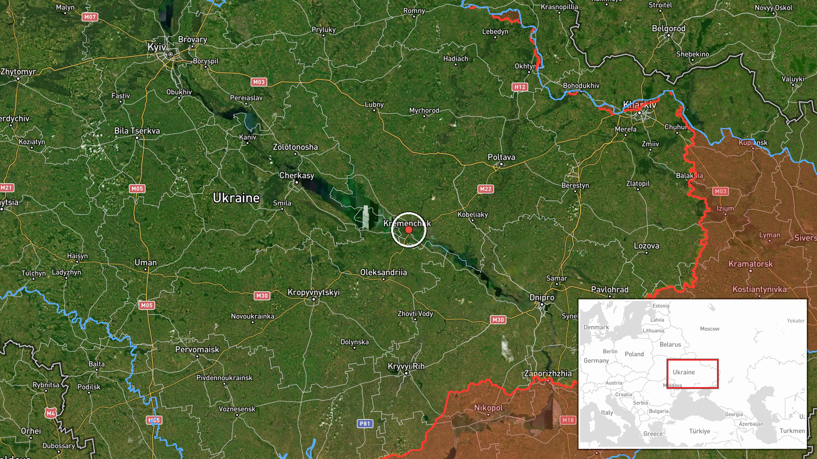
On 16 October 2026, at about 18:29 UTC, the Telegram channel @kpszsu, which carries Ukrainian air monitoring alerts, reported a single strike UAV approaching Kremenchuk from the east. The original Ukrainian wording, translated, reads roughly as 'Strike UAV toward Kremenchuk from the east,' and the summary attributes the aircraft to Russia as a Shahed-type drone. The report describes a drone in transit toward the city. It does not describe an impact, a casualty, or damage at any site, and no follow-up reporting on the outcome appears in the data. The event is logged at settlement-level precision, with Kremenchuk in central Ukraine as the reported target area.
Context and assessment
Kremenchuk matters to air-defense planners for several reasons. It is a large city on the Dnipro in Poltava oblast, it hosts a major oil refinery and industrial sites that are widely known to be strategically significant, and its river crossings and reservoir shape regional transport. The related events show a sustained pattern on the same day. Monitoring logged a jet-powered Geran-3 group of two or more heading toward Kremenchuk at 01:08 UTC, a similar group passing south of the city and heading west at 04:45 UTC, groups of three or more heading toward the city at 10:18 and 10:52 UTC, and then this single drone at 11:09 UTC before the present report. Repeated, staggered reports of this kind may indicate waves of launches, rerouted drones, or several aircraft tracked across different corridors. The data cannot show intent, so these readings are best treated as a hedged signal of continued pressure on the city's approaches rather than confirmation of a planned target.
Sources and confidence
The event rests on a single Telegram channel, @kpszsu, with no independent cross-confirmation in the dataset. The channel's official air-monitoring role gives its alerts a generally strong basis, which is why the confidence score is 8.0 rather than lower. The score is held back because the report is a transit warning, not an impact report, and because it has not been matched by local officials or independent monitors. Confidence would rise if regional authorities, other monitoring accounts, or later reports confirmed the track or any impact. It would fall if the track were revised, the sighting were withdrawn, or the drone were later reported as diverted elsewhere.
Location
The location is recorded at settlement level with high confidence, placing the report at the city of Kremenchuk, at roughly 49.07 N, 33.42 E. The coordinates should be read as the city centre rather than a specific facility. Kremenchuk sits in central Ukraine in Poltava oblast, on the Dnipro River. It is known for the large Kremenchuk Reservoir behind the hydroelectric dam, which runs north and south of the city and forms a prominent landscape feature.
Related events nearby
- Ukrainian air monitoring: 1 Russian Shahed-type drone heading toward Kremenchuk.2026-10-16 11:09 UTC · Drone Transit · Kremenchuk, Ukraine
- Ukrainian air monitoring: 3+ Russian Shahed-type drones heading toward Kremenchuk.2026-10-16 10:52 UTC · Drone Transit · Kremenchuk, Ukraine
- Ukrainian air monitoring: 3+ Russian Shahed-type drones heading toward Kremenchuk.2026-10-16 10:18 UTC · Drone Transit · Kremenchuk, Ukraine
- Ukrainian air monitoring: 2+ Russian jet-powered Shahed (Geran-3) drones heading toward Kremenchuk.2026-10-16 01:08 UTC · Drone Transit · Kremenchuk, Ukraine
- Ukrainian air monitoring: 2+ Russian jet-powered Shahed (Geran-3) drones passing south of Kremenchuk, heading 2026-10-16 04:45 UTC · Drone Transit · south of Kremenchuk, Ukraine
▶ View this event on the live map

Intel Mapper aggregates open-source reports from monitored Telegram and X channels, geolocates them, cross-checks duplicates across sources and assigns a confidence score. Entries are updated as new confirmations arrive. Read how we verify events.