Single Russian Shahed-type drone reported passing Kitsman, Chernivtsi Oblast, on 16 October 2026
What happened
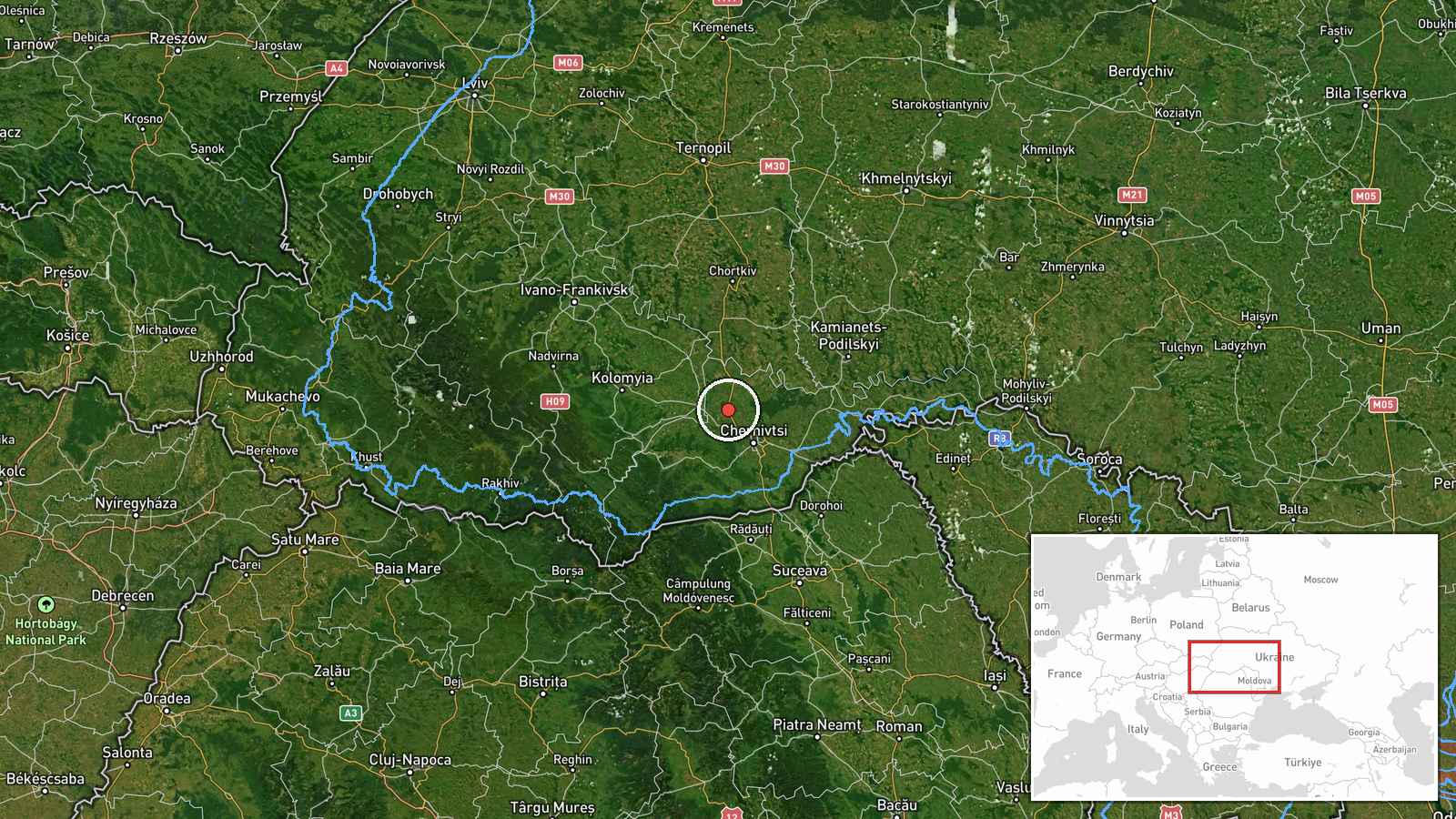
A single Telegram channel, @kpszsu, reported at 22:52 UTC on 16 October 2026 that one Russian Shahed-type drone was passing over Kitsman, a settlement in Chernivtsi Oblast in western Ukraine. The original Ukrainian wording, 'БпЛА повз Кіцмань' (a UAV passing Kitsman), describes a transit rather than a strike. The report contains no mention of impact, damage, casualties or interception. The event is classified as a drone transit with Russia as the actor. The location is recorded at settlement level with high confidence, so the marker sits on Kitsman itself. Because the notice is a brief air-monitoring update, its meaning rests on the movement it describes rather than on any observed result.
Context and assessment
Kitsman lies in the northwest of Chernivtsi Oblast, close to the boundary with Ternopil Oblast and well west of the front line. Its appearance on an air-monitoring feed therefore signals a drone passing through the western interior rather than a tactical target. The related events show a sequence on the same day. Between 01:07 and 04:42 UTC, multiple jet-powered Geran-3 drones were logged moving from Khmelnytskyi Oblast into southern Ternopil Oblast and toward Ivano-Frankivsk. At 21:03 UTC a Shahed-type drone was reported passing Chortkiv, heading west. Taken together, these reports describe a corridor of westward movement across the region over roughly twenty hours, and Kitsman lies along a plausible continuation of that track. The pattern may indicate routing toward western oblasts, deep-strike targeting, or decoy and saturation tactics, though the data alone cannot distinguish between these. Jet-powered variants are generally faster than the piston-engine Shahed design, which can shorten warning times for civilians and air defence crews. The repetition across several oblasts suggests a sustained flight path rather than an isolated sighting.
Sources and confidence
Only one source is recorded: the Telegram channel @kpszsu, which appears to be an official Ukrainian air-monitoring account. The source count is one, and no outlet in the dataset corroborates the report. The score of 8.0 reflects a credible official-style channel, a precise timestamp and a specific settlement. It is held below the top range because the report is single-channel and independently unconfirmed. Confidence would rise if other Ukrainian official channels issued matching notices, or if regional authorities or independent trackers logged the same track. It would fall if later reporting contradicted the flight path or showed the timestamp to be a relay delay.
Location
The location was assigned at settlement level with high confidence, so the marker reflects Kitsman's coordinates (approximately 48.44 N, 25.76 E) rather than a facility or wider district. Kitsman sits in the hilly, wooded terrain typical of northern Bukovina, in western Ukraine. Rivers draining toward the Dniester basin run through the wider area. The settlement is a short distance from the Ternopil Oblast border, which is relevant to the westward track described in nearby reports.
Related events nearby
- Ukrainian air monitoring: 1 Russian Shahed-type drone passing Chortkiv, heading west.2026-10-16 21:03 UTC · Drone Transit · Chortkiv, Ukraine
- Ukrainian air monitoring: 1 Russian jet-powered Shahed (Geran-3) drone heading toward Chortkiv.2026-10-16 01:08 UTC · Drone Transit · Chortkiv, Ukraine
- Ukrainian air monitoring: 1 Russian jet-powered Shahed (Geran-3) drone passing southern Ternopil Oblast, headi2026-10-16 04:34 UTC · Drone Transit · southern Ternopil Oblast, Ukraine
- Ukrainian air monitoring: 1 Russian jet-powered Shahed (Geran-3) drone from Khmelnytskyi Oblast toward souther2026-10-16 01:07 UTC · Drone Transit · southern Ternopil Oblast, Ukraine
- Ukrainian air monitoring: 1 Russian jet-powered Shahed (Geran-3) drone heading toward Ivano-Frankivsk.2026-10-16 04:42 UTC · Drone Transit · Ivano-Frankivsk, Ukraine
▶ View this event on the live map

Intel Mapper aggregates open-source reports from monitored Telegram and X channels, geolocates them, cross-checks duplicates across sources and assigns a confidence score. Entries are updated as new confirmations arrive. Read how we verify events.