Ukrainian air monitoring reports one jet-powered Shahed (Geran-3) drone heading toward Hlobyne
What happened
Ukraine's air monitoring service reported on Telegram that a single Russian jet-powered Shahed-type drone, identified as a Geran-3, was heading toward Hlobyne in Poltava Oblast. The original post, published in Ukrainian by the channel @kpszsu, reads in translation as 'Poltava region: jet-powered UAV in the direction of Hlobyne,' a brief notice without details on altitude, speed, or intended target. The alert was logged at 00:06 UTC on 17 October 2026. The report contains no confirmation of a strike, damage, or casualties, and it describes only the drone's reported heading. Because the message is a transit warning, it should be read as a tracking update rather than evidence of an attack on the settlement.
Context and assessment
Hlobyne is a small town in Poltava Oblast, and it has received little independent coverage in the monitoring data compared with larger urban centers. Its significance in this report comes mainly from its place in the regional pattern. In the preceding sixteen hours, the related events show repeated Shahed-type transit warnings aimed at Kremenchuk, a larger industrial city on the Dnipro that hosts major transport links and manufacturing. Those alerts ranged from a single drone to groups described as three or more, and they began with a jet-powered Geran-3 at 01:08 on 16 October. A single drone heading toward a smaller town after a sustained series of group alerts may indicate a route through the same corridor, a diversion, or a separate drone that was tracked independently. Monitoring data alone cannot show which of these is the case. Operators of long-range drones often change headings during flight, so a transit warning should not be treated as a fixed target. The pattern does suggest that the region remains under persistent aerial pressure through this period.
Sources and confidence
Only one channel, the Telegram account @kpszsu, reported this event, and no second source has been linked to it in the data. The confidence score of 8.0 reflects that the channel is an official Ukrainian air monitoring account with a consistent record of similar alerts, offset by the single-source status and the brief, unverified wording. Confidence would rise with corroboration from the Ukrainian Air Force, the Poltava regional military administration, or independent monitoring accounts that record the same track. It would fall if the drone's heading were revised, if the track were withdrawn, or if later reporting did not match the early alert.
Location
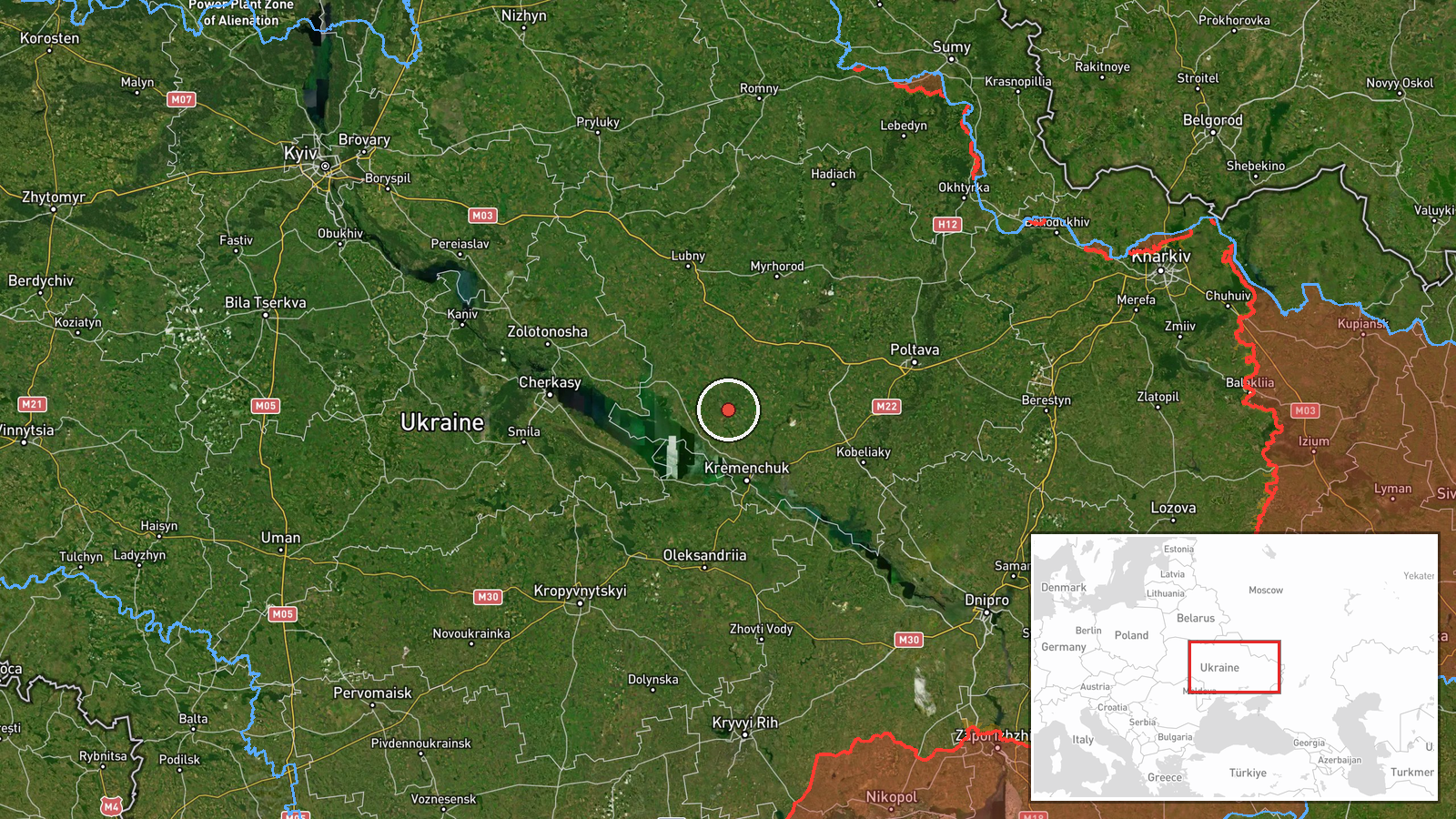
The location is recorded at settlement precision, placing the event at Hlobyne with high location confidence. The coordinates, roughly 49.379 N and 33.276 E, correspond to the town itself rather than a specific facility, which fits the wording of a heading toward the settlement. Hlobyne lies in Poltava Oblast in central Ukraine, an area of open agricultural land, forest belts, and river valleys with rail and road routes running through it. The town is located north-east of Kremenchuk, which is the city named in the related alerts.
Related events nearby
- Ukrainian air monitoring: 1 Russian Shahed-type drone heading toward Kremenchuk.2026-10-16 18:29 UTC · Drone Transit · Kremenchuk, Ukraine
- Ukrainian air monitoring: 1 Russian Shahed-type drone heading toward Kremenchuk.2026-10-16 11:09 UTC · Drone Transit · Kremenchuk, Ukraine
- Ukrainian air monitoring: 3+ Russian Shahed-type drones heading toward Kremenchuk.2026-10-16 10:52 UTC · Drone Transit · Kremenchuk, Ukraine
- Ukrainian air monitoring: 3+ Russian Shahed-type drones heading toward Kremenchuk.2026-10-16 10:18 UTC · Drone Transit · Kremenchuk, Ukraine
- Ukrainian air monitoring: 2+ Russian jet-powered Shahed (Geran-3) drones heading toward Kremenchuk.2026-10-16 01:08 UTC · Drone Transit · Kremenchuk, Ukraine
▶ View this event on the live map

Intel Mapper aggregates open-source reports from monitored Telegram and X channels, geolocates them, cross-checks duplicates across sources and assigns a confidence score. Entries are updated as new confirmations arrive. Read how we verify events.