Ukrainian air monitoring reports Russian jet-powered Shahed drone heading toward Smila
What happened
Ukraine's Air Force, posting on its Telegram channel @kpszsu, reported at about 00:25 UTC on 17 October 2026 that a single jet-powered Shahed-type drone, which the summary identifies as a Geran-3, was heading toward Smila in Cherkasy Oblast. The same post listed other air alerts: a jet-powered drone north of Nosivka in Chernihiv Oblast on a course toward Kozelets, a Shahed-type drone from Dnipropetrovsk Oblast on a course toward Shakhtarske, and guided glide bombs (KABs) heading toward Donetsk Oblast. The report attributes these launches to Russia. The wording describes drones in flight and courses of travel. It does not state whether any drone struck a target, and it names no casualties or damage.
Context and assessment
Smila sits on the Dnipro river corridor in Cherkasy Oblast, a area that Russian drones have crossed repeatedly in recent days. Earlier in the same period, air monitoring logged a jet-powered Geran-3 heading toward Cherkasy at 01:49 UTC on 16 October, and a Shahed-type drone heading toward Smila at 18:15 that day. The alert therefore fits a pattern of drones tracked over central Ukraine rather than a one-off sighting. Earlier on 16 October, a large combined attack was reported. Russia reportedly launched 315 attack drones, 78 of them jet-powered, along with Gerbera decoys and 15 S-8000 Banderol munitions, between 07:00 and 19:00. A separate launch of 149 drones from Oryol, occupied Donetsk and Crimea was reported at 06:42, with 114 downed or suppressed and 27 hits at 24 locations. Operationally, the sequence suggests that drones are being routed across the country in waves, with Smila and Cherkasy repeatedly on their paths. Tracking of individual jet-powered drones may signal that these platforms are being used for deeper strikes, though the data alone cannot show their intended targets.
Sources and confidence
The report comes from a single channel, the Telegram account @kpszsu, and no other outlet in the data confirms it. The item is recorded as one source, with a confidence score of 8.0. That score is fairly high because the channel is the official air-monitoring account and the related events from the same period follow a consistent pattern. It is not higher because the post reports only a flight course, not a confirmed impact, and the single-source base cannot be cross-checked. Confidence would rise with independent confirmation, such as a local authority statement, a report of debris or impact in Smila, or corroboration from regional military administrations. It would fall if later alerts revise the course or indicate the drone was shot down elsewhere.
Location
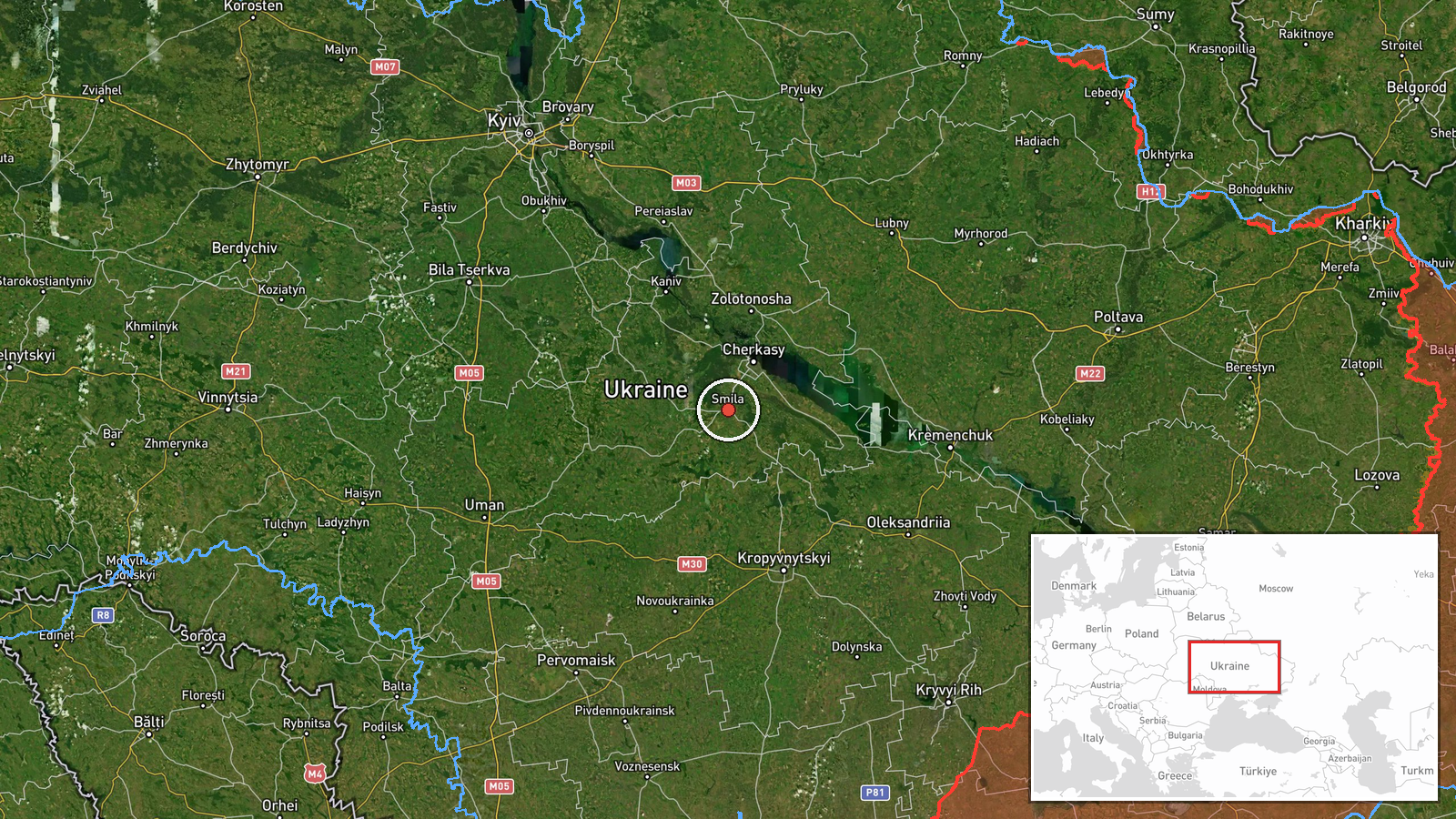
The location is recorded as Smila, Ukraine, at settlement-level precision with high location confidence. The coordinates place the marker at the town itself, not at a specific facility or street. Smila is a town in Cherkasy Oblast in central Ukraine, on the Tyasmyn river and the wider Dnipro lowlands. The area is open farmland and river terrain, with the Dnipro valley lying to the east. Because the alert concerns a drone heading toward the town, the marker shows the stated destination rather than a confirmed point of impact.
Related events nearby
- Ukrainian air monitoring: 1 Russian Shahed-type drone heading toward Smila.2026-10-16 18:15 UTC · Drone Transit · Smila, Ukraine
- Ukrainian air monitoring: 1 Russian jet-powered Shahed (Geran-3) drone heading toward Cherkasy.2026-10-16 01:49 UTC · Drone Transit · Cherkasy, Ukraine
- Russia launched 315 attack drones (78 jet-powered), plus Gerbera decoys and 15 S-8000 Banderol munitions, agai2026-10-16 16:45 UTC · UAS Strike · Ukraine (nationwide, no specific target named)
- A woman assaulted a military recruitment officer who had come to take her boyfriend for mobilization.2026-10-16 13:58 UTC · Security · Ukraine (location not reported)
- Russia launched 149 Shahed-type, Gerbera and decoy drones from Oryol, occupied Donetsk and Crimea. 114 downed 2026-10-16 06:42 UTC · UAS Strike · Ukraine
▶ View this event on the live map

Intel Mapper aggregates open-source reports from monitored Telegram and X channels, geolocates them, cross-checks duplicates across sources and assigns a confidence score. Entries are updated as new confirmations arrive. Read how we verify events.