Ukrainian air monitoring reports a Shahed-type drone heading toward Smila in Cherkasy Oblast
What happened
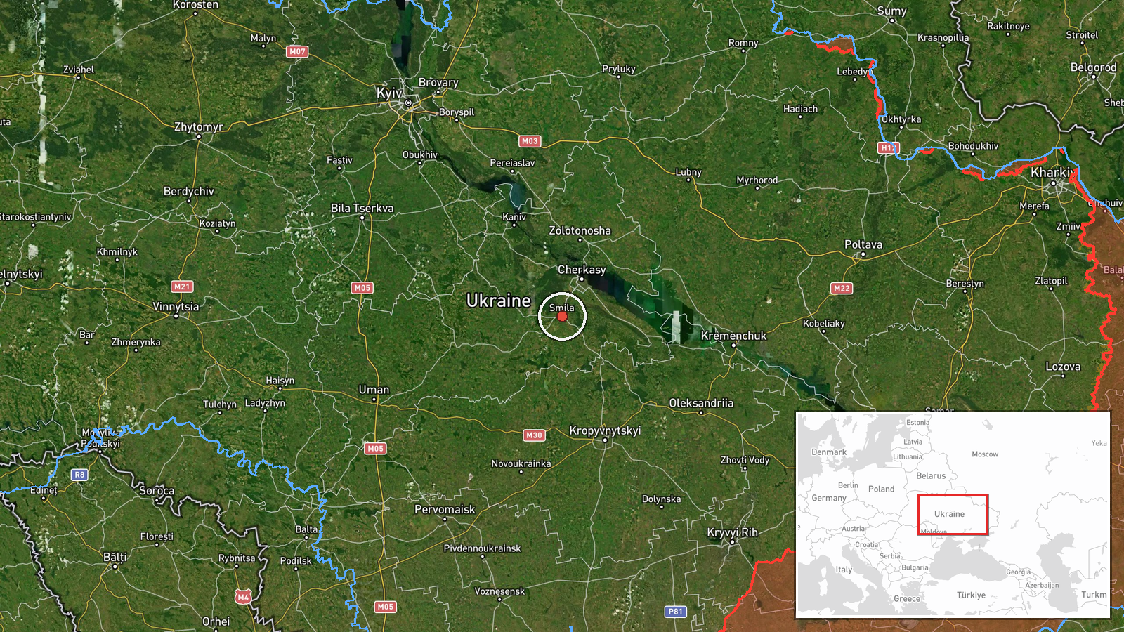
Ukraine's air monitoring channel on Telegram (@kpszsu) posted at about 02:18 UTC on 17 October 2026 that one Shahed-type drone was on a course toward Smila in Cherkasy Oblast. The same post, in its original Ukrainian wording, said jet-powered UAVs were moving from Kirovohrad Oblast toward Holovanivsk and Zakharivka. The English summary names only Zakharivka and labels the jet-powered drones Geran-3, a classification the original post does not use. The report describes heading and transit only. It names no impact, damage, casualties, or interception at Smila. Attribution to Russia reflects the standard classification of Shahed-family drones launched against Ukraine.
Context and assessment
Smila is a mid-sized city and rail junction in central Ukraine, and its industrial base and transport links make it a recurring point on drone routes passing through Cherkasy Oblast. The related events show a sustained pattern rather than a single track. Earlier on 16 October, at 18:15, a Shahed-type drone was reported heading toward Smila. At 00:25 on 17 October, a jet-powered Shahed was reported heading toward Smila and another was reported over Cherkasy Oblast, though that entry is also a monitoring warning rather than a confirmed strike. Those warnings sit against a much larger daytime attack logged at 16:45 on 16 October, when Russia reportedly launched 315 attack drones, 78 of them jet-powered, along with decoys and cruise munitions across Ukraine. Against that backdrop, a single drone heading toward Smila may be a probing or routing movement, a component of a larger wave tracked elsewhere, or a drone diverted from another target. The Air Force's ballistic-missile warning at 01:39 and its all-clear at 02:22 indicate that air defense was operating across the same overnight period.
Sources and confidence
The event rests on one Telegram channel, @kpszsu, which is associated with Ukraine's Air Force air-monitoring reporting and is generally regarded as a primary source for short-range heading alerts. No second outlet in the data independently confirms the Smila course. Confidence is scored at 8.0 out of 10, reflecting a credible, official-linked source and a precise location, offset by single-source status and the fact that a heading alert does not establish what happened afterward. Confidence would rise with corroboration from regional military administrations, local authority statements, or a later report of an impact or interception near Smila. It would fall if the channel corrected or withdrew the heading, or if later updates placed the drone elsewhere.
Location
The location is a settlement-level match for Smila, Cherkasy Oblast, which is where the reported heading points. The mapped coordinates sit on the city rather than on any specific facility, and no facility is named in the source. Smila lies in the forested-steppe belt of central Ukraine, on the Tiasmyn River. Zakharivka and Holovanivsk, mentioned in the original post, lie to the south and southwest in Kirovohrad Oblast and are not separately mapped here.
Related events nearby
- Ukrainian air monitoring: 1 Russian jet-powered Shahed (Geran-3) drone heading toward Smila; 1 Russian jet-pow2026-10-17 00:25 UTC · Airstrike · Smila, Ukraine
- Ukrainian air monitoring: 1 Russian Shahed-type drone heading toward Smila.2026-10-16 18:15 UTC · Drone Transit · Smila, Ukraine
- Ukrainian Air Force announces all-clear: the threat of Russian ballistic missile use has been cancelled.2026-10-17 02:22 UTC · Siren · Ukraine
- Ukrainian Air Force warns of threat of Russian ballistic missile use; no specific target or launch site report2026-10-17 01:39 UTC · Ballistic Missile · Ukraine
- Russia launched 315 attack drones (78 jet-powered), plus Gerbera decoys and 15 S-8000 Banderol munitions, agai2026-10-16 16:45 UTC · UAS Strike · Ukraine (nationwide, no specific target named)
▶ View this event on the live map

Intel Mapper aggregates open-source reports from monitored Telegram and X channels, geolocates them, cross-checks duplicates across sources and assigns a confidence score. Entries are updated as new confirmations arrive. Read how we verify events.