Ukrainian air monitoring reports one Shahed-type drone heading toward Chernihiv
What happened
Ukrainian air monitoring reported one Russian Shahed-type drone on a course toward Chernihiv, the regional centre of Chernihiv Oblast in northern Ukraine. The alert was logged at 03:24 UTC on 17 October 2026. The original post, written in Ukrainian under a regional heading, is brief: it names a single unmanned aerial vehicle (БпЛА) heading for the city and gives no altitude, speed, or payload. The report does not say whether the drone was intercepted, lost, or reached its target, and no impact or damage is described. The post comes from a single Telegram channel, @kpszsu, and the event is recorded as a drone transit rather than a confirmed strike.
Context and assessment
Chernihiv has appeared repeatedly in recent alerts of this kind. Earlier on 16 October, a report described three or more Shahed-type drones heading toward the city, and a separate entry from that morning recorded three or more drones moving from northern Chernihiv Oblast toward Slavutych, a town in neighbouring Kyiv Oblast. Overnight into 17 October the picture grew denser. An alert at 00:08 UTC cited two or more drones heading toward Chernihiv, and another at 00:39 described a jet-powered Geran-3 heading toward Sedniv, with a further Geran-3 coming from Kyiv Oblast. At 01:22 a single Geran-3 was tracked west of Chernihiv heading south. Taken together, these entries suggest that drones are regularly moving through the Chernihiv corridor on routes that cross the northern oblast and approach the Kyiv region. The lone drone reported at 03:24 fits that pattern and may reflect continued transit flights, reconnaissance, or decoy activity rather than a single planned strike. Because these reports describe headings rather than impacts, they are best read as tracking information, not evidence of intended targets.
Sources and confidence
The report comes from one Telegram channel, @kpszsu, and no second independent outlet in the supplied data carries it. Related entries in the same window also rest on air-monitoring posts, so they add pattern context but do not independently confirm this specific drone. The confidence score of 8.0 reflects a clear official-style alert with a precise timestamp and a stated heading, offset by single-source status and the absence of any follow-up. Confidence would rise if a second monitoring source or regional authority confirmed the track, or if an interception or impact were reported. It would fall if the alert were retracted, amended to a different target, or found to duplicate an earlier track.
Location
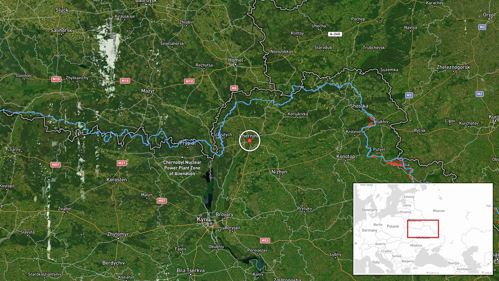
The point is placed at settlement level, at the city of Chernihiv (51.49 N, 31.29 E), with high location confidence because the report names the city directly. It is not a facility-level placement, as no specific site is named. Chernihiv lies in northern Ukraine, close to the Belarusian border, on the Desna River and its floodplain, roughly 140 kilometres north of Kyiv. Nearby features include the river, forested areas, and the road and rail links running toward Kyiv and the border.
Related events nearby
- Ukrainian air monitoring: 2+ Russian Shahed-type drones heading toward Chernihiv.2026-10-17 00:08 UTC · Drone Transit · Chernihiv, Ukraine
- Ukrainian air monitoring: 3+ Russian Shahed-type drones heading toward Chernihiv.2026-10-16 10:21 UTC · Drone Transit · Chernihiv, Ukraine
- Ukrainian air monitoring: one Russian jet-powered Shahed (Geran-3) drone tracked west of Chernihiv, heading so2026-10-17 01:22 UTC · Drone Transit · West of Chernihiv, Chernihiv Oblast, Ukraine
- Ukrainian air monitoring: 1 Russian jet-powered Shahed (Geran-3) drone heading toward Sedniv; 1 Russian jet-po2026-10-17 00:39 UTC · Drone Transit · Sedniv, Ukraine
- Ukrainian air monitoring: 1 Russian jet-powered Shahed (Geran-3) drone heading toward Honcharivske.2026-10-17 03:36 UTC · Drone Transit · Honcharivske, Ukraine
▶ View this event on the live map

Intel Mapper aggregates open-source reports from monitored Telegram and X channels, geolocates them, cross-checks duplicates across sources and assigns a confidence score. Entries are updated as new confirmations arrive. Read how we verify events.