Single jet-powered Shahed drone tracked west of Chernihiv heading south, per Ukrainian air monitoring
What happened
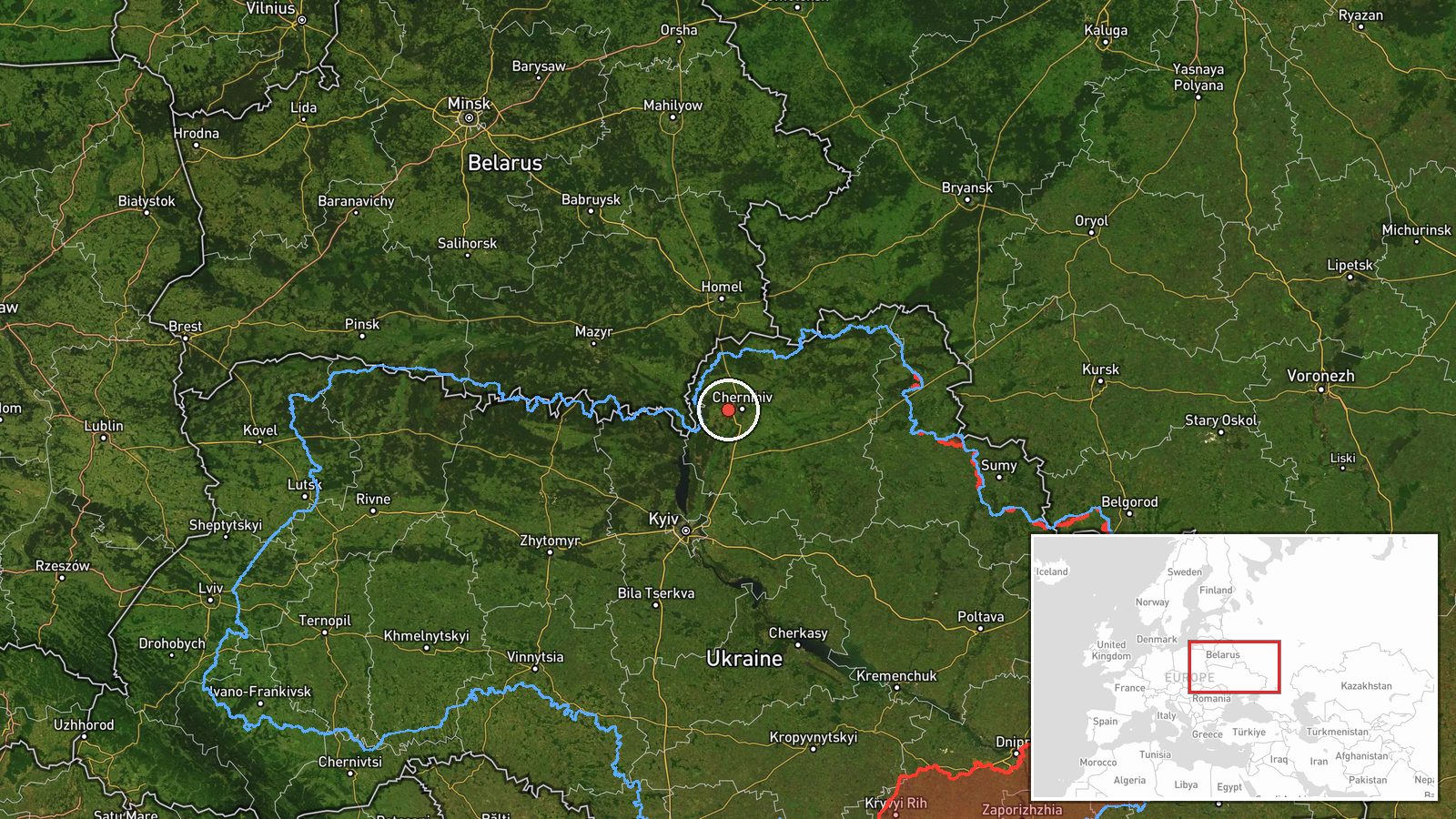
Ukrainian air monitoring reported on Telegram channel @kpszsu that one Russian jet-powered Shahed-type drone, identified in the report as a Geran-3, was tracked west of Chernihiv with a southern heading. The post was timestamped 17 October 2026 at 01:22 UTC. The source wording is brief: it describes a jet-powered UAV west of Chernihiv on a southern course, without stating any impact, target, or damage. The event is recorded as a drone transit rather than a strike. The coordinates place the sighting in the broader Chernihiv Oblast area rather than at a specific settlement, and the location is marked as low confidence.
Context and assessment
Chernihiv sits in northern Ukraine close to the Belarusian border, and it has appeared repeatedly in the recent reporting pattern. Earlier entries on October 16 record groups of three or more Shahed-type drones moving toward Chernihiv and Slavutych, with one jet-powered Geran-3 also tracked from northern Chernihiv Oblast toward Slavutych that morning. A further entry shortly before midnight on October 16-17 logged two or more drones heading toward Chernihiv, followed by a separate Geran-3 heading toward Sedniv. Taken together, the sequence suggests repeated routing of drones through the northern corridor, with the Geran-3 variant appearing alongside piston-engine Shahed types. Operationally, transits of this kind are often associated with route probing, air defense stimulation, or attempts to reach targets further south, but the data alone does not establish intent. A single track on a southern heading is consistent with a drone passing through rather than one aimed at Chernihiv itself.
Sources and confidence
The report comes from a single Telegram channel, @kpszsu, which is tied to Ukrainian air monitoring and has been the origin of several related entries. No second outlet in the data independently confirms this specific track. The confidence score of 8.0 reflects the channel's operational role and the specificity of the drone type, but it is held down by the single-source basis and the lack of a precise position. Confidence would rise with corroboration from additional monitoring channels, regional military administration statements, or radar-based tracking. It would fall if later updates contradicted the heading or if the drone type were revised.
Location
The location is recorded as west of Chernihiv in Chernihiv Oblast, with coordinates of approximately 51.49 N, 31.10 E. The precision is classed as regional rather than settlement-level, meaning the point is an approximation for the area reported rather than a fixed observation. The setting is flat northern Ukrainian terrain close to the Belarus border and the Desna river basin, a corridor frequently used by aerial traffic. The reported southern heading places the track's likely path toward the Kyiv and central regions.
Related events nearby
- Ukrainian air monitoring: 2+ Russian Shahed-type drones heading toward Chernihiv.2026-10-17 00:08 UTC · Drone Transit · Chernihiv, Ukraine
- Ukrainian air monitoring: 3+ Russian Shahed-type drones heading toward Chernihiv.2026-10-16 10:21 UTC · Drone Transit · Chernihiv, Ukraine
- Ukrainian air monitoring: 3+ Russian Shahed-type drones from northern Chernihiv Oblast toward Slavutych.2026-10-16 10:40 UTC · Drone Transit · Slavutych, Ukraine
- Ukrainian air monitoring: 1 Russian jet-powered Shahed (Geran-3) drone from northern Chernihiv Oblast toward S2026-10-16 06:54 UTC · Drone Transit · Slavutych, Ukraine
- Ukrainian air monitoring: 1 Russian jet-powered Shahed (Geran-3) drone heading toward Sedniv; 1 Russian jet-po2026-10-17 00:39 UTC · Drone Transit · Sedniv, Ukraine
▶ View this event on the live map

Intel Mapper aggregates open-source reports from monitored Telegram and X channels, geolocates them, cross-checks duplicates across sources and assigns a confidence score. Entries are updated as new confirmations arrive. Read how we verify events.