One Shahed-type drone reported heading toward Petrykivka, Dnipropetrovsk Oblast
What happened
A Ukrainian air monitoring post on Telegram (@kpszsu) reported at 03:36 UTC on 17 October 2026 that one Russian Shahed-type drone was on a course toward Petrykivka, a settlement in Dnipropetrovsk Oblast. The original Ukrainian-language message, which reads roughly as 'UAV on course for Petrykivka,' is brief and includes no information on impacts, debris, or damage. The wording describes a flight track rather than a confirmed strike, and the event is classified as Drone Transit. Russia is named as the actor on the basis of the drone type, and no launch location was recorded. The report is single-source and has not been corrected.
Context and assessment
Petrykivka is a small settlement, so its own value as a target is not clear from the report alone. Its significance lies more in its position within the Dnipro region, where several tracks were logged in the same period. Earlier on 17 October, a drone was reported heading toward Dnipro at 00:57 UTC, with a group of jet-powered Geran-3 drones reported passing northern Chernihiv Oblast, and a ballistic missile was reported toward Kamianske at 01:42. Another Shahed-type drone was reported heading toward Dnipro at 03:24. The previous afternoon, on 16 October, a drone from Kherson Oblast was tracked toward Dnipropetrovsk Oblast, and a group of at least two Geran-3 drones was reported toward the Kamianske district. Taken together, these reports may suggest sustained pressure on the Dnipro area over roughly a day. A single drone on a course toward a village may instead reflect a transit route, a decoy, or a track that was later redirected. Such tracks are often reported before any outcome is known, so the operational intent cannot be established from this entry.
Sources and confidence
The event rests on one Telegram channel, @kpszsu, and no second outlet is recorded as confirming the track. The score of 8.0 reflects a credible monitoring source with a clear, specific message and a high-confidence settlement location. It is held below the top of the range because no independent corroboration, impact report, or official follow-up is attached. Confidence would rise with a second monitoring source, local official statements, or imagery confirming the track or any impact. It would fall if the channel corrected the course, retracted the report, or if later reporting showed the track had been misattributed.
Location
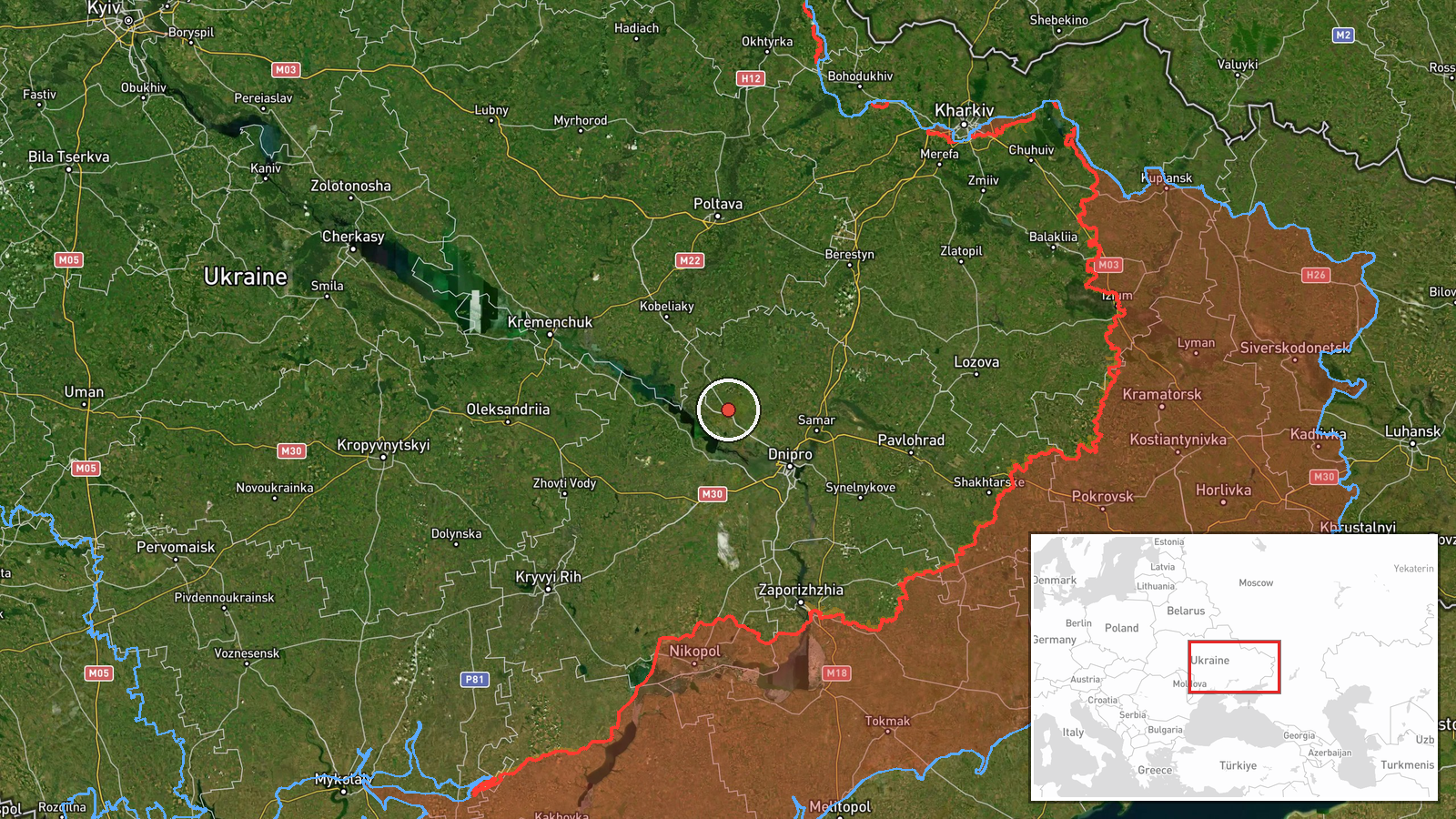
The location is recorded at settlement precision, with the coordinates placed on Petrykivka itself and location confidence rated high. The source names only the oblast and the village, so the point reflects the settlement rather than any specific facility. The area lies in central-eastern Ukraine within the Dnipro region, an area of open steppe crossed by the Dnipro River and dotted with towns and industrial sites. The nearby Kamianske district and the city of Dnipro are the main reference points in the related reports.
Related events nearby
- Ukrainian air monitoring: 1 Russian ballistic missile heading toward Kamyanske.2026-10-17 01:42 UTC · Ballistic Missile · Kamyanske, Ukraine
- Ukrainian air monitoring: 2+ Russian jet-powered Shahed (Geran-3) drones heading toward Kamianske district.2026-10-16 14:34 UTC · Drone Transit · Kamianske district, Ukraine
- Ukrainian air monitoring: 1 Russian Shahed-type drone heading toward Dnipro.2026-10-17 03:24 UTC · Drone Transit · Dnipro, Ukraine
- Ukrainian air monitoring: 1 Russian Shahed-type drone heading toward Dnipro; 2+ Russian jet-powered Shahed (Ge2026-10-17 00:57 UTC · Drone Transit · Dnipro, Ukraine
- Ukrainian air monitoring: 1 Russian Shahed-type drone from Kherson Oblast toward Dnipropetrovsk Oblast.2026-10-16 14:31 UTC · Drone Transit · Dnipropetrovsk Oblast, Ukraine
▶ View this event on the live map

Intel Mapper aggregates open-source reports from monitored Telegram and X channels, geolocates them, cross-checks duplicates across sources and assigns a confidence score. Entries are updated as new confirmations arrive. Read how we verify events.