Single Shahed-type drone reported moving from northern Chernihiv toward Kyiv Oblast
What happened
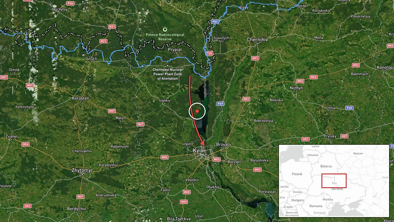
Ukrainian air monitoring reported one Russian Shahed-type drone in the north of Chernihiv Oblast, moving along the border with Belarus toward Kyiv Oblast. The report was posted by the Telegram channel @kpszsu at 06:39 UTC on 17 October 2026. The original Ukrainian wording describes a БпЛА, or unmanned aerial vehicle, on the northern Chernihiv border with Belarus, heading in the direction of Kyiv region. The event is classified as a drone transit rather than a confirmed strike, and the report describes no impact, casualties, or damage. The attribution to Russia follows the classification of Shahed-type systems in the feed. The event record contains no launch point, so the Belarus reference reflects the route described in the post rather than a confirmed origin.
Context and assessment
The report fits a dense sequence of drone transits over the previous day. Between 17:03 UTC on 16 October and 04:07 UTC on 17 October, the feed logged single Shahed-type drones passing Slavutych and Drabiv, a jet-powered Geran-3 variant passing Drabiv, and another drone near Kyiv. At 03:59 a group of at least three drones was reported moving from western Chernihiv Oblast toward Kyiv Oblast, with one passing the Vyshhorod district. A jet-powered Geran-3 was also logged passing Hlevakha, heading west, at 04:07. Taken together, these entries suggest a repeated approach corridor from the north that uses the Chernihiv and Belarus border area to reach the Kyiv region. Kyiv is a high-value political and military target, so sustained overflight reports there are routinely watched. Single drones in such sequences may be used for reconnaissance, to saturate air defences, or as decoys ahead of larger attacks, but the data alone cannot establish which purpose applies here.
Sources and confidence
All details come from one Telegram channel, @kpszsu, and no independent outlet or second channel is listed in the record. The confidence score of 8.0 reflects a clear, specific post from an established channel, but the single-source status and the absence of cross-confirmation keep it below the level of a multi-source event. Confidence would rise with corroboration from the Ukrainian Air Force, regional military administrations in Chernihiv or Kyiv, flight tracking data, or reports of interception or impact. It would fall if the channel corrected or retracted the post, or if later reporting placed the drone on a different route.
Location
The location is recorded at region precision for Kyiv Oblast, and the listed coordinates, 50.45 and 30.52, match central Kyiv rather than the drone's position. The point is therefore a regional placeholder, and the location confidence is low. The original post places the drone in northern Chernihiv Oblast along the Belarus border. The wider setting is northern Ukraine, where the Belarusian frontier lies to the north and Kyiv Oblast to the south. The Dnipro River corridor and the Pripyat basin lie across this area, and both shape the terrain that drones typically follow when approaching the capital.
Related events nearby
- Ukrainian air monitoring: 1 Russian Shahed-type drone heading toward Kyiv; 1 Russian jet-powered Shahed (Geran2026-10-17 04:07 UTC · Drone Transit · Kyiv, Ukraine
- Ukrainian air monitoring: 3+ Russian Shahed-type drones from western Chernihiv Oblast toward Kyiv Oblast; 1 Ru2026-10-17 03:59 UTC · Drone Transit · Kyiv Oblast, Ukraine
- Ukrainian air monitoring: 1 Russian Shahed-type drone heading toward Kyiv.2026-10-17 01:36 UTC · Drone Transit · Kyiv, Ukraine
- Ukrainian air monitoring: 1 Russian jet-powered Shahed (Geran-3) drone passing Drabiv, heading toward Kyiv Obl2026-10-16 20:18 UTC · Drone Transit · Kyiv Oblast, Ukraine
- Ukrainian air monitoring: 1 Russian Shahed-type drone passing Slavutych, heading toward Kyiv Oblast.2026-10-16 17:03 UTC · Drone Transit · Kyiv Oblast, Ukraine
▶ View this event on the live map

Intel Mapper aggregates open-source reports from monitored Telegram and X channels, geolocates them, cross-checks duplicates across sources and assigns a confidence score. Entries are updated as new confirmations arrive. Read how we verify events.