Ukrainian air monitoring reports jet-powered Shahed drone from Bryansk toward northern Chernihiv
What happened
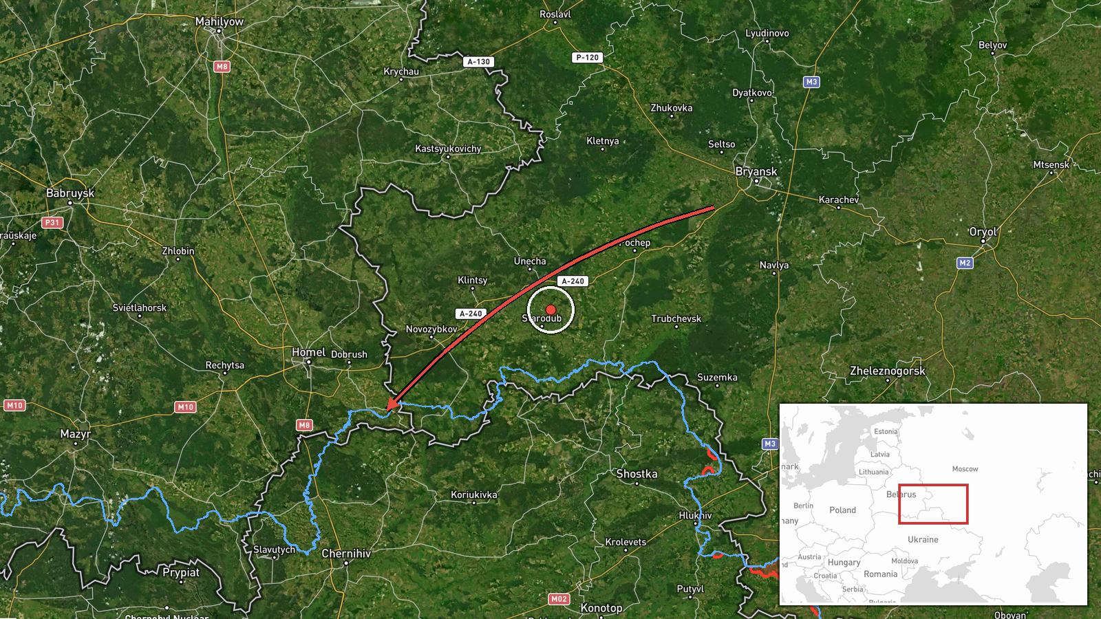
Ukraine's Air Force monitoring channel on Telegram (@kpszsu) reported at about 07:10 UTC on 17 October 2026 that one jet-powered Shahed-type drone, identified as a Geran-3, was moving from Bryansk region in Russia toward northern Chernihiv Oblast. The original Ukrainian post describes a 'reactive UAV' flying from Bryansk region and heading north of Chernihiv region. The English summary frames it as a transit report rather than a confirmed strike. The report names no settlement target or impact, and it does not state whether the drone was later intercepted or lost from tracking. The most accurate reading is that a drone was detected in airspace near northern Chernihiv, with its destination unclear. Only one channel has carried the report so far.
Context and assessment
Northern Chernihiv Oblast borders Russia and Belarus, and the city of Chernihiv lies a short distance south of the frontier. That position makes the area a natural approach corridor for drones heading toward Kyiv and central Ukraine from the north. The related reports fit this pattern. On 16 October, a single Shahed-type drone was reported passing northern Chernihiv Oblast heading southwest. Shortly after midnight on 17 October, monitoring notices logged more than three Shahed-type drones over the same area. A jet-powered Geran-3 was reported heading toward Sedniv, and another was tracked from the Kyiv Oblast direction. Between 06:55 and 07:12 UTC, separate notices placed a Shahed-type drone heading toward Chernihiv and a Geran-3 heading toward Snovsk. Taken together, this looks like a sustained series of approaches rather than an isolated flight. Operationally, a growing share of jet-powered airframes could suggest efforts to test air defence coverage or stretch interceptor capacity, though the data cannot establish intent. Reports like these help track movement, but they do not by themselves show what the drones were aimed at.
Sources and confidence
Only one source, the Telegram channel @kpszsu, is listed for this event, so there is no cross-confirmation from independent media, radar data, or wreckage. The channel is the Ukrainian Air Force's monitoring feed and is generally treated as an official source for airspace alerts. The confidence score of 8.0 reflects that official origin and the consistent pattern of related monitoring notices in the same area. It sits below the top range because the single-channel basis and the lack of follow-up on the track leave the event unverified. Confidence would rise with a second official or journalistic confirmation, or a report of interception or impact. It would fall if later updates revised the drone type or route.
Location
The coordinates are approximate and set at regional precision, with low location confidence. The original post names no specific settlement, so the marker represents northern Chernihiv Oblast as a whole rather than a single point. The oblast lies in northern Ukraine, bordering Russia to the north and east and Belarus to the north-west. Its northern districts are mostly flat, wooded terrain drained by the Desna river system, with forest and marshland of the Polissia lowlands nearby.
Related events nearby
- Ukrainian air monitoring: 3+ Russian Shahed-type drones over northern Chernihiv Oblast.2026-10-17 00:07 UTC · Drone Transit · northern Chernihiv Oblast, Ukraine
- Ukrainian air monitoring: 1 Russian Shahed-type drone passing northern Chernihiv Oblast, heading southwest.2026-10-16 11:09 UTC · Drone Transit · northern Chernihiv Oblast, Ukraine
- Ukrainian air monitoring: 1 Russian jet-powered Shahed (Geran-3) drone heading toward Sedniv; 1 Russian jet-po2026-10-17 00:39 UTC · Drone Transit · Sedniv, Ukraine
- Ukrainian air monitoring: 1 Russian jet-powered Shahed (Geran-3) drone heading toward Snovsk.2026-10-17 07:12 UTC · Drone Transit · Snovsk, Ukraine
- Ukrainian air monitoring: 1 Russian Shahed-type drone heading toward Chernihiv.2026-10-17 07:57 UTC · Drone Transit · Chernihiv, Ukraine
▶ View this event on the live map

Intel Mapper aggregates open-source reports from monitored Telegram and X channels, geolocates them, cross-checks duplicates across sources and assigns a confidence score. Entries are updated as new confirmations arrive. Read how we verify events.