Single Russian Shahed-type drone reported transiting Uman district, heading north
What happened
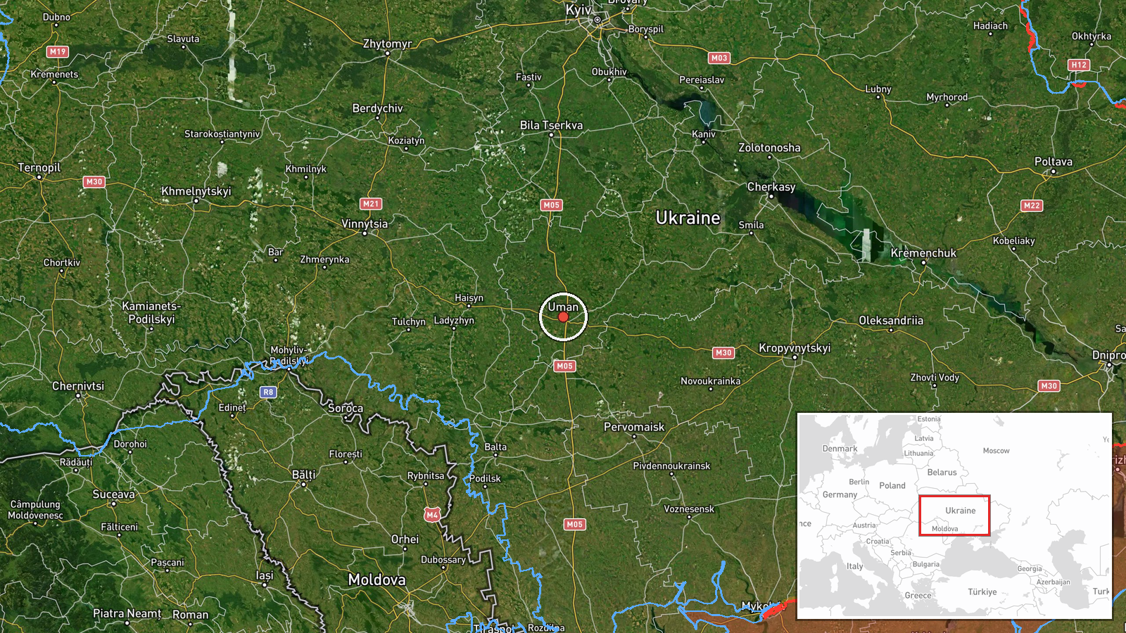
A Telegram channel listed as @kpszsu reported one Russian Shahed-type drone passing through Uman district in Ukraine at 08:07 UTC on 17 October 2026, moving north. The mapped point sits at settlement level near Uman, in Cherkasy Oblast. The original Ukrainian post describes a UAV in Synelnykove district of Dnipropetrovsk region heading north, a place name that does not match the mapped coordinates. The English summary on Intel Mapper instead reads Uman district. The report describes air monitoring and transit only. It does not state any impact, casualties, or damage, and it does not identify the drone's model.
Context and assessment
Uman is a regional rail and road junction in central Ukraine, which makes it a plausible waypoint on routes that cross the country's centre. The recent pattern in the related events is notable. On 16 October, a jet-powered Shahed, identified as Geran-3, was tracked from Kirovohrad Oblast toward Uman. Later that day, Shahed-type drones were logged near Tyshkivka heading west and near Dashiv in Vinnytsia Oblast heading west. Early on 17 October, a Geran-3 was reported moving from Vinnytsia Oblast toward Teplyk at 08:04, and another drone was reported passing Uman district heading northwest at 07:50. This event, at 08:07, is a single drone described as heading north. Taken together, the reports suggest a series of individual drones moving through a corridor across Kirovohrad, Vinnytsia and Cherkasy oblasts over roughly 23 hours, with headings varying between west, northwest and north. Such variation may reflect rerouting, loitering, or different tracks. Single-channel transit reports cannot establish intent or the eventual target. Operationally, the pattern is consistent with long-range strike drones being moved through central Ukraine, and the northward heading could point toward northern areas, though the data do not confirm this.
Sources and confidence
The report comes from one Telegram channel, @kpszsu, and is recorded as a single source with a source count of one. No independent outlet, second monitoring channel, or flight track is listed as confirming the transit. The confidence score of 8.0 reflects the channel's format as an air monitoring feed and its consistency with other same-day transit alerts in the related events. It is not higher because the report is uncorroborated, the district wording conflicts with the mapped location, and the event is not marked as corrected. Confidence would rise with a second monitoring source or a confirmed track. It would fall if the district discrepancy remains unresolved or if later reports contradict the heading.
Location
The coordinates, 48.7501 N and 30.21944 E, correspond to Uman, a city in Cherkasy Oblast, and are tagged at settlement precision with high location confidence. The original text names Synelnykove district in Dnipropetrovsk region, roughly 200 kilometres east, so the mapped point follows the English summary rather than the Ukrainian wording. Uman lies in the forest-steppe zone of central Ukraine, a setting of farmland, river valleys and rail lines, with the Dnipro basin farther east.
Related events nearby
- Ukrainian air monitoring: 1 Russian jet-powered Shahed (Geran-3) drone passing Uman district, heading northwes2026-10-17 07:50 UTC · Drone Transit · Uman district, Ukraine
- Ukrainian air monitoring: 1 Russian jet-powered Shahed (Geran-3) drone from Vinnytsia Oblast toward Teplyk.2026-10-17 08:04 UTC · Drone Transit · Teplyk, Ukraine
- Ukrainian air monitoring: 1 Russian Shahed-type drone passing Tyshkivka, heading west.2026-10-16 15:36 UTC · Drone Transit · Tyshkivka, Ukraine
- Ukrainian air monitoring: one Russian Shahed-type strike drone tracked near Dashiv, Vinnytsia Oblast, heading 2026-10-16 15:16 UTC · Drone Transit · Dashiv, Ukraine
- Ukrainian air monitoring: 1 Russian Shahed-type drone passing Zvenyhorodka, heading west.2026-10-16 12:27 UTC · Drone Transit · Zvenyhorodka, Ukraine
▶ View this event on the live map

Intel Mapper aggregates open-source reports from monitored Telegram and X channels, geolocates them, cross-checks duplicates across sources and assigns a confidence score. Entries are updated as new confirmations arrive. Read how we verify events.