Ukrainian air monitoring reports a jet-powered Geran-3 drone in transit toward Tomashpil, Vinnytsia Oblast
What happened
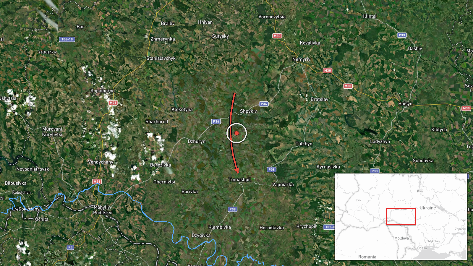
Ukraine's air monitoring channel on Telegram (@kpszsu) reported on 17 October 2026 at 12:39 UTC that one Russian jet-powered Shahed, identified as a Geran-3, was moving from Vinnytsia Oblast toward Tomashpil, a settlement in the oblast. The original Ukrainian-language post, headed as a jet-type drone bound for Tomashpil, describes a drone transit rather than a strike. The report does not say whether any impact, damage, or casualties followed. The event is classed as a drone transit with Russia named as the actor. It rests on this single source and has not been corrected.
Context and assessment
The report sits within a dense run of drone transits across Vinnytsia Oblast on 16 October. Earlier that day, monitoring posts logged a group of three or more Shahed-type drones passing the southeastern part of the oblast heading west at 16:48 UTC, with single drones tracked near Vapnyarka at 16:21 and toward Zhmerynka at 17:28. Later that evening, a jet-powered Geran-3 was reported heading toward Ladyzhyn at 21:17, and a Shahed-type drone was reported heading toward Tomashpil at 21:40. Tomashpil therefore appears twice in roughly fifteen hours. Zhmerynka is a significant rail junction, which may explain why drones are tracked through this corridor. Operationally, repeated tracks over the same settlements suggest drones moving along routes that cross the oblast toward western Ukraine, rather than a single fixed target. The jet-powered variant is generally associated with higher speed than piston-engine Shaheds, which tends to shorten the window for interception. The reports do not establish a specific target, and the pattern alone should not be read as intent.
Sources and confidence
The entry rests on one Telegram channel, @kpszsu. No second outlet or independent monitoring feed in the dataset confirms this specific track. The confidence score of 8.0 is high because the channel is an official Ukrainian air-monitoring feed, the post is timed and typed clearly, and it matches the pattern of related entries from the same period. It is held below the maximum because the report is single-sourced and does not describe impact. Confidence would rise with corroboration from another monitoring channel, an official statement, or an impact or debris report. It would fall if the track were revised, downgraded, or retracted.
Location
The location is settlement-level, placed at Tomashpil in Vinnytsia Oblast, with coordinates near 48.54 N, 28.51 E, which likely reflects the town centre rather than any specific facility. Location confidence is rated high. Tomashpil is a small town in west-central Ukraine, set among the agricultural plains and gentle terrain typical of the oblast. Nearby points named in related reports include Ladyzhyn and Zhmerynka, the latter a rail junction. These are reference points for the track, not confirmed targets.
Related events nearby
- Ukrainian air monitoring: 1 Russian Shahed-type drone heading toward Tomashpil.2026-10-16 21:40 UTC · Drone Transit · Tomashpil, Ukraine
- Ukrainian air monitoring: 1 Russian Shahed-type drone passing Vapnyarka, heading west.2026-10-16 16:21 UTC · Drone Transit · Vapnyarka, Ukraine
- Ukrainian air monitoring: 3+ Russian Shahed-type drones passing southeastern Vinnytsia Oblast, heading west.2026-10-16 16:48 UTC · Drone Transit · southeastern Vinnytsia Oblast, Ukraine
- Ukrainian air monitoring: 1 Russian Shahed-type drone heading toward Ladyzhyn.2026-10-17 13:28 UTC · Drone Transit · Ladyzhyn, Ukraine
- Ukrainian air monitoring: 1 Russian jet-powered Shahed (Geran-3) drone heading toward Ladyzhyn.2026-10-16 21:17 UTC · Drone Transit · Ladyzhyn, Ukraine
▶ View this event on the live map

Intel Mapper aggregates open-source reports from monitored Telegram and X channels, geolocates them, cross-checks duplicates across sources and assigns a confidence score. Entries are updated as new confirmations arrive. Read how we verify events.