Shahed-type drone reported passing Horodnia in Chernihiv Oblast, heading southwest
What happened
Ukraine's Air Force Telegram channel (@kpszsu) reported at 13:45 UTC on 17 October 2026 that one Russian Shahed-type drone was passing Horodnia in Chernihiv Oblast, moving southwest. The original Ukrainian-language message adds that the track ran along the border with Belarus and then turned to a western heading. The post names no casualties, impacts, or interceptions, and it does not state the drone's model. The English summary uses the generic Shahed-type label, while earlier posts that morning specify jet-powered Geran-3 variants. The report is a monitoring notice of a transit, not a strike, and it describes only the drone's movement over the area.
Context and assessment
Horodnia sits in northern Chernihiv Oblast, close to the Belarusian frontier and to the Desna valley corridor that runs north toward the border. Air monitoring in this zone was heavy on this date. Related entries show at least five Shahed-type transits between 00:07 and 12:40 UTC: three or more drones over northern Chernihiv Oblast shortly after midnight, a drone heading toward Sedniv that was described as coming from Kyiv Oblast, a drone reported from Bryansk, Russia, toward northern Chernihiv Oblast at 07:10, and two passes over Snovsk, one heading toward it at 07:12 and another heading south at 12:40. Taken together, the sequence suggests repeated long-range drones moving through the Chernihiv corridor, some apparently routed via Russian territory and Belarus-adjacent airspace. Such tracks are usually reported as monitoring rather than targeting. Operationally, the southwest and western headings may indicate routing around air defense coverage or travel toward western Ukraine, but the data cannot confirm intent. The sequence is best read as persistent air activity in the north rather than evidence of a specific target at Horodnia.
Sources and confidence
Only one channel, the Telegram account @kpszsu, is listed, and no independent outlet or second monitoring feed has confirmed this track. The confidence score of 8.0 reflects a credible official-style air monitoring source, a precise timestamp, and a pattern consistent with same-day reports, but it is not higher because single-source status cannot be cross-checked and the post lacks detail on drone type. Confidence would rise if the Air Force, regional authorities, or a second monitoring channel reported the same track, or if radar or flight-path data corroborated it. It would fall if the channel later corrected or retracted the report, or if the wording proved to refer to a different drone or location.
Location
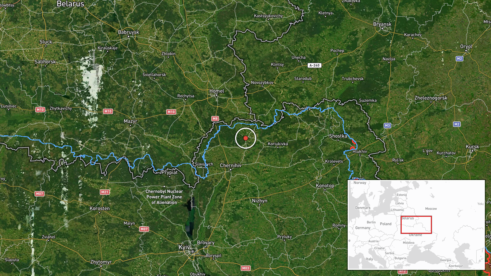
Horodnia was placed at settlement level, with coordinates of about 51.89 N, 31.60 E, and high location confidence because the source names the settlement directly. This precision marks the town itself, not a precise flight path or any facility. Horodnia lies in northern Chernihiv Oblast, in the Desna river basin of the Polissia lowlands, near the Belarusian border and the forested, marshy terrain typical of the area. The border corridor is the feature the source itself highlights.
Related events nearby
- Ukrainian air monitoring: 1 Russian jet-powered Shahed (Geran-3) drone passing Snovsk, heading south.2026-10-17 12:40 UTC · Drone Transit · Snovsk, Ukraine
- Ukrainian air monitoring: 1 Russian jet-powered Shahed (Geran-3) drone heading toward Snovsk.2026-10-17 07:12 UTC · Drone Transit · Snovsk, Ukraine
- Ukrainian air monitoring: 1 Russian jet-powered Shahed (Geran-3) drone heading toward Sedniv; 1 Russian jet-po2026-10-17 00:39 UTC · Drone Transit · Sedniv, Ukraine
- Ukrainian air monitoring: 1 Russian jet-powered Shahed (Geran-3) drone from Bryansk (Russia) toward northern C2026-10-17 07:10 UTC · Drone Transit · northern Chernihiv Oblast, Ukraine
- Ukrainian air monitoring: 3+ Russian Shahed-type drones over northern Chernihiv Oblast.2026-10-17 00:07 UTC · Drone Transit · northern Chernihiv Oblast, Ukraine
▶ View this event on the live map

Intel Mapper aggregates open-source reports from monitored Telegram and X channels, geolocates them, cross-checks duplicates across sources and assigns a confidence score. Entries are updated as new confirmations arrive. Read how we verify events.