Single jet-powered Shahed (Geran-3) drone reported in transit toward Cherkasy Oblast
What happened
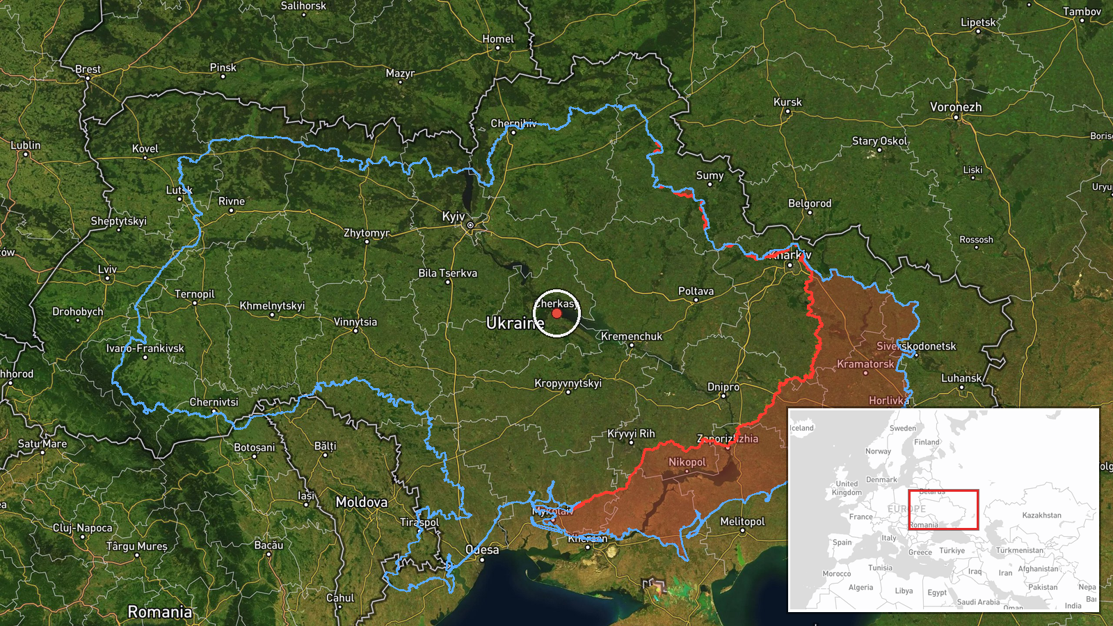
A Ukrainian air monitoring alert published on the Telegram channel @kpszsu reported one Russian jet-powered Shahed (Geran-3) drone moving toward Cherkasy Oblast in central Ukraine. The original Ukrainian-language message described a jet-type unmanned aerial vehicle flying over the Kremenchuk reservoir toward the Cherkasy region. The alert was logged at 15:38 UTC on 17 October 2026. The report names no impact site, casualties, or damage, and it does not say where the drone was launched or where it was ultimately headed. Because the alert is a short tracking notice, the event is best read as a sighting of an airborne track rather than a confirmed strike.
Context and assessment
This track sits within a busy stretch of activity over central Ukraine that day. Earlier alerts logged a Shahed-type drone heading toward Smila around 00:25 UTC, and by 02:18 UTC two or more Geran-3 drones were reported moving from Kirovohrad Oblast toward the Zakhari area. Around 11:42 UTC a Banderol mini cruise missile was reported passing Cherkasy Oblast heading northwest, and at 12:08 UTC two or more jet-powered Shahed drones were reported heading toward Cherkasy. A further Geran-3 was reported moving from Cherkasy Oblast toward Smila at 13:49 UTC. The repeated appearance of Smila and Cherkasy in these alerts suggests a sustained flight corridor rather than an isolated incursion. Operationally, a jet-powered variant on this route may indicate a deliberate effort to pass through or around the region toward targets farther west or northwest, though the data cannot confirm target selection. Transit alerts of this kind also often serve to track multi-wave raids, so this report should be read as one data point in a longer sequence.
Sources and confidence
The event rests on a single Telegram channel, @kpszsu, which is the only source listed and is not corroborated by a second independent channel, wire service, or official impact report in the data provided. The confidence score of 8.0 reflects that single-source status together with the approximate location and the absence of a follow-up. Confidence would rise with independent monitoring channels or regional military administration statements confirming the same track, or with a report of an impact or interception near the indicated route. It would fall further if later updates contradict the heading or if the alert is revised or withdrawn. The record has not been marked as corrected.
Location
The location is recorded at region level, with coordinates near 49.44 N, 32.06 E, which falls within Cherkasy Oblast. No settlement is named in the source, so the point is an approximation and should not be read as a specific target. The area lies along the Dnipro River system, close to the Kremenchuk reservoir, a large water body that spans parts of central Ukraine and is often used as a visual navigation reference for aircraft and drones. The surrounding terrain is largely flat agricultural land with river and reservoir features.
Related events nearby
- Ukrainian air monitoring: 2+ Russian jet-powered Shahed (Geran-3) drones heading toward Cherkasy.2026-10-17 12:08 UTC · Drone Transit · Cherkasy, Ukraine
- Ukrainian air monitoring: 1 Russian Banderol mini cruise missile passing Cherkasy Oblast, heading northwest.2026-10-17 11:42 UTC · Cruise Missile · Cherkasy Oblast, Ukraine
- Ukrainian air monitoring: 1 Russian jet-powered Shahed (Geran-3) drone from Cherkasy Oblast toward Smila.2026-10-17 13:49 UTC · Drone Transit · Smila, Ukraine
- Ukrainian air monitoring: 1 Russian Shahed-type drone heading toward Smila; 2+ Russian jet-powered Shahed (Ger2026-10-17 02:18 UTC · Drone Transit · Smila, Ukraine
- Ukrainian air monitoring: 1 Russian jet-powered Shahed (Geran-3) drone heading toward Smila; 1 Russian jet-pow2026-10-17 00:25 UTC · Airstrike · Smila, Ukraine
▶ View this event on the live map

Intel Mapper aggregates open-source reports from monitored Telegram and X channels, geolocates them, cross-checks duplicates across sources and assigns a confidence score. Entries are updated as new confirmations arrive. Read how we verify events.