Ukrainian air monitoring reports Russian Banderol cruise missile near Drabiv, Cherkasy Oblast
What happened
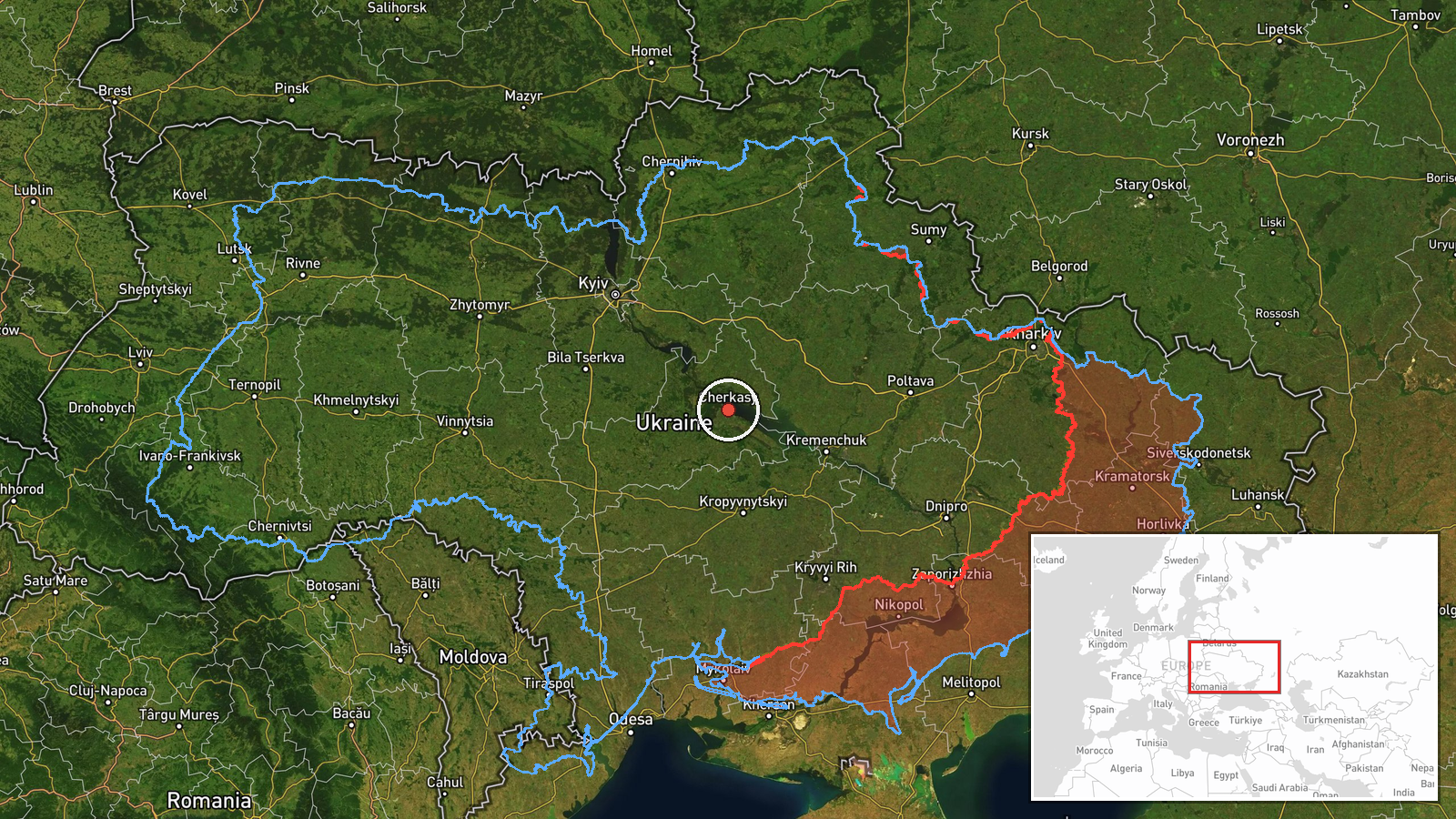
On 17 October 2026 at about 11:42 UTC, Ukrainian air monitoring reported one Russian Banderol mini cruise missile passing Drabiv in Cherkasy Oblast and heading northwest. The report was posted on the Telegram channel @kpszsu, which carries Ukrainian air alerts. The original Ukrainian wording reads that the missile passed past Drabiv in the Cherkasy region in a northwestern direction. The post names no target, impact site, or outcome, and it does not say whether the missile was intercepted or what it was aimed at. The event is recorded as a single-source sighting of a missile in flight, not as a confirmed strike.
Context and assessment
Drabiv lies on the Dnipro in central Ukraine, a corridor that Russian long-range weapons have repeatedly crossed on routes toward western and central regions. The same morning's related reports point to an active air picture in the area. Earlier that day, monitoring tracked Shahed-type drones heading toward Smila, a town in Cherkasy Oblast. Reports from the previous evening included jet-powered Shahed, or Geran-3, drones over Cherkasy Oblast and toward Smila. Separate reports described drones moving through northern Kirovohrad Oblast toward Zakhari and westward. Later the same day, Zelensky publicly described massive Russian attacks on energy infrastructure at multiple sites. Taken together, the pattern suggests coordinated long-range activity across several oblasts rather than an isolated launch. A cruise missile passing through this region could indicate a route toward distant targets, but a single sighting does not establish intent or a specific objective. Analysts would typically treat the cruise missile as one component of a broader raid rather than as a separate event.
Sources and confidence
The report comes from one Telegram channel, @kpszsu, and no independent outlet has yet confirmed it in the available data. Single-channel reports of this kind are usually based on air monitoring data, which gives them a moderate baseline credibility, and the confidence score of 8.0 reflects that position. The score is held down by the lack of a second source, the brief and unlocated wording, and the absence of any impact or interception detail. Confidence would rise with corroboration from other Ukrainian official channels, regional military administration statements, or a second independent track. It would fall if the Ukrainian air command retracted or revised the track.
Location
The location is recorded at region level, not as a precise point. The coordinates, 49.44 north and 32.06 east, sit within Cherkasy Oblast, and the location confidence is low. The report names Drabiv, a small settlement on the Dnipro in the Kaniv reservoir area, as the point the missile passed. The geography is mostly flat to gently rolling farmland, with the river and reservoir shaping movement through the area. The coordinates should be read as approximate and indicate only the oblast, not the exact track of the missile.
Related events nearby
- Ukrainian air monitoring: 2+ Russian jet-powered Shahed (Geran-3) drones heading toward Cherkasy.2026-10-17 12:08 UTC · Drone Transit · Cherkasy, Ukraine
- Ukrainian air monitoring: 1 Russian Shahed-type drone heading toward Smila; 2+ Russian jet-powered Shahed (Ger2026-10-17 02:18 UTC · Drone Transit · Smila, Ukraine
- Ukrainian air monitoring: 1 Russian jet-powered Shahed (Geran-3) drone heading toward Smila; 1 Russian jet-pow2026-10-17 00:25 UTC · Airstrike · Smila, Ukraine
- Ukrainian air monitoring: 1 Russian Shahed-type drone heading toward Smila.2026-10-16 18:15 UTC · Drone Transit · Smila, Ukraine
- Ukrainian air monitoring: 1 Russian Shahed-type drone passing northern Kirovohrad Oblast, heading west.2026-10-17 04:26 UTC · Drone Transit · northern Kirovohrad Oblast, Ukraine
▶ View this event on the live map

Intel Mapper aggregates open-source reports from monitored Telegram and X channels, geolocates them, cross-checks duplicates across sources and assigns a confidence score. Entries are updated as new confirmations arrive. Read how we verify events.