Single Shahed-type drone reported transiting Chernihiv Oblast near Desna, Ukraine
What happened
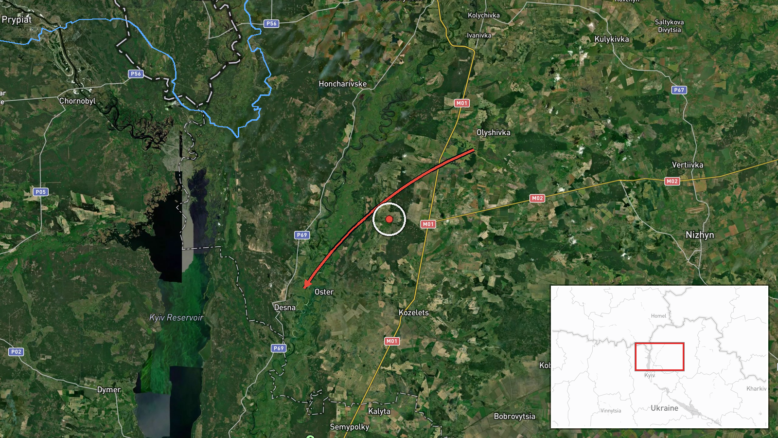
Ukrainian air monitoring channel @kpszsu reported on Telegram that one Russian Shahed-type strike drone was passing Olyshivka and heading in the direction of Desna in Chernihiv Oblast. The post was timestamped 18 October 2026 at 02:04 UTC. The original Ukrainian wording describes the object as an 'ударний БпЛА' (strike unmomaned aerial vehicle), passing 'повз Олишівку у напрямку Десни,' a phrasing typical of routine air-alert updates that track a single airframe without reporting impacts. The report describes only the drone's track; it does not mention any detonation, damage, casualties, or interception. Because the account is the sole source, the details rest on that one channel's monitoring.
Context and assessment
Chernihiv Oblast sits on Ukraine's northern border with Belarus and Russia, and drones moving through its territory toward Kyiv Oblast have been a recurring feature of the air campaign. The related events in this feed show a sustained pattern over roughly one day on 17 October 2026: drones from northern Chernihiv Oblast heading toward northern Kyiv Oblast at 06:32 and 08:45 UTC, a group of two or more Shahed-type drones reportedly launched from Belarus at 07:40 UTC, and jet-powered Geran-3 variants tracked toward Oster and northern Kyiv Oblast in the afternoon. The Desna area lies on the approach corridor that these tracks share. A single drone in this corridor may be a trailing element of a larger wave, a decoy or reconnaissance airframe, or part of a route used for general saturation. The data does not establish which, and a single transit report should not be read as evidence of intent against any specific target.
Sources and confidence
The event rests on one Telegram channel, @kpszsu, which is an official Ukrainian air monitoring account and is generally regarded as a timely primary feed for drone tracks. No second outlet in the dataset independently reported this specific track, so cross-confirmation is absent. The confidence score of 8.0 reflects a credible official source and a clear, specific location, offset by the single-source basis and the lack of any corroborating radar or follow-up report. Confidence would rise with confirmation from another monitoring channel, regional military administration, or subsequent reporting of impacts. It would fall if later updates revised the track or indicated the object was a different type or had been neutralized.
Location
The location is tagged as Desna, Ukraine, at settlement-level precision with high location confidence, placing the marker at roughly 50.93 N, 30.77 E. The original report names Olyshivka as the point the drone passed, and the heading toward Desna suggests the track was in the Chernihiv Oblast countryside between these two settlements. The area is largely flat, forested and agricultural, with the Desna River, a major left-bank tributary of the Dnipro, running through the region. The marker should be read as an approximate settlement reference rather than an exact drone position.
Related events nearby
- Ukrainian air monitoring: 1 Russian jet-powered Shahed (Geran-3) drone heading toward Oster.2026-10-17 15:14 UTC · Drone Transit · Oster, Ukraine
- Ukrainian air monitoring: 1 Russian jet-powered Shahed (Geran-3) drone heading toward northern Kyiv Oblast.2026-10-17 15:24 UTC · Drone Transit · northern Kyiv Oblast, Ukraine
- Ukrainian air monitoring: 1 Russian Shahed-type drone from northern Chernihiv Oblast toward northern Kyiv Obla2026-10-17 08:45 UTC · Drone Transit · northern Kyiv Oblast, Ukraine
- Ukrainian air monitoring: 2+ Russian Shahed-type drones from Belarus toward northern Kyiv Oblast.2026-10-17 07:40 UTC · Drone Transit · northern Kyiv Oblast, Ukraine
- Ukrainian air monitoring: 1 Russian Shahed-type drone from northern Chernihiv Oblast toward northern Kyiv Obla2026-10-17 06:32 UTC · Drone Transit · northern Kyiv Oblast, Ukraine
▶ View this event on the live map

Intel Mapper aggregates open-source reports from monitored Telegram and X channels, geolocates them, cross-checks duplicates across sources and assigns a confidence score. Entries are updated as new confirmations arrive. Read how we verify events.