Ukrainian air monitoring reports 2+ Shahed-type drones moving toward northern Kyiv Oblast
What happened
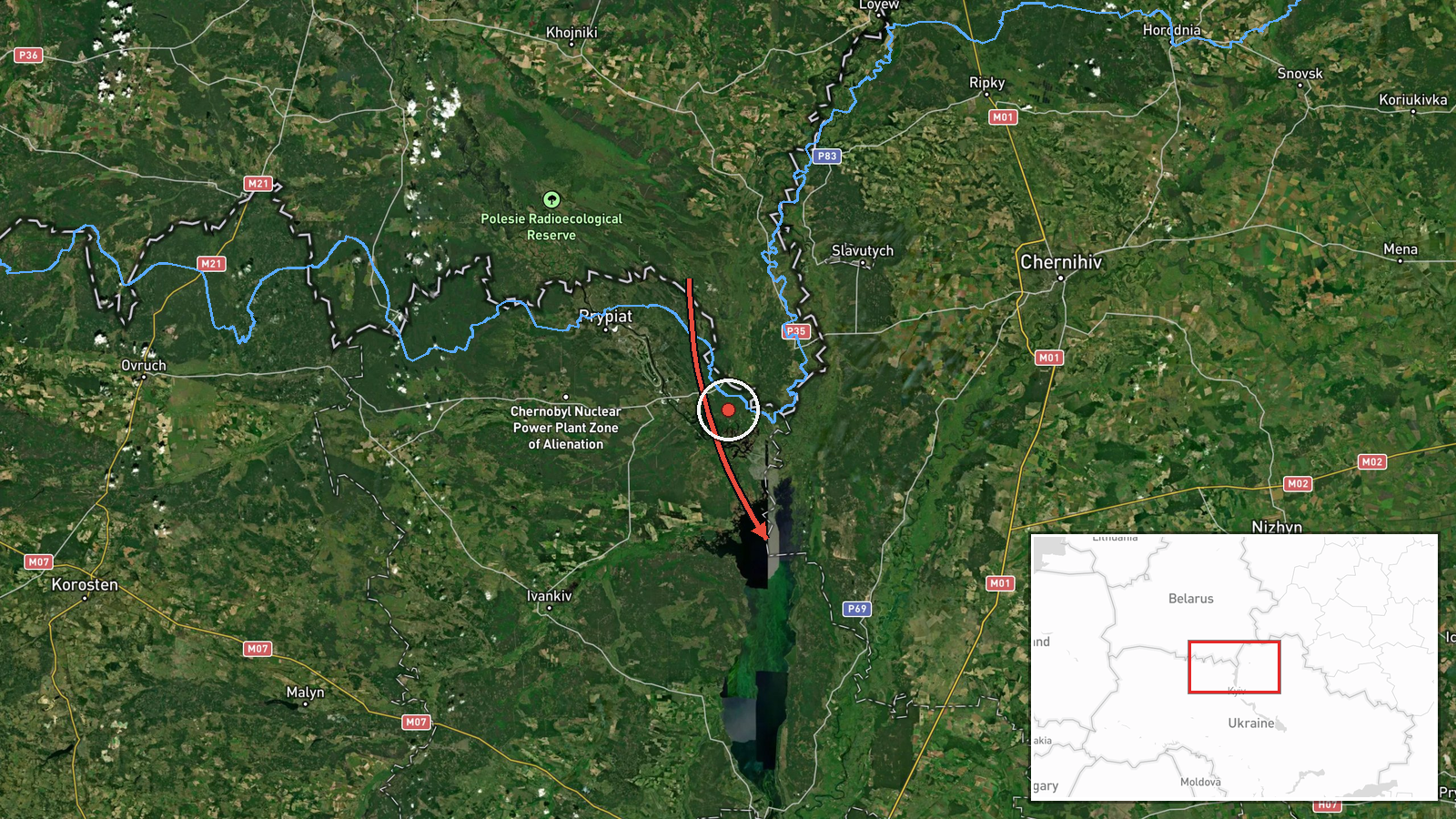
A Telegram channel, @kpszsu, reported at 07:40 UTC on 17 October 2026 that a group of at least two Russian Shahed-type drones was moving toward northern Kyiv Oblast. The original Ukrainian-language post describes a group of strike UAVs in northern Chernihiv Oblast, along the border with Belarus, heading toward the north of Kyiv Oblast. The summary's '2+' reflects that the count was given as a minimum rather than a fixed total. The post describes a transit, not an impact. It does not report a strike, damage, or casualties. Because only one channel is cited, the account currently rests on that single monitoring source.
Context and assessment
Northern Kyiv Oblast sits on the main air corridor from the north, where drones entering from Belarus or northern Chernihiv Oblast can reach the capital region in a short time. The related reports form a sequence over the same morning. Earlier entries logged a jet-powered Shahed, identified as Geran-3, from western Chernihiv Oblast toward Oster at 01:23 UTC, another heading toward Honcharivske at 03:36, and single drones over Moshchun and passing northern Kyiv Oblast westward around 04:25 and 04:26. A further single drone from northern Chernihiv Oblast was logged at 06:32, before this group report. The repeated appearance of drones along similar settlements suggests a steady stream of single and small-group flights rather than one isolated launch. Operationally, this pattern may indicate routing through the northern border area to test air defense coverage, to spread threats across several directions, or to keep warning systems occupied. These readings are inferences from timing and routing, not confirmed intent, and the monitoring posts do not establish the purpose of the flights.
Sources and confidence
The report comes from one Ukrainian monitoring channel, @kpszsu, and no second independent outlet is listed for this entry. Its confidence score of 8.0 reflects a clear, timestamped post from an official-style air monitoring source that matches a pattern of similar reports earlier the same morning. The score is held below the top range because it lacks independent cross-confirmation and because the drone count is stated as a minimum. Confidence would rise with corroboration from a second monitoring feed, regional military administration statements, or imagery. It would fall if later updates contradicted the route, the count, or the timing.
Location
The location is approximate and recorded at region level for northern Kyiv Oblast, with coordinates near 50.995 N, 30.52 E. The post names no specific settlement as the drones' target, so the location confidence is low. The area lies north of Kyiv, adjacent to the Chernihiv border and close to Belarus. It is largely flat, with forests, wetlands, and river valleys, including the Desna basin to the north and east. These features shape low-altitude drone routes and are commonly used as reference points in monitoring reports.
Related events nearby
- Ukrainian air monitoring: 1 Russian Shahed-type drone from northern Chernihiv Oblast toward northern Kyiv Obla2026-10-17 06:32 UTC · Drone Transit · northern Kyiv Oblast, Ukraine
- Ukrainian air monitoring: 1 Russian Shahed-type drone passing northern Kyiv Oblast, heading west.2026-10-17 04:26 UTC · Drone Transit · northern Kyiv Oblast, Ukraine
- Ukrainian air monitoring: 1 Russian jet-powered Shahed (Geran-3) drone from western Chernihiv Oblast toward Os2026-10-17 01:23 UTC · Drone Transit · Oster, Ukraine
- Ukrainian air monitoring: 1 Russian jet-powered Shahed (Geran-3) drone heading toward Honcharivske.2026-10-17 03:36 UTC · Drone Transit · Honcharivske, Ukraine
- Ukrainian air monitoring: 1 Russian Shahed-type drone over Moshchun.2026-10-17 04:25 UTC · Drone Transit · Moshchun, Ukraine
▶ View this event on the live map

Intel Mapper aggregates open-source reports from monitored Telegram and X channels, geolocates them, cross-checks duplicates across sources and assigns a confidence score. Entries are updated as new confirmations arrive. Read how we verify events.