Ukrainian air monitoring reports one Shahed-type drone moving from Chernihiv toward northern Kyiv Oblast
What happened
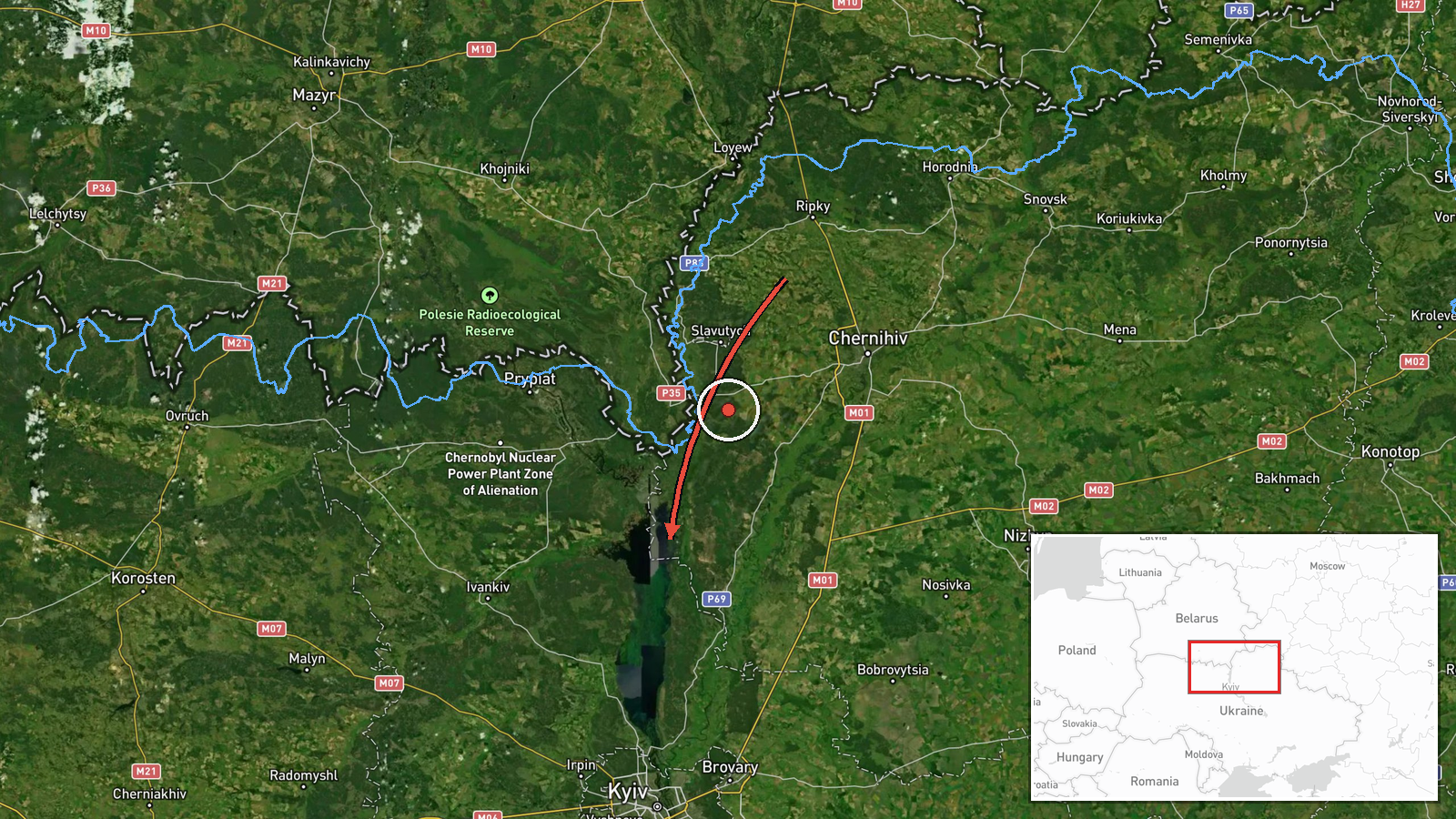
Ukrainian air monitoring reported a single Russian Shahed-type attack drone traveling from northern Chernihiv Oblast toward northern Kyiv Oblast, according to a post on the Telegram channel @kpszsu. The original wording, in Ukrainian, describes an 'ударний БпЛА' (strike UAV) moving from the north of Chernihiv region toward the north of Kyiv region, with an arrow indicating direction of travel. The report is timestamped 17 October 2026 at 08:45 UTC. The message does not describe any impact, damage, or casualties, and it names no origin settlement. The event is logged as a drone transit, meaning a track through the area rather than a confirmed strike on a specific target.
Context and assessment
Shahed-type drones have repeatedly crossed northern Ukraine on routes through Chernihiv and Kyiv oblasts, and this report fits that pattern. The related events in the data show a cluster of tracks over roughly nine hours on 17 October. An earlier report describes two or more drones from Belarus heading toward northern Kyiv Oblast, and a 06:32 report uses nearly identical wording to this one, describing a single drone from northern Chernihiv Oblast. A 04:26 entry notes a drone passing northern Kyiv Oblast heading west. Two reports describe jet-powered Geran-3 variants, one from western Chernihiv Oblast toward Oster and another toward Honcharivske. Operationally, a sequence of tracks along the same northern corridor may suggest sustained waves moving through the region, or drones routed toward targets farther south or west. Transit reports rarely reveal the intended target, so any inference about purpose remains tentative. The repeated Chernihiv-to-Kyiv wording also raises the possibility that the 08:45 post is a re-report or a separate launch of the same track, which the data alone cannot resolve.
Sources and confidence
All information comes from a single Telegram channel, @kpszsu, which is widely understood to be the official Ukrainian Air Force channel. No independent outlet, radar feed, or second channel in the data confirms this track. The platform assigns a confidence score of 8.0, but the location confidence is recorded as low and the source count is one, so the score mainly reflects the channel's standing rather than corroboration of the specific movement. Confidence would rise with matching flight-track data, independent monitoring, or confirmed sightings in the named areas. It would fall if the channel corrected or withdrew the post, or if the timing proved to duplicate the 06:32 report.
Location
The location is recorded at region level, with coordinates near 50.995 N, 30.52 E. That point approximates the center of northern Kyiv Oblast, not a specific settlement, so the position should be read as approximate. The area is part of the flat, forested Polissia lowlands, where Desna and Dnipro river basins cross the landscape. Chernihiv Oblast lies to the north, and the Belarus border is nearby.
Related events nearby
- Ukrainian air monitoring: 2+ Russian Shahed-type drones from Belarus toward northern Kyiv Oblast.2026-10-17 07:40 UTC · Drone Transit · northern Kyiv Oblast, Ukraine
- Ukrainian air monitoring: 1 Russian Shahed-type drone from northern Chernihiv Oblast toward northern Kyiv Obla2026-10-17 06:32 UTC · Drone Transit · northern Kyiv Oblast, Ukraine
- Ukrainian air monitoring: 1 Russian Shahed-type drone passing northern Kyiv Oblast, heading west.2026-10-17 04:26 UTC · Drone Transit · northern Kyiv Oblast, Ukraine
- Ukrainian air monitoring: 1 Russian jet-powered Shahed (Geran-3) drone from western Chernihiv Oblast toward Os2026-10-17 01:23 UTC · Drone Transit · Oster, Ukraine
- Ukrainian air monitoring: 1 Russian jet-powered Shahed (Geran-3) drone heading toward Honcharivske.2026-10-17 03:36 UTC · Drone Transit · Honcharivske, Ukraine
▶ View this event on the live map

Intel Mapper aggregates open-source reports from monitored Telegram and X channels, geolocates them, cross-checks duplicates across sources and assigns a confidence score. Entries are updated as new confirmations arrive. Read how we verify events.