Single Russian Shahed-type drone reported transiting Kirovohrad Oblast, moving north past Vilshanka
What happened
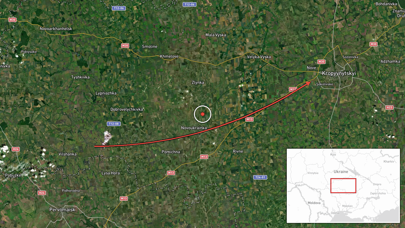
On 18 October 2026, at about 02:49 UTC, a Ukrainian air monitoring post reported one Russian Shahed-type attack drone passing near Vilshanka in Kirovohrad Oblast. The report was posted on Telegram by the channel @kpszsu. The original Ukrainian wording describes a strike drone moving from Mykolaiv region into Kirovohrad region, past Vilshanka, on a northerly course. The English summary Intel Mapper uses says the drone was heading toward Kirovohrad Oblast, but the source itself specifies north. The report names no impact, damage, or target. It identifies only the drone's transit through the area. The event is classified as a drone transit, with Russia as the attributed actor.
Context and assessment
This track fits a sequence of single-drone reports across central Ukraine on 17 October. Related entries show drones described as jet-powered Shahed (Geran-3) variants moving from Mykolaiv Oblast toward Kirovohrad Oblast at 07:54 and 09:59 UTC. Later that day, further single drones were logged passing Podilsk district heading northwest and Kropyvnytskyi district heading west. The same day, Zelensky stated that Russia was carrying out large-scale attacks on energy infrastructure at multiple sites. Taken together, these reports suggest drones repeatedly crossing Kirovohrad Oblast along different bearings. Operationally, such tracks may reflect routing toward distant targets, reconnaissance, or deliberate dispersal to stress air defence and warning systems. Single-drone transits can also be decoys within a larger raid. The data does not show a target for this specific drone, and the recent pattern alone does not establish intent. Any link to the energy strikes mentioned in the statement would be an inference rather than a confirmed fact.
Sources and confidence
The event rests on one Telegram channel, @kpszsu, and the source count is one. Intel Mapper has found no independent confirmation of the track from another monitoring source, official statement, or media outlet at the time of writing. The confidence score of 8.0 reflects a credible official-style air monitoring channel with a consistent reporting pattern, but the single-source basis and the lack of cross-confirmation keep it below the highest tier. Confidence would rise with corroboration from additional Ukrainian official channels, regional military administration statements, or independent tracking. It would fall if the track were later attributed to a different drone type, a different route, or an unrelated aerial object.
Location
The coordinates, 48.51 N and 32.26 E, are an approximate region-level point, not a verified position for the drone. Vilshanka is named in the original report as a reference point, but the exact location of the sighting was not given, so the marker does not identify a specific settlement or facility. Kirovohrad Oblast lies in central Ukraine, on the flat, largely agricultural steppe of the Dnipro basin. The area has few natural obstacles to low-flying drones, and the main features are rivers, road networks, and rail corridors.
Related events nearby
- Ukrainian air monitoring: 1 Russian jet-powered Shahed (Geran-3) drone from Mykolaiv Oblast toward Kirovohrad 2026-10-17 09:59 UTC · Drone Transit · Kirovohrad Oblast, Ukraine
- Ukrainian air monitoring: 1 Russian jet-powered Shahed (Geran-3) drone from Mykolaiv Oblast toward Kirovohrad 2026-10-17 07:54 UTC · Drone Transit · Kirovohrad Oblast, Ukraine
- Ukrainian air monitoring: 1 Russian jet-powered Shahed (Geran-3) drone passing Kropyvnytskyi district, heading2026-10-17 12:32 UTC · Drone Transit · Kropyvnytskyi district, Ukraine
- Ukrainian air monitoring: 1 Russian jet-powered Shahed (Geran-3) drone passing Podilsk district, heading north2026-10-17 12:23 UTC · Drone Transit · Podilsk district, Ukraine
- Zelensky says Russia is launching massive energy infrastructure attacks while the US ignores the Lindsey Graha2026-10-17 09:09 UTC · Statement · Ukraine (energy infrastructure, multiple sites)
▶ View this event on the live map

Intel Mapper aggregates open-source reports from monitored Telegram and X channels, geolocates them, cross-checks duplicates across sources and assigns a confidence score. Entries are updated as new confirmations arrive. Read how we verify events.