Jet-powered drones tracked near Khmelove, Kirovohrad Oblast, heading northwest, per Ukrainian air monitoring
What happened
Ukrainian air monitoring reports, relayed through a single Telegram channel (@kpszsu), that jet-powered drones were tracked in the vicinity of Khmelove, a settlement in Kirovohrad Oblast in central Ukraine, at about 04:53 UTC on 18 October 2026. The original Ukrainian-language post refers to reactive UAVs (реактивні БпЛА) on a northwest course and does not name a specific model. The English summary attributes the drones to Russia and identifies them as jet-powered Shahed (Geran-3) types. That identification is the summary's wording, not something stated in the original post. The source reports no impacts, casualties, or damage, and it does not give the number of drones or their altitude.
Context and assessment
Kirovohrad Oblast sits on a corridor between southern Ukraine and the central and western regions, so repeated drone tracks there are a recurring feature of Russian long-range strike campaigns. The related events show a pattern of single-drone tracks over roughly 21 hours. On 17 October, two jet-powered Geran-3 drones were reported moving from Mykolaiv Oblast toward Kirovohrad Oblast at 07:54 and 09:59 UTC. Another was reported passing Kropyvnytskyi district heading west at 12:32, and a Shahed-type drone was seen passing Vilshanka at 02:49 on 18 October. Taken together, these tracks are consistent with drones routed northward and westward across central Ukraine. The same day, Zelensky publicly described massive Russian attacks on energy infrastructure, which provides broader context for the sustained activity. Operationally, low-count tracks like these often reflect transit flights through the region rather than a single intended target, and they may indicate routing toward other areas. Because jet-powered variants are faster than piston-engine Shaheds, they can shorten warning times, which matters for air defence and civil alerts.
Sources and confidence
The report rests on one Telegram channel, and the data contains no independent cross-confirmation from another monitoring feed, official statement, or news outlet. The channel's format matches an official air-monitoring feed, and the report fits the same-region sequence in the related events, which supports a score of 8.0. The score is held below the top range because the drone type appears only in the English summary, not in the original post. Confidence would rise with corroboration from a second air-monitoring source, radar-based reporting, or subsequent official confirmation of the route. It would fall if the channel corrected the report, if its timing conflicted with other feeds, or if later reporting identified the objects as something other than drones.
Location
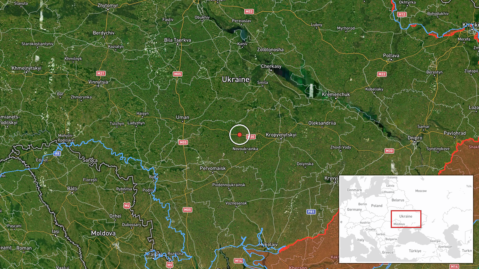
The location is recorded at settlement level, with high location confidence. The coordinates, roughly 48.57 N and 31.40 E, mark the settlement's centre rather than a precise point, and the report does not name a specific site. Khmelove lies in Kirovohrad Oblast, in the central-southern part of Ukraine, in lowland agricultural terrain typical of the steppe. The region is dominated by farmland, rural settlements, and river valleys, with few large natural obstacles along the northwest track described in the report.
Related events nearby
- Ukrainian air monitoring: 1 Russian Shahed-type drone passing Vilshanka, heading toward Kirovohrad Oblast.2026-10-18 02:49 UTC · Drone Transit · Kirovohrad Oblast, Ukraine
- Ukrainian air monitoring: 1 Russian jet-powered Shahed (Geran-3) drone from Mykolaiv Oblast toward Kirovohrad 2026-10-17 09:59 UTC · Drone Transit · Kirovohrad Oblast, Ukraine
- Ukrainian air monitoring: 1 Russian jet-powered Shahed (Geran-3) drone from Mykolaiv Oblast toward Kirovohrad 2026-10-17 07:54 UTC · Drone Transit · Kirovohrad Oblast, Ukraine
- Ukrainian air monitoring: 1 Russian jet-powered Shahed (Geran-3) drone passing Kropyvnytskyi district, heading2026-10-17 12:32 UTC · Drone Transit · Kropyvnytskyi district, Ukraine
- Russia launched one Iskander-M ballistic missile and about 180 Shahed-type and decoy drones overnight. Ukraini2026-10-18 05:01 UTC · UAS Strike · Ukraine
▶ View this event on the live map

Intel Mapper aggregates open-source reports from monitored Telegram and X channels, geolocates them, cross-checks duplicates across sources and assigns a confidence score. Entries are updated as new confirmations arrive. Read how we verify events.