Single Russian Shahed-type drone reported moving from northern Zhytomyr toward Sarny, Rivne Oblast
What happened
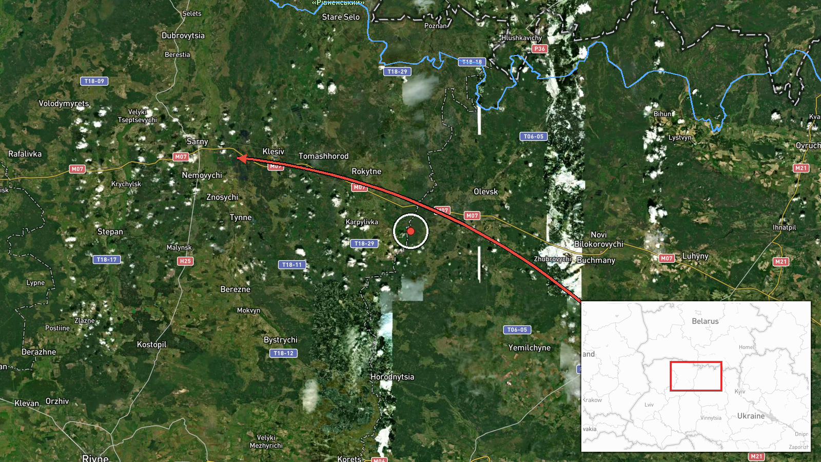
Ukrainian air monitoring reported on Telegram, via the channel @kpszsu, that one Russian Shahed-type drone was tracked from northern Zhytomyr Oblast on a course toward Sarny, in neighbouring Rivne Oblast. The event is logged for 18 October 2026 at 05:36 UTC. The original Ukrainian-language post describes the object as a UAV (БпЛА) in northern Zhytomyr region, with its heading given as Rivne region, Sarny. The report is a short operational notice and does not describe any impact, explosion, or damage at or near Sarny. The event is classified as a drone transit rather than a strike. No casualty or damage figures are attached to the record, and none are assumed here.
Context and assessment
Sarny sits in the north of Rivne Oblast, close to the Belarusian border and along rail and road routes that link western Ukraine with the north. Its appearance in air alerts is consistent with a wider pattern in which Shahed-type drones cross the northern and western oblasts on routes that bypass the main air defence concentrations near Kyiv. The related events show the same corridor in use over the preceding day. Earlier on 17 October, a drone was tracked from northern Zhytomyr toward northern Rivne Oblast, and another was logged passing northern Rivne heading west. On 18 October, further single drones were reported heading toward Dubrovytsya, Rivne, and Rivne Oblast from northern Khmelnytskyi. Several of these were described as jet-powered Geran-3 variants. Taken together, the sequence suggests a sustained series of single-airframe transits through the north-western axis rather than one coordinated salvo. Operationally, such tracks may reflect routing choices, decoy use, or reconnaissance of alert response. The data alone cannot establish which of these applies.
Sources and confidence
The event rests on a single Telegram channel, @kpszsu, which relays Ukrainian air monitoring alerts. No second outlet is recorded as confirming the track, so the source count is one. The confidence score of 8.0 reflects a credible official-style alert with a clear heading and settlement reference, offset by the lack of independent corroboration and the absence of any confirmed impact. Confidence would rise with a matching report from regional military administration or an independent tracking service, or with confirmation of the drone's endpoint. It would fall if the track were revised or retracted by the originating channel.
Location
The location is recorded at settlement precision for Sarny, Ukraine, at roughly 51.339 N, 26.607 E, with location confidence rated high. The alert names Sarny as the target settlement of the heading rather than a confirmed impact site, so the point marks the destination of the track, not a verified location of any event. The town lies in the north of Rivne Oblast, on flat Polissia lowland with extensive forest and marsh, a terrain that has historically complicated low-altitude surveillance. Notable nearby features include the Ustia River basin and the Belarusian frontier to the north.
Related events nearby
- Ukrainian air monitoring: 1 Russian Shahed-type drone heading toward Dubrovytsya.2026-10-18 02:03 UTC · Drone Transit · Dubrovytsya, Ukraine
- Ukrainian air monitoring: 1 Russian jet-powered Shahed (Geran-3) drone passing northern Rivne Oblast, heading 2026-10-17 10:12 UTC · Drone Transit · northern Rivne Oblast, Ukraine
- Ukrainian air monitoring: 1 Russian Shahed-type drone from northern Zhytomyr Oblast toward northern Rivne Obla2026-10-17 08:32 UTC · Drone Transit · northern Rivne Oblast, Ukraine
- Ukrainian air monitoring: 1 Russian Shahed-type drone passing Tsuman, heading southwest.2026-10-18 06:36 UTC · Drone Transit · Tsuman, Ukraine
- Ukrainian air monitoring: 1 Russian Shahed-type drone from northwestern Zhytomyr Oblast toward Rivne Oblast.2026-10-18 06:51 UTC · Drone Transit · Rivne Oblast, Ukraine
▶ View this event on the live map

Intel Mapper aggregates open-source reports from monitored Telegram and X channels, geolocates them, cross-checks duplicates across sources and assigns a confidence score. Entries are updated as new confirmations arrive. Read how we verify events.