Single Shahed-type drone reported moving from Zhytomyr Oblast toward Rivne Oblast, Ukraine
What happened
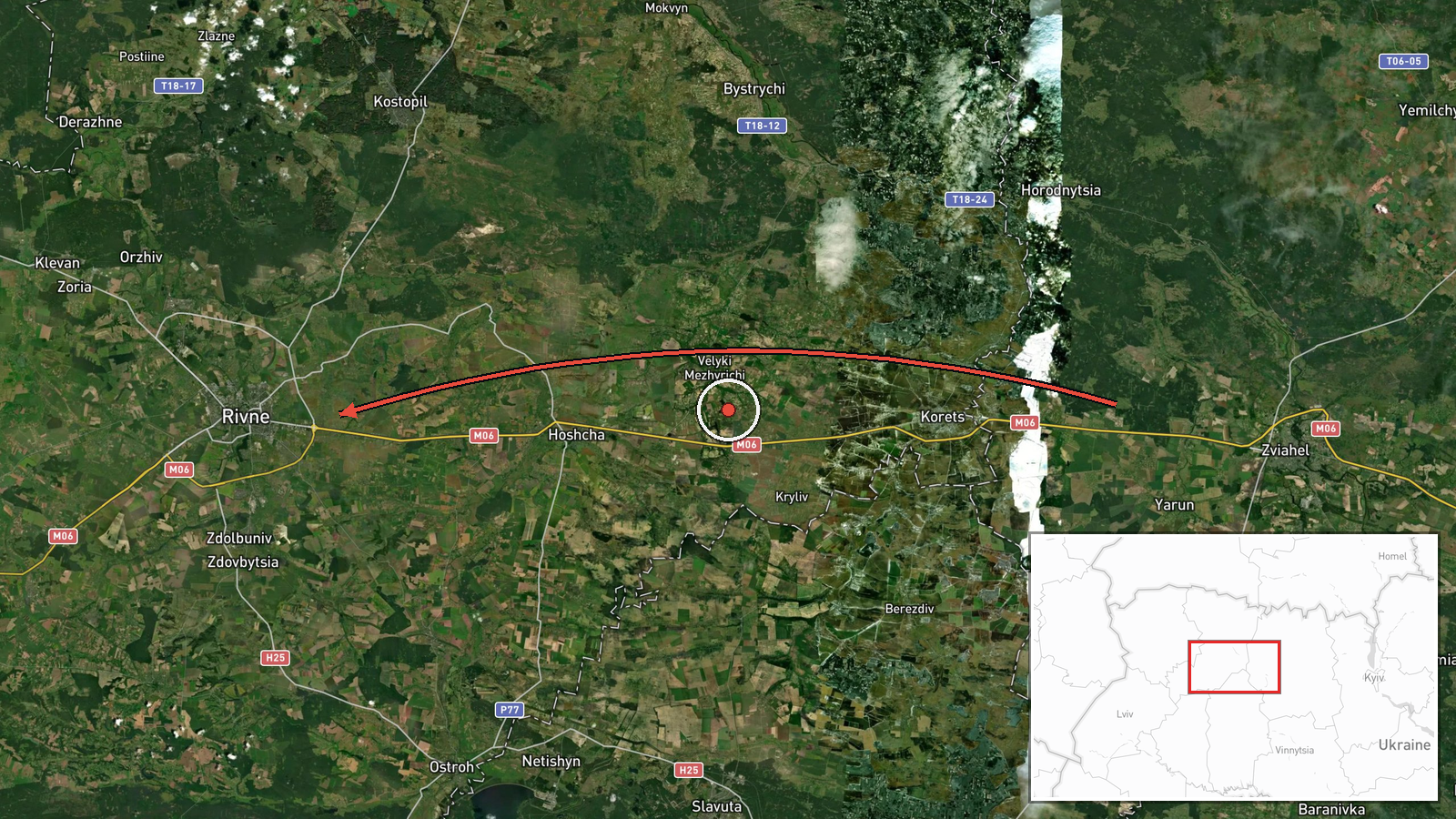
Ukraine's air monitoring reported one Russian Shahed-type drone entering airspace from northwestern Zhytomyr Oblast on a course toward Rivne Oblast, logged at 06:51 UTC on 18 October 2026. The original Ukrainian-language post, published on the Telegram channel @kpszsu, describes the object as a UAV, using the term БпЛА, and gives its heading as toward Rivne region. The report does not describe any strike, impact, or damage, and it does not specify altitude, speed, or the drone's final position. Attribution to Russia comes from the feed's classification of the object as a Shahed-type system, which fits the wider campaign of long-range drones launched against Ukraine. This item is a transit report rather than a confirmed attack.
Context and assessment
Rivne Oblast sits in northwestern Ukraine, bordering Belarus to the north, and is far from the front line, so drones tracked into it are crossing a long depth corridor. The city of Rivne is the oblast's administrative center and a regional hub for road and rail links, which is why air-alert messaging names it repeatedly. The related events show a sustained pattern. Between 08:14 on 17 October and 05:52 on 18 October, the feed logged at least five separate single-drone transits toward Rivne or passing through the oblast, including one from northern Khmelnytskyi Oblast and several described as jet-powered Geran-3 variants. Repeated single-object tracks over roughly a day may reflect sequential launches along a recurring approach route, or a monitoring system following the same drones as they move across western Ukraine. Operationally, the pattern could suggest that drones are being routed through northwestern airspace toward targets in the region or farther west, but transit reports alone do not establish intent or a specific objective. The absence of reported impacts in this cluster is consistent with interceptions or with drones that never reached populated areas, though the data does not confirm which.
Sources and confidence
The report rests on a single channel, the Telegram account @kpszsu, which carries Ukrainian Air Force air-alert and drone-tracking messages. No second outlet in the dataset independently confirms this specific transit, so the source count is one. The confidence score of 8.0 reflects the official-appearing channel and the consistency of the wording with surrounding reports, but it sits below the highest band because the post is a brief monitoring line without track data, intercept times, or confirmation of impact. Confidence would rise with corroborating air-alert notices from regional authorities or with reports of interception or debris, and would fall if later monitoring revised the object type or heading.
Location
The location is coded at region level, Rivne Oblast, rather than at a settlement or facility. The stated coordinates, 50.62 north and 26.25 east, fall close to Rivne city, the oblast's administrative center, but the feed does not indicate that the drone was located there. The track is described as heading toward the oblast from the northwest, so its true position is unknown. The region is mostly flat to gently rolling, with extensive forest and marsh in the north, the Horyn river system, and the Polissia lowlands. Its wooded and wetland terrain shapes low-altitude flight paths.
Related events nearby
- Ukrainian air monitoring: 1 Russian jet-powered Shahed (Geran-3) drone from northern Khmelnytskyi Oblast towar2026-10-18 05:52 UTC · Drone Transit · Rivne Oblast, Ukraine
- Ukrainian air monitoring: 1 Russian jet-powered Shahed (Geran-3) drone heading toward Rivne.2026-10-18 03:30 UTC · Drone Transit · Rivne, Ukraine
- Ukrainian air monitoring: 1 Russian jet-powered Shahed (Geran-3) drone passing Rivne Oblast, heading southwest2026-10-18 02:04 UTC · Drone Transit · Rivne Oblast, Ukraine
- Ukrainian air monitoring: 1 Russian jet-powered Shahed (Geran-3) drone heading toward Rivne.2026-10-17 08:18 UTC · Drone Transit · Rivne, Ukraine
- Ukrainian air monitoring: 1 Russian jet-powered Shahed (Geran-3) drone passing Horodnytsia, heading toward Riv2026-10-17 08:14 UTC · Drone Transit · Rivne Oblast, Ukraine
▶ View this event on the live map

Intel Mapper aggregates open-source reports from monitored Telegram and X channels, geolocates them, cross-checks duplicates across sources and assigns a confidence score. Entries are updated as new confirmations arrive. Read how we verify events.