Ukrainian air monitoring reports two jet-powered Geran-3 drones moving through Rivne Oblast on 18 October
What happened
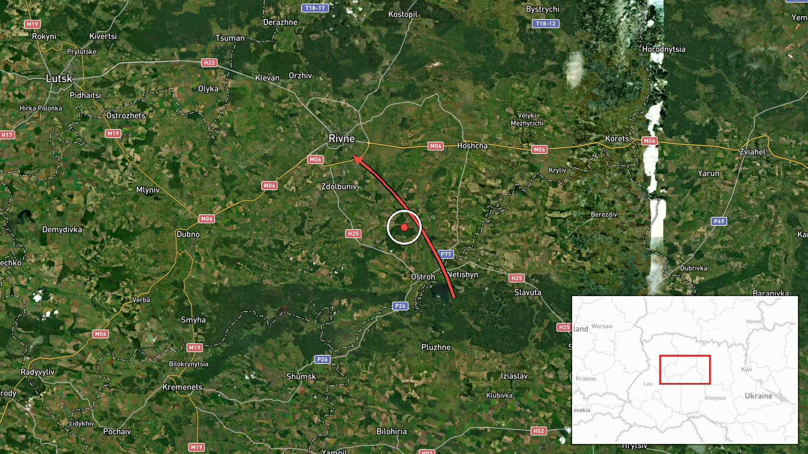
A Telegram channel carrying Ukrainian air monitoring updates, @kpszsu, reported on 18 October 2026 at 05:52 UTC two Russian jet-powered Shahed (Geran-3) drones in northwestern Ukraine. The first was reported moving from northern Khmelnytskyi Oblast toward Rivne Oblast. The second was reported passing across northern Rivne Oblast on a course to the west. The original Ukrainian-language post uses the phrase reaktyvnyi BpLA, meaning jet drone, for both, and names regions rather than specific settlements. The report does not mention impacts, casualties, or damage, and it does not say where either drone went after leaving the described area. The wording reads as an air-movement alert rather than a confirmed strike.
Context and assessment
This report is one entry in a run of drone transits through Rivne Oblast over roughly 24 hours. Between 06:29 and 08:18 UTC on 17 October, the same type of monitoring feed logged several drones passing the oblast or heading toward Rivne, including one passing Horodnytsia. Further transits were logged in the early hours of 18 October, with the nearest prior entries placing drones toward Rivne at 03:30 UTC and passing the oblast heading southwest at 02:04 UTC. The directional changes, with drones shown heading west, southwest and toward Rivne, suggest that the flight paths were not fixed on a single aim point. Rivne lies on routes between Ukraine's central regions and its western border with Poland and Belarus's southern neighbors, so repeated transits there may reflect launches routed to avoid defenses further south or east. The Geran-3 is a jet-powered variant, generally faster than the piston-engined Geran-2, which may matter for interception timing. These reports alone do not establish intent, targets or whether any drone was shot down, and the pattern should be read as a continuing air-threat picture rather than evidence of a specific planned strike.
Sources and confidence
The only source for this entry is the @kpszsu Telegram channel, so cross-confirmation is absent. The confidence score of 8.0 is high for a single channel, which reflects that the channel is an established Ukrainian air monitoring feed, that its earlier entries on the same route are consistent, and that the report is brief and procedural. It is not higher because no independent outlet, official statement, or imagery confirms the individual track. Confidence would rise with corroboration from other Ukrainian air alerts, regional military administration statements, or reports of interception or impact in Rivne or Khmelnytskyi. It would fall if later updates revise the directions or drone types.
Location
The coordinates, 50.62 N and 26.25 E, match the centre of Rivne city, but the entry is coded as region-level precision with low location confidence. The report names only Rivne Oblast and the northern parts of Khmelnytskyi and Rivne oblasts, so the pin is an approximate regional marker and should not be read as a city-level hit. The oblast lies in northwestern Ukraine, with extensive Polissia lowlands, forests and wetlands to the north. Rivers such as the Horyn and Sluch cross the area.
Related events nearby
- Ukrainian air monitoring: 1 Russian Shahed-type drone from northwestern Zhytomyr Oblast toward Rivne Oblast.2026-10-18 06:51 UTC · Drone Transit · Rivne Oblast, Ukraine
- Ukrainian air monitoring: 1 Russian jet-powered Shahed (Geran-3) drone heading toward Rivne.2026-10-18 03:30 UTC · Drone Transit · Rivne, Ukraine
- Ukrainian air monitoring: 1 Russian jet-powered Shahed (Geran-3) drone passing Rivne Oblast, heading southwest2026-10-18 02:04 UTC · Drone Transit · Rivne Oblast, Ukraine
- Ukrainian air monitoring: 1 Russian jet-powered Shahed (Geran-3) drone heading toward Rivne.2026-10-17 08:18 UTC · Drone Transit · Rivne, Ukraine
- Ukrainian air monitoring: 1 Russian jet-powered Shahed (Geran-3) drone passing Horodnytsia, heading toward Riv2026-10-17 08:14 UTC · Drone Transit · Rivne Oblast, Ukraine
▶ View this event on the live map

Intel Mapper aggregates open-source reports from monitored Telegram and X channels, geolocates them, cross-checks duplicates across sources and assigns a confidence score. Entries are updated as new confirmations arrive. Read how we verify events.