Jet-powered Shahed drone reported heading toward Poltava, per Ukrainian air monitoring
What happened
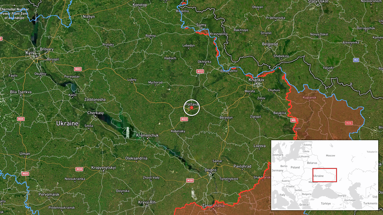
Ukraine's Air Force Telegram channel, @kpszsu, reported on 18 October 2026 at 06:35 UTC that one jet-powered unmanned aerial vehicle was heading toward or past Poltava from the southeast. The original Ukrainian wording, 'курсом на/повз Полтаву', leaves open whether the drone was aimed at the city or only passing it, so the report does not establish a target. The event is recorded as a Drone Transit attributed to Russia. A follow-up identified the drone as a Russian jet-powered Shahed, also known as the Geran-3. A later update at 06:45 UTC told residents of Poltava to take shelter. The available data describes no impact, casualties or damage, and the report comes from a single channel.
Context and assessment
Poltava is a regional capital in central-eastern Ukraine, and it has repeatedly appeared on air-alert routes across the centre and east of the country. The related events show a pattern over roughly thirty hours. At 08:17 UTC on 17 October a Geran-3 passed through Poltava Oblast heading northwest. At 11:26 and 18:33 that day, first one and then two Banderol mini cruise missiles were reported heading toward Poltava. Early on 18 October another Geran-3 was tracked toward the city, and the shelter warning followed. The sequence combines drone transit with low-flying cruise missiles aimed at the same city. This may indicate repeated probing of air defence coverage in the region, or a wider campaign routing strike packages across Poltava Oblast. The monitoring messages describe headings rather than impacts, so the operational purpose cannot be confirmed from this data. The jet-powered Geran-3 is generally understood to be faster and harder to intercept than piston-engine Shaheds, which makes early warning more important. The data does not show whether Poltava itself was the intended target.
Sources and confidence
Only one channel is recorded, the Telegram account of Ukraine's Air Force (@kpszsu). The source count is one and the event has not been corrected. The confidence score of 8.0 reflects an official monitoring source and a consistent series of related alerts, but it is held below the top range because no independent outlet, wire service or regional authority has confirmed the transit or any impact. Confidence would rise with corroboration from Poltava officials, reports of interceptions or debris, or independent flight tracking. It would fall if later updates changed the heading, withdrew the report, or revised the drone type.
Location
The coordinates correspond to Poltava city and are recorded at settlement precision with high location confidence. The point therefore marks the city rather than a specific facility. The report places the drone to or past Poltava from the southeast, so the exact flight track is not known. Poltava lies on the Vorskla River in Poltava Oblast, on the flat steppe terrain typical of central Ukraine.
Related events nearby
- Ukrainian air monitoring reports a Russian jet-powered Shahed (Geran-3) drone over Poltava; residents told to 2026-10-18 06:45 UTC · Drone Transit · Poltava, Poltava Oblast, Ukraine
- Ukrainian air monitoring: 1 Russian jet-powered Shahed (Geran-3) drone heading toward Poltava.2026-10-18 06:37 UTC · Drone Transit · Poltava, Ukraine
- Ukrainian air monitoring: 2 Russian Banderol mini cruise missiles heading toward Poltava.2026-10-17 18:33 UTC · Cruise Missile · Poltava, Ukraine
- Ukrainian air monitoring: 1 Russian Banderol mini cruise missile heading toward Poltava.2026-10-17 11:26 UTC · Cruise Missile · Poltava, Ukraine
- Ukrainian air monitoring: 1 Russian jet-powered Shahed (Geran-3) drone passing Poltava Oblast, heading northwe2026-10-17 08:17 UTC · Drone Transit · Poltava Oblast, Ukraine
▶ View this event on the live map

Intel Mapper aggregates open-source reports from monitored Telegram and X channels, geolocates them, cross-checks duplicates across sources and assigns a confidence score. Entries are updated as new confirmations arrive. Read how we verify events.